Greenhouse Gas Monitoring Project
Last updated:13 October 2021
Monitoring the effectiveness of geological storage of CO2 is a challenging task because CO2 is naturally present in the atmosphere, soil, ocean and groundwater. Geoscience Australia collaborates with a number of organisations to develop and test techniques and tools to detect and quantify CO2.
Greenhouse gas monitoring project, 2009–2015
The Greenhouse Gas Monitoring Project was established in 2009 as part of Geoscience Australia's Carbon Capture and Storage Program and concluded in 2015. The primary aim for the project was to assess monitoring techniques for geological storage of carbon dioxide (CO2) and collect regional atmospheric and groundwater baseline data in selected onshore areas. The work assisted government and industry to determine best practice in this emerging field. Follow the links below to find out more about each aspect of the project, including publications and datasets from the project
Monitoring the effectiveness of geological storage of CO2 is a challenging task because CO2 is present naturally in the atmosphere, soil, ocean and groundwater. Geoscience Australia collaborated with a number of organisations to investigate techniques that could detect and quantify CO2 migration or leakage.
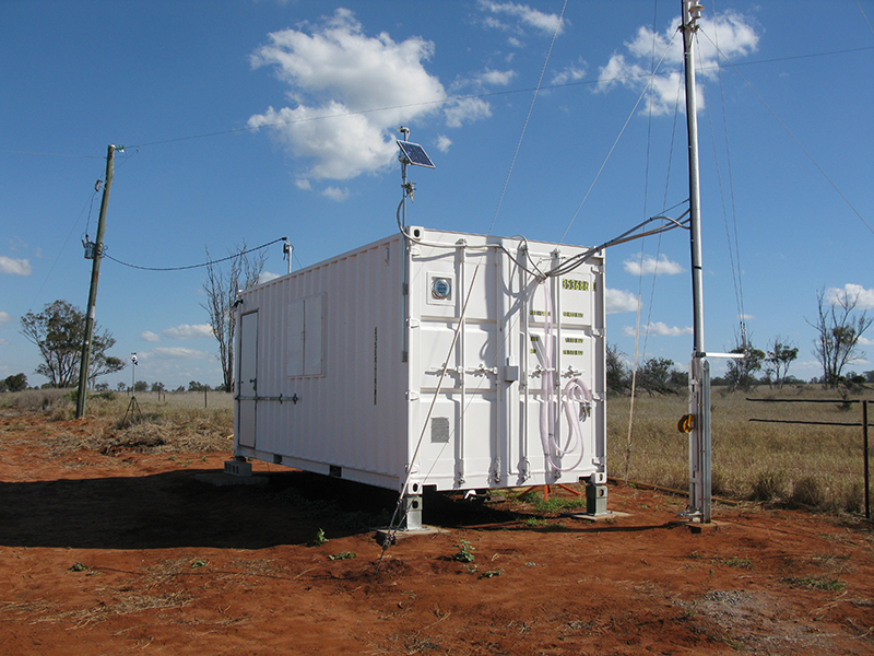
Remotely operated, atmospheric greenhouse gas baseline station (Arcturus) trialled in central Queensland (GA-CSIRO)
Outputs
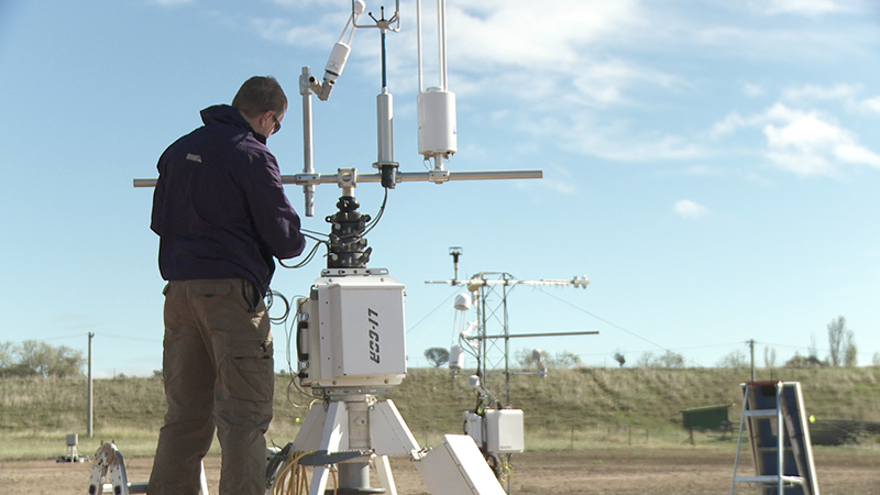
- Controlled Release Studies - installed and operated a joint Geoscience Australia - CO2CRC facility to conduct shallow sub-surface and above surface releases of greenhouse gases. The facility enabled researchers to test existing and develop new monitoring and quantification techniques.
- Conducted three sub-surface CO2 release experiments, one surface CO2 release experiment, and one combined CO2/CH4/N2O surface release experiment. Data from the sub-surface release experiments is available for download.
- Conducted an international comparison of controlled release sites and discovered all sites exhibit similar patchy leakage behaviour. This information can be used to better inform monitoring strategies for geological storage sites.
- Installed a prototype, remotely operated, atmospheric greenhouse gas baseline station in central Queensland (joint CSIRO-Geoscience Australia facility). For more information see the installation report and eddy covariance data.
- A statistical analysis showed that detection of CO2 leakage using a single atmospheric monitoring station is not effective but could be suitable for monitoring CH4 leakage from coal seam gas fields or coal mines.
- Conducted eight joint Geoscience Australia-Geological Survey of Queensland groundwater surveys that have produced a new comprehensive groundwater data set for the Bowen and Surat Basins.
- Produced a Hydrogeochemical Atlas of the Great Artesian Basin.
- Applied emissions quantification techniques to a leaky CO2 well analogue in Qinghai, China.
- Contributed to the FLUXNET2015 dataset that provides data on CO2, water, and energy exchange between the biosphere and the atmosphere, and other meteorological and biological measurements, from 212 sites around the globe.
- Developed a new method for estimating CO2 and CH4 emissions that uses both point and line (laser) measurements. The free software code and data are available here {https://github.com/Lcartwright94/BayesianAT}.

