Australian geography
Factsheets and Resources
- Australian dimensions and information about landforms
- Astronomical information (including sunrise and sunset times)
- Maps of Australia (including black-line outline maps and report maps)
- Theme and reference maps of Australia
- Interactive maps
- Water observation from space (observations of surface water across the continent)
Posters
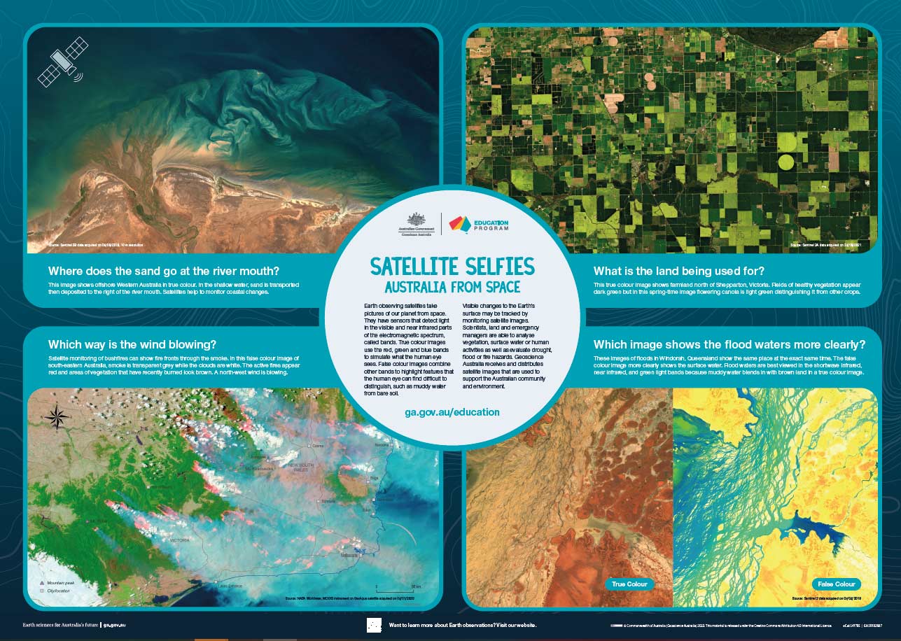 Satellite Selfies: Australia from Space Education Poster
Poster showing satellite imagery across Australia. Introduction to sensors and bands in the electromagnetic spectrum, true and false colour and applications of monitoring Earth observing satellite data.
 Topography of the Australian continent
 Australia Through Time
 Sea floor and land topography of Australia and surrounding region
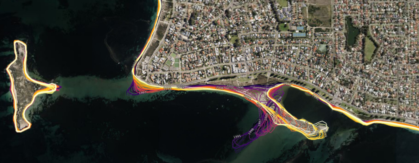 Analysing landscape changes over time using satellite data
This combined teacher guide and student activity uses satellite imagery from the Digital Earth Australia portal to track landscape changes over time.