Tropical cyclone & severe wind
Page last updated:13 December 2024
What is severe wind?
Severe wind is a general description of high-wind conditions that occur during severe thunderstorms, tropical cyclones, deep low-pressure systems and tornadoes. These can often be described as gale-force or storm-force winds in weather reports.
How does a severe wind hazard come about?
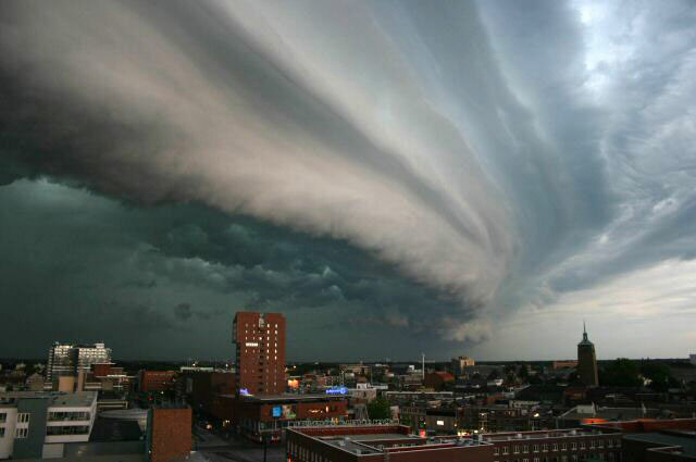
Severe storms
Severe storms are associated with low pressure systems. Intense low pressure systems and their associated cold fronts can generate strong winds and heavy rain over large areas, causing local flash flooding and riverine flooding. Coastal areas and adjacent mountain ranges often experience damaging winds from severe storms. Severe storms can also cause coastal erosion due to storm surge. Storm surge is the combined effect of large waves and an increase in sea level caused by a severe storm. Severe winds can also contribute to extreme bushfire activity.
Tropical cyclones
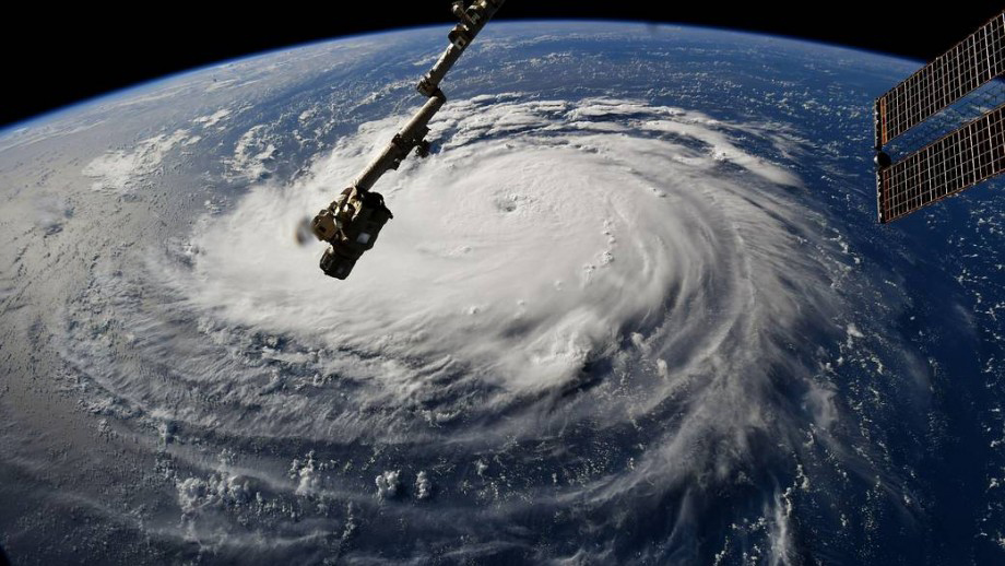
A tropical cyclone is an intense low-pressure system that develops over warm tropical oceans. Tropical cyclones have ongoing severe wind of at least 63 km per hour. The Bureau of Meteorology rates tropical cyclones based on the maximum average wind speed from category 1 to category 5 cyclones. In other parts of the world tropical cyclones are called hurricanes or typhoons.
In tropical cyclones, wind gusts higher than 90 km/h can be expected around their centre, or eye. In the most severe tropical cyclones, gusts can exceed 360 km/h. Although the strongest winds are near the eye, damaging winds can extend hundreds of kilometres from the centre. The eye can have quite calm winds and cloud-free skies, but this lull is temporary and is followed by destructive winds from another direction. This is because the winds spiral around the eye in a clockwise direction (in the southern hemisphere). The effect of this on the ground is that winds on opposite sides of the eye blow in different directions. The severe wind from tropical cyclones can caused damage to buildings, infrastructure, farmland and the natural environment.
Storm surge
Another more dangerous hazard associated with tropical cyclones which make landfall is storm surge. Storm surge has been responsible for more deaths than any other feature of tropical cyclones. Storm surge is a raised dome of water about 60 to 80 kilometres across and typically about two to five metres higher than the normal tide level. It is caused by a combination of strong winds driving water onshore and the lower atmospheric pressure in a tropical cyclone. In the southern hemisphere, the onshore winds occur to the left of the tropical cyclone's path. In Australia, this is the east side on the northwest and north coasts and the south side on the east coast.
The largest surge usually extends between 30 and 60 kilometres from the crossing point of the tropical cyclone centre, or eye. Its magnitude also depends on the local bathymetry of the seafloor and the angle and speed at which the tropical cyclone crosses the coast. If the surge occurs at the same time as a high astronomical tide the area inundated can be extensive, particularly along low-lying coastlines.
Thunderstorms
Severe thunderstorms generate damaging wind gusts, often caused by downbursts as heavy rain and hail drag surrounding air towards the ground. Severe thunderstorms produce wind gusts of 90 km/h or more, with peak wind gusts exceeding 160 km/h in the most damaging storms. In Australia, the strongest measured wind gust during a thunderstorm was 196 km/h at Double Island Point, Queensland, on 16 December 2006.
Tornadoes
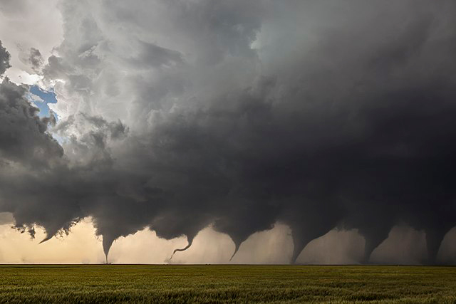
Tornadoes are the rarest and most violent of thunderstorm phenomena. A tornado is a violently rotating column of air suspended from large thunderstorm clouds that is in contact with the ground. It has a funnel shape and can range in width from a few metres to hundreds of metres. The majority of strong and violent tornadoes occur in association with supercell thunderstorms. Tornadoes often occur at the connecting zone between updraught and downdraught regions of a thunderstorm. Weaker tornadoes may spawn from either multi-cell or single-cell thunderstorms.
Tornadoes come in many sizes but are typically in the form of a visible funnel with the narrow end touching the ground. A cloud of debris commonly encircles the lower portion of the funnel. They usually rotate with wind speeds of 175 km/h or less, but can have wind speeds up to 350 km/h. They usually average 75 metres or less in diameter and travel several kilometres before dissipating, although some are more than a kilometre across and can stay on the ground for over 100 kilometres. Severe tornadoes can have winds exceeding 400 km/h but are mostly restricted to widths of less than 100 metres.
Tornadoes typically have a short life span of only a few minutes but are powerful events which can cause extensive damage. The six-point enhanced Fujita scale (EF0 to EF5) was established to quantify the intensity of a tornado and its danger. This scale relates tornado intensity indirectly to structural and/or vegetation damage and corresponds that information to wind speed intervals from 65-510 km/h.
Where does severe wind hazard occur?
Severe storms
Severe storms can occur anywhere in Australia and do so more frequently than any other major natural hazard. Insurance statistics show that severe thunderstorms account for the majority of damaging events. The most common areas for severe thunderstorms are along the east coast from central Queensland to central NSW.
Tropical cyclone
The main source of energy for tropical cyclones is the warm oceans in the tropical regions. To initiate a tropical cyclone the sea-surface temperature generally needs to be above 26.5°C. However, existing tropical cyclones often persist as they move over cooler waters. They lose their source of energy when they move over land or colder oceans causing them to dissipate.
In the Australian region, the official tropical cyclone season runs from 1 November to 30 April, with most occurring between December and April. On average, about 11 tropical cyclones develop over Australian waters each year and around 4 of these cross the coast. In an average season, tropical cyclones are mostly experienced in northwest Australia between Exmouth and Broome in Western Australia and in northeast Queensland between Port Douglas and Maryborough.
Tropical cyclone statistics:
- The greatest number of tropical cyclones in the Australian region in any one year was 20 in 1983. Since 1950, the lowest number of tropical cyclones in any season was just three in 2015.
- The most intense tropical cyclone observed in the Australian region was Tropical Cyclone Monica (2006). When it made landfall near Maningrida, NT, the estimated maximum wind gusts were over 350 km/h.
- The highest (non-tornadic) wind speed ever recorded was observed in Tropical Cyclone Olivia (1996). As it passed over Barrow Island, an anemometer recorded a wind gust of 408 km/h.
Tornadoes
Although tornadoes have been observed throughout Australia, they occur most commonly in the southwestern and eastern parts of the continent and are not as rare as once thought. It was thought that tornadoes were rare because Australia's population is sparse and there was a lack of detection equipment in the past. This meant many tornadoes that occurred were not observed or reported. There have been more than 40 tornado-related deaths in Australia in the past 100 years.
Our Role
Reducing risk to Australians from severe wind
We are committed to support Australia's capability to managing the impact of natural hazards, including severe wind. Our teams:
- develop an understanding of natural hazards and community exposure to support risk mitigation and community resilience
- provide authoritative, independent information and advice to the Australian Government and other stakeholders to support risk mitigation and community resilience
- maintain and improves systems for effective natural disaster preparedness, response and recovery
- contribute to Australia's overseas development program.
In particular we:
- develop national-scale tropical cyclone wind hazard assessments
- GA develops and applies models of severe wind events to evaluate the likelihood and magnitude of TCs. Our Tropical Cyclone Risk Model can be used to simulate thousands of years of TC events, or provide a high-resolution estimate of the winds from individual TCs
- GA maintains fundamental datasets that underpin our understanding of wind hazard and impact across the country, including the national local wind multiplier dataset. These include national elevation and land cover products
- assess the potential impact of severe wind on the community and infrastructure
- Bringing together GA’s location information capabilities and our engineering knowledge , we can estimate the impacts a TC may have on the community, and deliver that information to the EM sector
- support Emergency Management Australia, and the jurisdictions to understand what is exposed to tropical cyclones before, during and after events
- Informs decision making and response planning with quantitative information
- collaborate with the Bureau of Meteorology to develop impact-based forecasting capabilities
- Support more informed national warnings frameworks
- collaborate nationally and internationally to enhance the wind impact and risk modelling capability
- assess strategies to increase the resilience of buildings to severe wind
- conduct post-disaster surveys to understand how severe wind impacts the built environment.
To learn more about our work, access our latest data or hazard assessment tools, visit the Community Safety page. For further information about tropical cyclones the following page from the Bureau of Meteorology has more details What is a Tropical Cyclone?


