


Classroom Resources Search

Analysing landscape changes over time
Teacher guide exploring how satellite data can track landscape and environmental change over decades.
Activity/game; Booklet for teachers

Observing Australian natural hazards
This teacher guide introduces satellite imagery as a way of studying the impacts of natural hazards on Australia.
Activity/game; Booklet for teachers
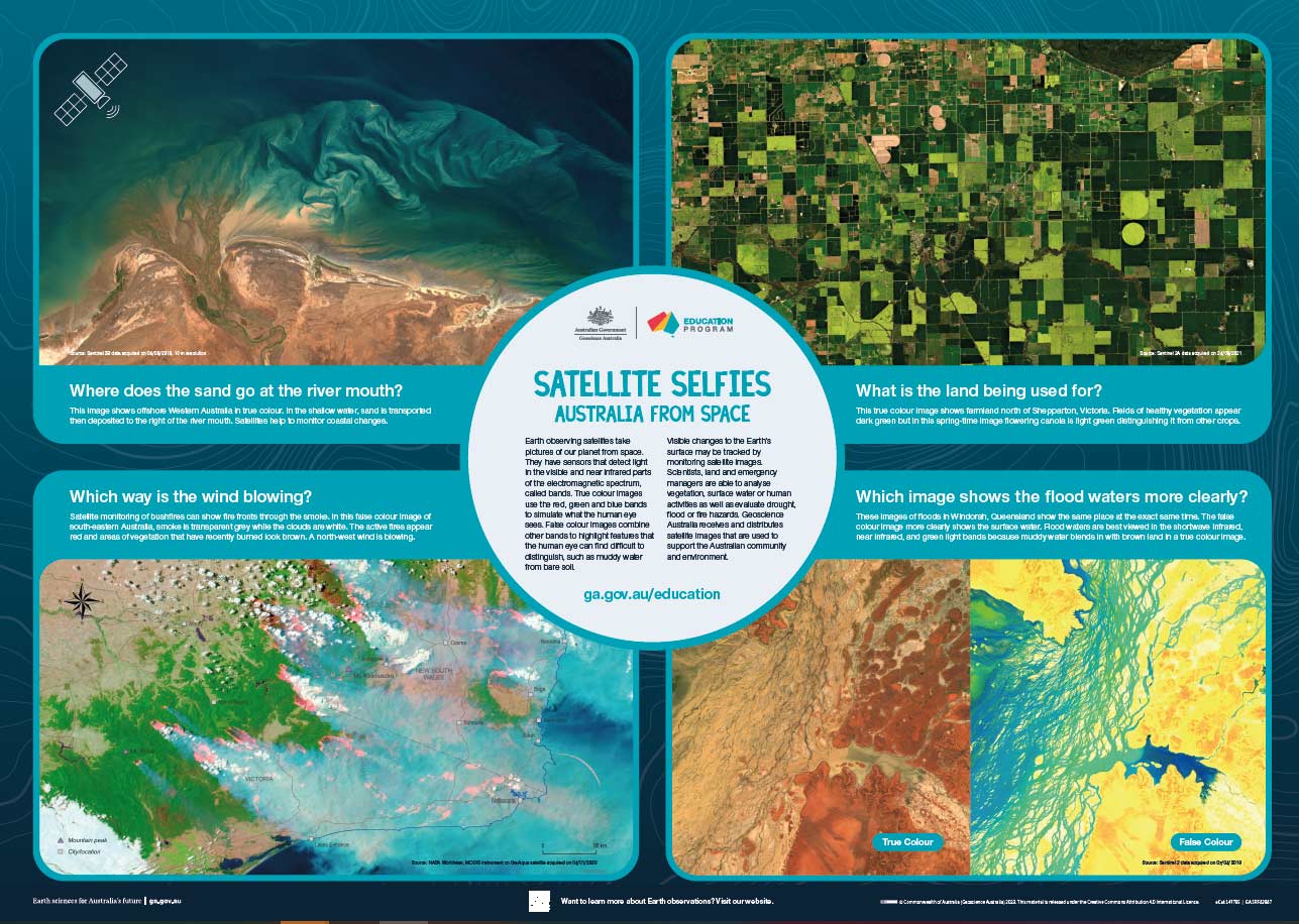
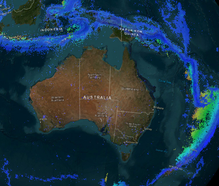
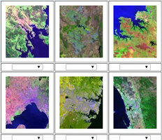
Satellite selfies: Australia from Space Poster
Poster showing satellite imagery across Australia. Introduction to sensors, true and false colour, and application.
Map; Poster
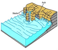
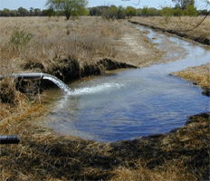
How do rocks store groundwater?
This classroom resource for secondary teachers explores porosity and permeability as it relates to groundwater.
Booklet for teachers
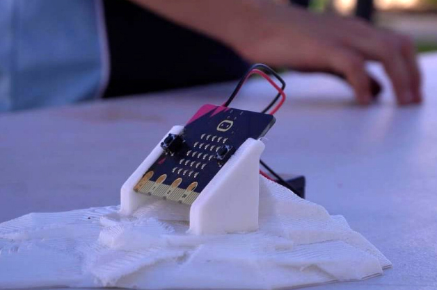
Make your own micro:bit seismometer
This teacher guide explains how to set a micro:bit (small programable computer) up as a mini seismometer.
Activity/game; Booklet for teachers
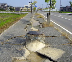
Analysis of earthquakes using real map and data sets
This teacher guide introduces Geoscience Australia earthquake data, and contains student activities.
Activity/game; Booklet for teachers
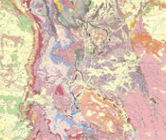
Discovering geological maps
Poster describing each of the elements on a geological map.
Map; Poster
Groundwater mini unit
Explore important concepts about groundwater which includes First Nations Australian perspectives.
Booklet for teachers
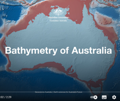
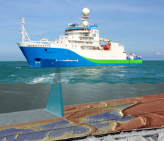
Bathymetry of Australia video
Video flythrough around the coast of Australia showing the major topographic features of the seafloor.
Multimedia
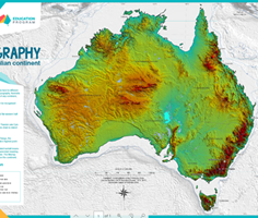
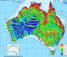
Topography of the Australian continent poster
Poster showing the height and shape of the land surface across Australia.
Poster
Space Education in Australia
Explore different space education resources for preschool students all the way to university students.
Factsheet/pamphlet
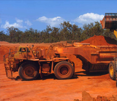
Minerals in Modern Technology
Learn about the many minerals, both common and rare, that are essential for modern technology and renewable energy.
Website external
Ice Power
Investigate the expansion rate of water to ice and how this relates to weathering of rocks in the environment.
Activity/game
Scientific talks
‘Crib sheets’ that summarise talks and provide easy access links to each part of the videos.
Factsheet/pamphlet; Multimedia
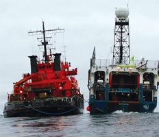
Mapping the ocean floor
Explore sonar and bathymetry with bouncy balls and pre-prepared data.
Activity/game; Factsheet/pamphlet
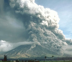
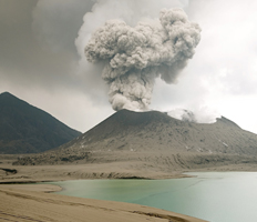
Volcanic hazards
Students learn to think like Emergency Managers.
Activity/game; Map
Spaghetti quakes
Investigate earthquake magnitude using spaghetti pasta.
Activity/game
See how they run
Explore the concept of lava viscosity and influence on volcanic cone shape.
Activity/game
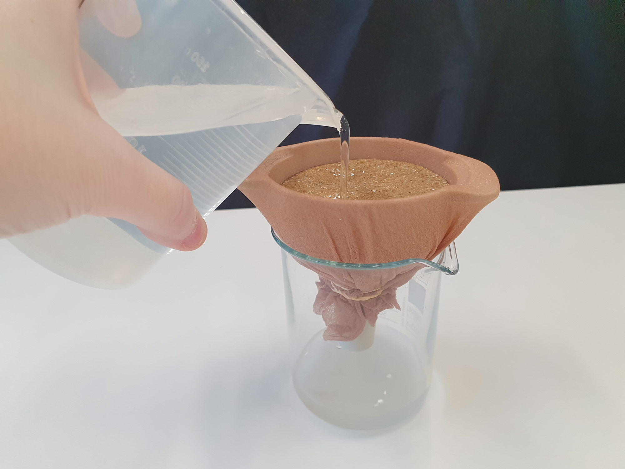
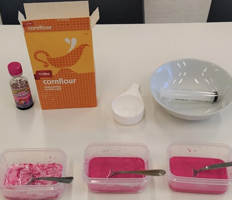
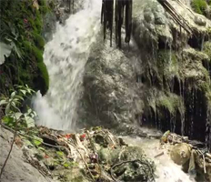
Sugar shake: erosion experiment
This activity introduces the concepts of weathering and erosion by investigating why river pebbles are often rounded.
Activity/game
Volcanoes - teacher notes and student activities
A comprehensive booklet exploring volcanoes. Includes Australian case studies.
Booklet for teachers
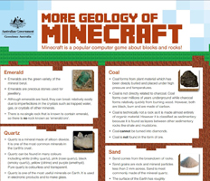
Geology of Minecraft 2
Poster entitled 'More Geology of Minecraft'.
Poster
Google Arts and Culture
National Mineral and Fossil Collection specimens displayed as themed exhibitions and items.
Website external
Tectonic Plates Jigsaw Puzzle
A world map that shows the edges of the major tectonic plates.
Activity/game
Education Centre Updates
A quarterly email newsletter for teachers of science and geography in Australian schools.
Website external
Shaping a Nation: A geology of Australia book
Illustrated book on the geological evolution of Australia through the lens of human impacts.
Book
Earthquakes - Teacher notes and student activities
A comprehensive booklet exploring earthquakes. Includes Australian case studies.
Booklet for teachers
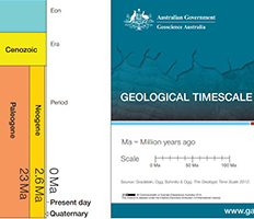
Geological Timescale
A simple to-scale geological timescale.
Activity/game
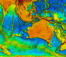
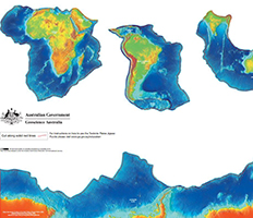
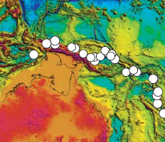
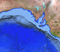
Topography of Australia and surrounding region
The height of the land and features of the sea floor including deep trenches.
Poster
Tsunami - Teacher notes and student activities
A comprehensive booklet exploring tsunami. Includes Australian case studies.
Booklet for teachers
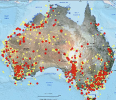
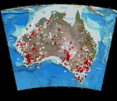
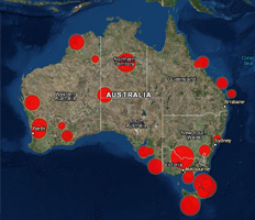
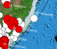
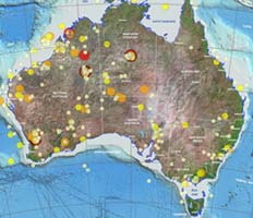
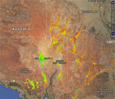
Australian Earthquakes 2014-15
Map of Australia showing earthquake locations and size with accompanying information.
Poster

Tsunamis, earthquakes, volcanoes and you.
Illustrated suite of educational products about earthquake, volcano and tsunami hazard awareness in PNG.
Factsheet/pamphlet
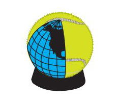
Plate tectonics cut-out on a tennis ball
A4 paper model showing tectonic plates, ready to cut out and assemble onto a tennis ball.
Activity/game
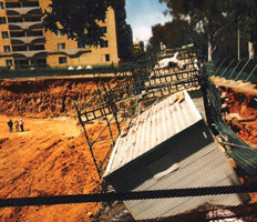
Landslides - Teacher notes and student activities
A comprehensive booklet exploring landslides. Includes Australian case studies.
Booklet for teachers
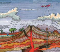
Discovering Geoscience
Theoretical geological cross section from the ocean through a mountain range to inland plains.
Poster
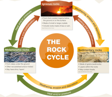
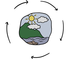
Our Changing Earth - The Rock Cycle
Simple rock cycle: formation and features of igneous, sedimentary and metamorphic rocks.
Poster
Australian Earthquakes 2013
Seismological report for the year - report of poster map.
Poster
Tsunami awareness pamphlet
Pamphlet on warning signs of impending tsunami and what to do in such an event.
Factsheet/pamphlet
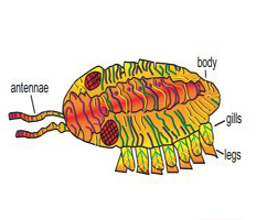
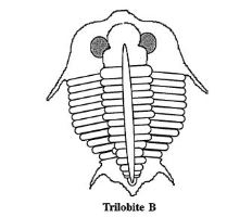
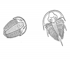
Trilobite 3D cut-out model
A4 paper model, ready to print, cut out and assemble into a 3D model of a trilobite.
Activity/game
Serendipaceratops 3D cut-out model
A4 paper model, ready to print, cut out and assemble into a 3D model of a serendipaceratops.
Activity/game
Map reading guide
Handy booklet for purchase with instructions on how to use topographic maps.
Website external
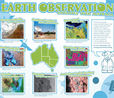
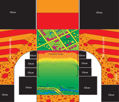
Earth Observation: satellites over Australia
Poster showing a satellite image of each state. Many show natural hazards.
Poster
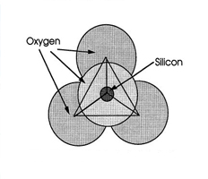
Silicate chemistry - Teacher notes and student activities
Black and white booklet focussed on silicate minerals, their structure and properties.
Booklet for teachers
Magnetic Anomaly Map of Australia
A3 PDF of the magnetic intensity map of Australia.
Map
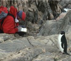
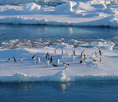
Antarctic Geoheritage activities
Activities for primary and secondary students about living and working in Antarctica..
Activity/game
Time and life, geological time and palaeontology - Teacher notes and activities
Learn about geological time, radioactive decay curves, fossilisation and dating (b & w).
Booklet for teachers

Geographic information
Information about elevation, water bodies, significant rocks, rivers, islands, waterfalls and deserts.
Website internal; Map; Website external
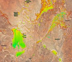
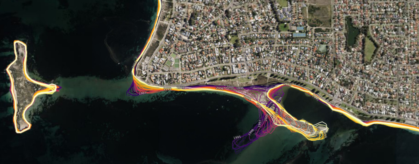
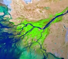
Water observations from space
History of surface water coverage in Australia.
Website internal; Map
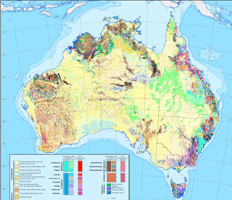
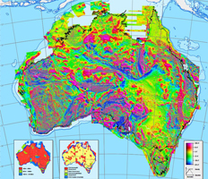
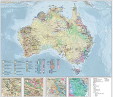
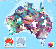
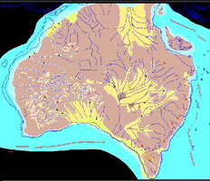
Surface Geology of Australia
JPEG or PDF download of surface geology map of Australia. A3 size.
Map

Outline maps of Australia
Outline maps of Australia - black and white. State boundaries and capital cities or coastline only.
Map
Australia's Maritime Jurisdiction - Teacher notes and student activities
A guide to Australian maritime boundaries such as the EEZ and how they are determined.
Booklet for teachers
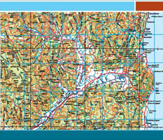
Reference maps of Australia
Four-part wall map (2m x 1.7m), reference maps (1:5 million and 1:10 million), Asia-Pacific region map.
Website external
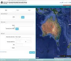
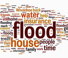
Australian Flood Risk Information portal
Map of Australia with search engine to find flood risk studies from around the country.
Website internal; Map
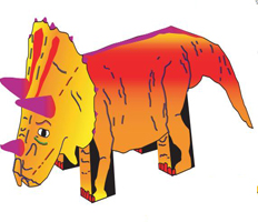
Triceratops 3D cut-out model
A4 paper model, ready to print, cut out and assemble into a 3D model of a triceratops.
Activity/game
Australia, an ancient land - Teacher notes
Explore geological time, fossils and rock dating with an Australia focus (black and white).
Booklet for teachers

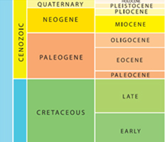
Australia Through Time
Reference poster - evolution of life, palaeogeography, sea level, climate change, minerals.
Poster
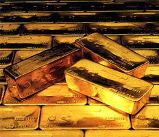
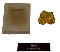
The science of gold - Teacher notes and student activities
Purity, value and properties of gold (black and white).
Booklet for teachers
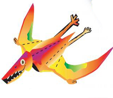
Pterosaur cut-out 3D model
A4 paper model, ready to print, cut out and assemble into a 3D model of a pterosaur.
Activity/game
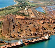
Australia Operating mines map
Large JPEG or PDF map file: operating mines 2018 on a generalised surface geology background.
Map
What lies beneath the Antarctic Ice?
Full colour information and activities about drilling beneath Antarctic ice and the life forms discovered.
Activity/game
Historic Earthquakes of Australia Storymap
Interactive map with detailed information about significant earthquakes in Australia.
Website internal
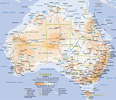
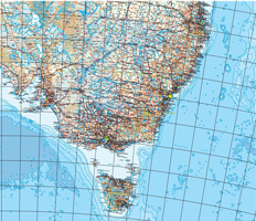
A4 Map of Australia
Compact colour reference map of Australia showing major cities, roads, rail and topography.
Map
A3 Map of Australia
Compact colour reference map of Australia showing major cities, roads, rail and topography.
Map
Shaping a Nation - Chapter 1
Australia and the Australian people: geography, geological heritage and the people.
Book
Shaping a Nation - Chapter 2
Australia in time and space: geology of the continent, flora, fauna and landscapes.
Book
Shaping a Nation - Chapter 3
Living Australia: isolation from other large continental masses has shaped flora and fauna.
Book
Shaping a Nation - Chapter 4
Out of Gondwana: economic benefits of having been part of Gondwana in the form of fossil fuels.
Book
Shaping a Nation - Chapter 5
Old, flat and red: Australia's distinctive landscape, flatness, rivers and regolith.
Book
Shaping a Nation - Chapter 6
Living on the edge: The highly diverse costal margin has influenced the patern of settlement in Australia..
Book
Shaping a Nation - Chapter 7
Groundwater: water availability for crops, farms and cities is underpinned by the knowledge of geology.
Book
Shaping a Nation - Chapter 8
Foundations of wealth: Mineral wealth in Australia and the geological processes that created it.
Book
Shaping a Nation - Chapter 9
Sustaining Australia's wealth: geological stability has created bulk commodities in iron ore, bauxite, coal and gas.
Book
Shaping a Nation - Chapter 10
Deep heat: geothermal energy could supply Australia's future electrical power needs.
Book
Shaping a Nation - Chapter 11
Advance Australia Fair: the opportunities and challenges that Australian geology creates for the future of this nation.
Book
Gravity Anomaly Map of Australia
PDF download of the gravity anomaly map of the Australian region (large file).
Map
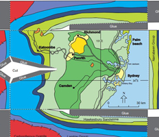
Sydney Basin cut-out
An A4 page ready to cut out and assemble into a 3D model of the Sydney Basin.
Activity/game
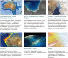
Interactive Maps
Range of Geoscience Australia's geospatial services/maps. Includes marine, geology, hazards and water.
Multimedia
Radiometric Map of Australia
PDF A3 and A0 version of the radiometric map of Australia.
Map
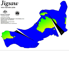
Plate tectonics cut-out on a basket ball
Paper model of a globe showing tectonic plates, ready to cut out and assemble on a basketball.
Activity/game
Australian Earthquakes 2013 map
Summary of earthquakes in Australia for 2013 including the last decade for comparison.
Poster
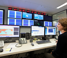
Remote sensing at Geoscience Australia video
Detailed video of Geoscience Australia's highly varied work in remote sensing.
Multimedia
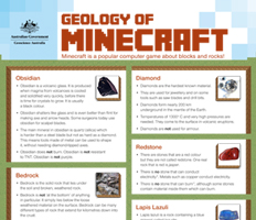
Geology of Minecraft
Poster comparing the concepts in the computer game Minecraft with science/geology.
Poster
Nautilus 3D cut-out model
A4 paper model, ready to print, cut out and assemble into a 3D model of a nautilus.
Activity/game
Geological timescale bookmark
A bookmark featuring the geological timescale. Suitable to print on A4 paper.
Image/diagram/slides
Geological timescale: Australia Through Time app
Geological history of Australia; animated continental drift maps over the last 600 Ma.
App
Rock and mineral factsheets
Rock factsheets downloadable as PDFs on a range of commodities, mostly metals.
Factsheet/pamphlet
Geographic dimensions
Dimensions of States and Territories, Australia compared to other countries, border lengths.
Website internal
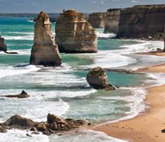
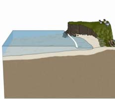
Australian Coast - Teacher notes and student activities
A comprehensive booklet exploring Australia's Coasts. Includes Australian case studies.
Booklet for teachers
50 years of large Australian earthquakes
Map of Australia showing large earthquakes over the last 50 years.
Poster
Weathering, erosion, landforms and regolith
Comprehensive teacher notes with student activities.
Booklet for teachers
Tsunami animations
Animations of tsunami caused by undersea earthquakes, landslides and volcanic eruptions.
Multimedia
Groundwater in Timor Leste
Three short videos on groundwater resources in Timor, hydrogeology and vulnerability.
Multimedia
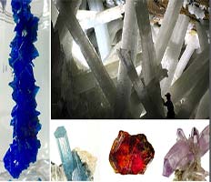
Exploring minerals and crystals
Comprehensive teacher notes with student activities.
Booklet for teachers
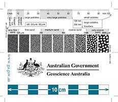
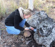
Sediment analysis card
This card is useful for analysis of sediments - size, roundness, sorting.
Image/diagram/slides
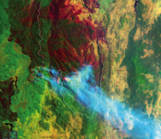
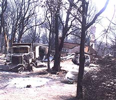
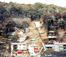
Canberra firestorm January 2003
Satellite image showing burnt land and the fire front during the 2003 Canberra bushfires.
Poster
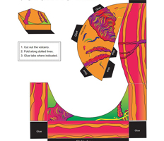
Shield volcano cut-out
An A4 paper model, ready to cut out and assemble into a 3D shield volcano.
Activity/game
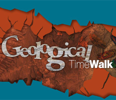
Geological TimeWalk: Australia's geological history
A comprehensive 52 page colour booklet exploring the geological history of Australia.
Book
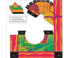
Strato volcano cut-out
An A4 paper model, ready to cut out and assemble into a 3D strato volcano.
Activity/game
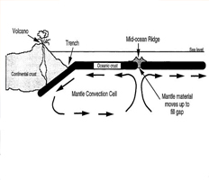
Plate tectonics - Teacher notes and student activities
Introduction to the theory of plate tectonics; includes evidence and student activities (b & w).
Booklet for teachers
Create your own geological timewalk
Instructions on how to create your own to-scale geological time scale for three distances.
Activity/game
As the cocky flies
Allows you to calculate the distance between two places in Australia.
Website internal
Australian Mines Atlas
Mineral factsheets and information about Australia's identified mineral resources.
Website internal
Minerals Downunder
Useful information on gold, copper, silver, mineral sands, iron and exploration techniques.
Website internal
Hazards
Comprehensive webpages about natural hazards, risk analysis and nuclear monitoring.
Website internal
Geocaching activity
Instructions on how to geocache together with spatial activity ideas for the classroom.
Activity/game
Australia's maritime jurisdiction
A booklet explaining Australia's land and water jurisdictions in plain language.
Booklet for teachers
Sentinel bushfire mapping application
National bushfire monitoring system showing hotspots for emergency service managers across Australia.
Website internal
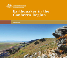
Earthquakes in the Canberra region
32 page booklet about seismic activity in the ACT region.
Book
Landslides cut-out
An A4 paper model, ready to cut out and assemble into a 3D model of a landslide.
Activity/game
Fossils - Teacher notes, fact sheets and student activities
Black and white booklet about fossils, fossilisation and major fossil groups.
Booklet for teachers
Landslide awareness brochure
Colour brochure about landslide awareness and what to do in unstable areas.
Factsheet/pamphlet
Slump cut-out
An A4 paper model, ready to cut out and assemble into a 3D model of a moving slump.
Activity/game
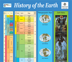
History of the Earth
Geological time scale, palaeogeographic maps and illustrations of life forms over time.
Poster
Land cover in Australia
Map of Australia's land cover. Includes a link to a 3D data viewer.
Website internal
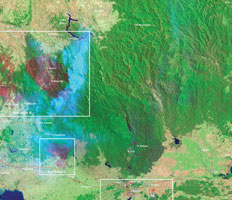
Satellite images of Victoria bushfires 2009
Satellite image of landcover across Victoria during the 2009 bushfires.
Poster
Water
Information on groundwater, the Great Artesian Basin and groundwater resources in Australia.
Website internal
Large data cube: earth observation data
Video on the future of earth observation data management and analysis e.g. flood studies
Multimedia
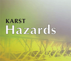
Karst hazard brochure
The distinctive landform features associated with limestone rock weathering e.g. sinkholes.
Factsheet/pamphlet
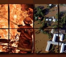
Natural Hazards in Australia
Overview of rapid onset hazards in Australia, impact on communities and risk evaluation.
Book
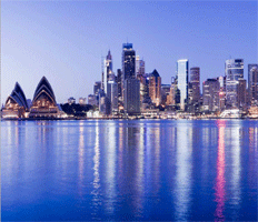
City Quest
Interactive Quiz using satellite images of Australian capital cities
Activity/game
Australia - Palaeogeographic Atlas
Click through the images to see what Australia looked like throughout geological time.
Multimedia
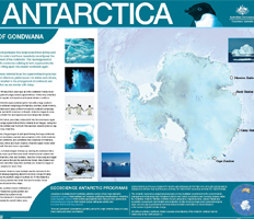
Antarctica poster
Poster featuring satellite image of Antarctica and geological history of the continent.
Poster