News
Australian Geoscience Data Cube innovation recognised on world stage
Published:24 January 2017
Australian Geoscience Data Cube innovation recognised on world stage
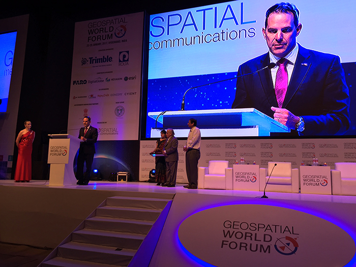
The Australian Geoscience Data Cube has won the 2016 Content Platform of the Year category at the Geospatial World Leadership Awards.
The Australian Geoscience Data Cube has won the 2016 Content Platform of the Year category at the Geospatial World Leadership Awards.
These awards recognise significant contributions made by champions of change within the global geospatial industry, and were presented this week during the gala evening of the 2017 Geospatial World Forum in Hyderabad, India.
Developed by Geoscience Australia in partnership with the CSIRO and the National Computational Infrastructure (NCI) at the Australian National University, the Data Cube is a world-leading data analysis system for satellite and other Earth observation data.
Chief of Geoscience Australia's Environmental Geoscience Division, Dr Stuart Minchin said the award recognises how the Data Cube is helping Australia and other countries to capitalise on the billions of dollars invested in launching and operating Earth observation satellites.
"The volume and diversity of satellite and other Earth observation data has increased exponentially over the last 30 to 40 years, and until recently this presented significant technical barriers to realising its full potential.
"The Data Cube is an innovative approach to organising and analysing this data, making it quicker and easier to provide information to decision makers in fields such as agriculture, natural resource management and community safety.
"This enables us to take the incredible resource of freely-available Earth observation data from around the world and improve how we monitor our landscape and better target the money we spend to protect our environment and grow our economy," Dr Minchin explained.

Geoscience Australia's Dr Stuart Minchin receives the Geospatial World Leadership Awards Content Platform of the Year
This Australian innovation is now influencing how the world looks at and uses satellite data. The Data Cube was intentionally developed using Open Source technology and freely available data, to make it possible for other governments to easily adapt and implement their own versions of the Data Cube.
The Data Cube consortium is now actively working to build a global community that further develops the open-source codebase as a resource for the benefit of the broader international community. Through partnerships with the international Committee on Earth Observation Satellites (CEOS), the technology has already been adapted and is being implemented in Cameroon, Colombia and Kenya. This will provide valuable insight into key issues such as water resource management, and which could in turn help to address the UN sustainable development goals.
"An example of the type of analysis possible is the Water Observations from Space product, the world's first continent-scale map of surface water derived from Landsat satellite imagery. Another example is the recently developed Intertidal Extent Model, which uses satellite imagery to model the extent and elevation profile of Australia's extensive intertidal zone," Dr Minchin said.

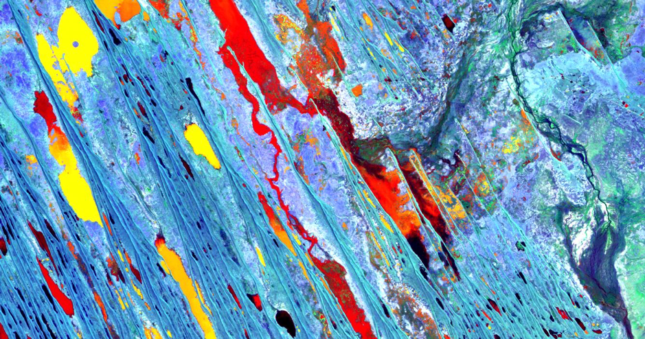
Landsat 5 imagery acquired over part of the Georgina River, north of Lake Eyre in South Australia on 28 March 2011.
A key innovation of the Data Cube is its sophisticated geospatial cataloguing system to manage and analyse the large volumes of satellite imagery and other gridded geospatial datasets covering the Australian continent. The system is run on the NCI, which is built on infrastructure funded by the National Collaborative Research Infrastructure Strategy.
CSIRO's Executive Director of Digital, National Facilities and Collections, Dr Dave Williams said "the Data Cube is a catalyst for the Australia's spatial applications industry. It provides small businesses with access to stable and standardised data from which they can innovate to produce new products and services for both domestic and international markets."
"Before Data Cube, satellite imagery and other gridded geospatial datasets were downloaded, analysed and provided to users on a customised basis ¿ an inefficient and time consuming process.
"Data Cube creates a whole range of opportunities within Australia for example, products and applications that can improve agricultural productivity, provide more efficient tools for environmental accounting and monitoring at mine sites," Dr Williams said.
This video introduces the architecture of the Australian Geoscience Data Cube as a key tool for unlocking Earth observation satellite data.
Visit www.datacube.org.au to find out more including the technical specifications, and learn how you can develop your own Data Cube and become part of the collective.
Further information
Contact:
Phone:
Email:


