News
Continental-scale mapping of mineral potential wins top award
Published:28 July 2016
Continental-scale mapping of mineral potential wins top award
A Geoscience Australia project that is helping to build a better understanding of Australia's mineral potential has won the Engaging with the Edge category of the 2016 Public Sector Innovation Awards.
The awards recognise the past year's best examples of innovation within the Australian Government and were presented by Minister for Industry, Innovation and Science the Hon Greg Hunt MP at a ceremony in Canberra last night.
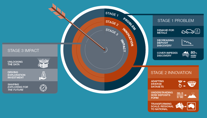
Discovery of major new resources of economically-vital base and precious metals has slowed over the past decade or so, across periods of both increasing and decreasing exploration investment. For Australia to regain its position as a world leader in mineral exploration, the exploration industry needs new approaches to overcome a key impediment: the blanket of sediments that conceals large areas of Australia's basement rocks that are prospective for undiscovered mineral deposits.
Geoscience Australia is helping to address the problem by developing a new approach to targeting prospective mineral provinces. This study is the first of its kind in Australia, and it is also understood to be the first time in the world that this has ever been attempted at the continental scale.

The Mineral Potential Mapper is a new computer-based decision support tool being used to help identify prospective regions for new deposits
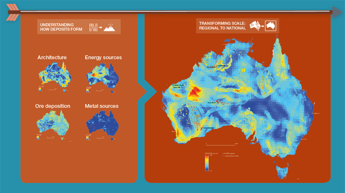
This innovative approach is being implemented via the Mineral Potential Mapper, a new computer-based decision support tool which is being used to help identify prospective regions for new deposits of nickel, copper and the platinum-group elements (PGEs). A key innovation has been the integration of new datasets that map the structure of the Australian continent beneath the blanket of sediments to depths of 100 kilometres or more. These datasets, many of which have not been previously used in mineral potential assessments, help map the pathways of metal-rich magmas from Earth's mantle into the near-surface parts of the crust, where the deposits are most likely to be discovered.
The Mineral Potential Mapper has already been used to highlight 13 regions with high potential for nickel, copper and PGEs, and uncovered previously unseen patterns in Australian geology that are of direct relevance to identifying prospective areas for these deposits. Importantly, the results also predict high mineral potential in several areas where no deposits were previously known to exist.

New combinations of existing datasets have provided additional insight into Australia's mineral potential
These results provide the mineral exploration industry with new target regions within which further data acquisition can be focused on discovering new mineral deposits. By reducing risk in exploration investment, the Mineral Potential Mapper has identified regions that will be very attractive for investment, and will hold the lure of discovery of entirely new mineral provinces.
Contact:
Phone:
Email:


