News
Helping coastal managers plan better for future storms
Published:24 April 2018
Helping coastal managers plan better for future storms
Researchers from Geoscience Australia have developed a new tool-kit that is helping coastal managers to better understand how beaches are impacted by storm events.
Our Australian coast is dynamic with an ever changing shoreline shaped by the normal action of tides, waves and storms. However, some storms cause significant erosion, causing an ongoing problem for some populated areas of the Australian coast. Without adequate baseline knowledge of the coastal environment, we cannot predict the likely response of shorelines to future storms.
The Resilience to clustered disaster events at the coast: storm surge project, supported by the Bushfire and Natural Hazards CRC has developed a comprehensive method for understanding the impact of storm events on the beach environment. The project studied two Australian locations where coastal erosion is an ongoing management issue.
In the first case study, which looked at Old Bar on the central-north coast of New South Wales, erosion is ongoing and has led to property loss in recent years. In the second case study, which looked at Adelaide's metropolitan beaches, beach erosion has been actively managed since the 1970s¿and continues through Adelaide's Living Beaches Strategy.
 The actively eroding dune face at Old Bar, as seen in June 2015.
The models and information from the Old Bar project allow coastal managers to evaluate the impact of an event and to better respond to severe storms or multiple storm events.
James Guy from South Australia's Department for Environment and Water highlights the important role thisproject has played in building the body of knowledge around shoreline response to clustered storms.
"The new data, modelling tools and summary information for case study sites, are essential reference materials for coastal managers."
He confirmed that the Department for Environment and Water will use the outcomes of this research to refine their annual beach replenishment program, which is used to maintain adequate storm buffers for the protection of infrastructure along the Adelaide coast.
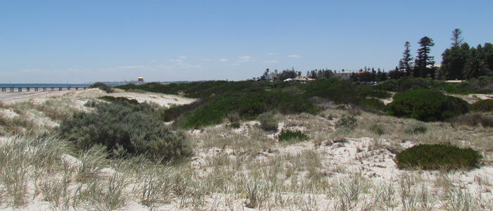
 Dunes at Adelaide's Semaphore Beach.
The benefits and outcomes of this work have now been presented via a new Coastal Erosion StoryMap. These methods can be applied at any other location nationwide¿where sufficient data is available¿supporting decision making to protect valuable coastal assets.
Further information:
- StoryMap: Coastal Erosion Understanding cause, response and impact
- Scientific Topic: Coastal Erosion
Contact:
Phone:
Email:


