


News archive (November 2013 to July 2023)

Cancellation of Antarctic voyage
10 January 2022
CSIRO has taken the decision to cancel the upcoming voyage of research vessel (RV) Investigator after a voyage participant tested positive for COVID-19.
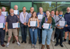
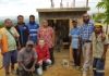
Geoscience Australia celebrates International Volunteer Day
8 December 2021
To mark International Volunteer Day, Geoscience Australia staff gathered to acknowledge the important contributions made by their group of dedicated volunteers over 2021 at a thank you event.
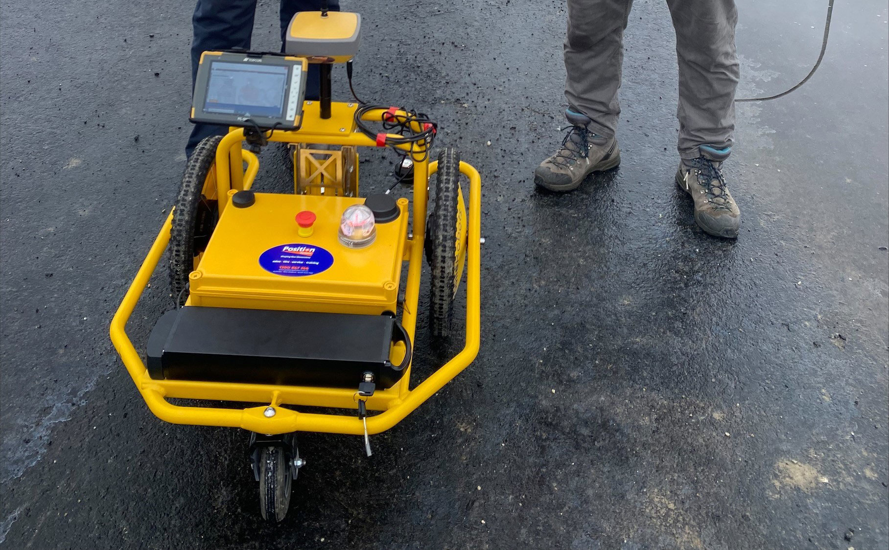
Data Driven Discoveries initiative to shed new light on resource potential
1 December 2021
Geoscience Australia will re-examine decades-old seismic data as part of a new initiative to identify opportunities for energy, minerals and groundwater in a key underexplored basin.
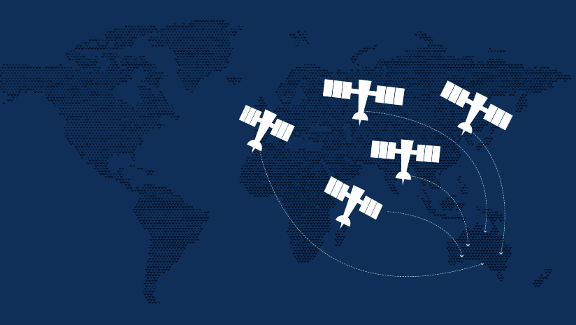
Geoscience Australia part of international effort to compare next generation of satellite data
29 November 2021
Geoscience Australia has taken part in a global campaign to compare data from the Landsat 8 and 9 satellites during a rare underfly.

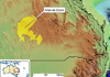
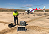
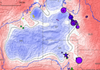
Magnitude 5.3 earthquake in Pilbara, Western Australia
14 November 2021
Geoscience Australia recorded an earthquake of a preliminary magnitude of 5.3 on 13 November 2021 at 9.05 pm local time east of Marble Bar in the Pilbara, Western Australia.
Chalice makes history with discovery
10 November 2021
Geoscience Australia's award-winning Mineral Potential Mapper has supported the largest nickel sulphide discovery in over two decades.
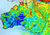
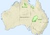
Exploring for the Future takes a deeper look at northern Australia
28 October 2021
A new electrical conductivity model released by Geoscience Australia’s Exploring for the Future program offers a deeper look at the geology in northern Australia with promising results.
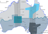
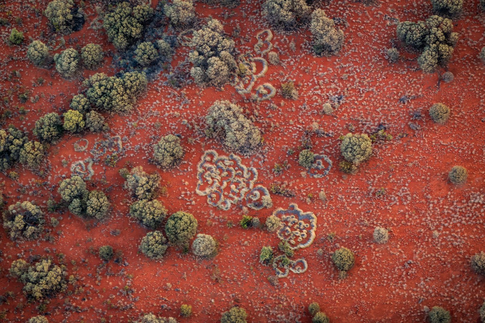
Geochemical results show promise of Carrara Sub-basin
27 October 2021
New geochemical analysis indicates a previously unexplored area of northern Australia has promise as a new hydrocarbon province.
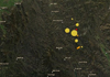
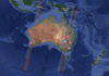
Victoria’s biggest earthquake on record
23 September 2021
Geoscience Australia says more aftershocks may be felt across Victoria, after the largest onshore earthquake for the state was recorded on Wednesday.
Recent earthquake in Victoria
22 September 2021
Geoscience Australia can confirm that a 5.9 magnitude earthquake was recorded at 09.15 AEST, Wednesday, 22 September 2021.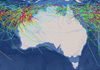
Latest research strengthens cyclone preparedness
28 September 2021
New research that demonstrates the potential impact of tropical cyclones on Western Australian homes will assist local communities to prepare for extreme weather ahead of the upcoming wet season.
First major release from expanded Exploring for the Future program
15 September 2021
New airborne electromagnetic data from the Exploring for the Future program will provide an unprecedented snapshot of the geology of south-eastern Australia.

Key step taken for Digital Earth Africa
6 August 2021
Geoscience Australia has reached another milestone in the establishment phase of Digital Earth Africa, with the South African National Space Agency (SANSA) appointed to host the Program Management Office going forward.

Critical minerals portal to strengthen supply chains
29 June 2021
Geoscience Australia has taken a key step in its partnership with the United States Geological Survey and the Geological Survey of Canada, with the release of the Critical Minerals Mapping Initiative online portal today.

Geoscience Australia releases inaugural Australian Energy Commodity Resources assessment
16 June 2021
Minister for Resources, Water and Northern Australia Keith Pitt today launched the inaugural Australia’s Energy Commodity Resources (AECR) 2021 publication, a national stocktake of our natural gas, coal, and uranium resources.

CEO Statement on Budget 2021-22
12 May 2021
Recent events such as the COVID-19 pandemic and the Black Summer bushfires have demonstrated the urgent need for timely, authoritative and accessible information to make informed decisions to strengthen Australians’ resilience to disasters and open up new economic and social opportunities to grow Australia’s future.
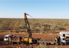
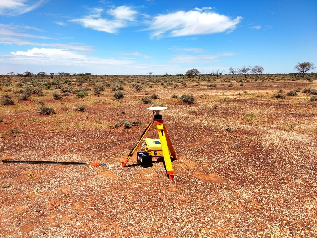
First data released from National Drilling Initiative’s South Nicholson campaign
20 April 2021
The first data from one of the most promising exploration frontiers in Australia is now available from Geoscience Australia.
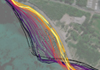
Satellite imagery reveals three decades of coastal change
14 April 2021
The evolution of Australia’s coastlines can now be seen in unprecedented scale and detail, via a new tool developed by Geoscience Australia’s Digital Earth Australia (DEA) program.
Trial of Accurate Positioning Technology wins Asia Pacific Spatial Excellence Award!
9 April 2021
Geoscience Australia was proud to accept the People and Community category of the Asia-Pacific Spatial Excellence Awards for the Satellite-Based Augmentation System (SBAS) Test-bed project.
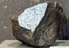
The Georgetown (iron) meteorite has found its home at Geoscience Australia!
7 April 2021
Thanks to support from the Australian Government, the largest piece of the Georgetown (iron) meteorite ever discovered will educate and inspire new generations of Australians who visit Geoscience Australia.

Mineral exploration spend at highest levels since 2012
12 March 2021
Exploration investment in Australia has boomed, according to a new report launched today by Minister for Resources, Water and Northern Australia Keith Pitt.
New Exploring for the Future projects announced
4 March 2021
Minister for Resources, Water and Northern Australia, Keith Pitt today announced eight new projects will unlock the potential of Australia’s groundwater, energy and mineral resources during the next four years of the Australian Government’s $225 million Exploring for the Future program.
Australia’s world-leading precompetitive geoscience looking deep undercover
5 March 2021
While the Australian Government’s Exploring for the Future program is successfully driving economic benefits, the internationally recognised science behind it is also some of the first of its kind.
A new frontier for mineral exploration
5 March 2021
The first results from the National Drilling Initiative have highlighted exciting new opportunities for the resources industry in the Northern Territory.
Stratigraphic drilling completed in the East Tennant and South Nicholson
3 February 2021
The Australian Government’s $225 million Exploring for the Future Program, led by Geoscience Australia, has enabled the completion of MinEx CRC’s first National Drilling Initiative campaigns.
Preparing for the unexpected — Knowing when, where, and the impact of tropical cyclones
1 December 2020
With the return of La Nina to Australia, it’s more important than ever for emergency managers and communities to be better prepared for severe weather.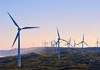
Mapping Australia’s hydrogen future
23 November 2020
Geoscience Australia is supporting Australia’s increased use of low emissions technology with a world-first tool that maps the nation’s clean hydrogen potential.
Statement on Budget 2020-21
7 October 2020
Geoscience Australia’s budget information is published in the Industry, Science, Energy and Resources 2020-21 Portfolio Budget Statements.
Gravity: More than meets the eye
7 October 2020
Ever opted to take the stairs over the lift for the sake of additional exercise? You’ll be pleased to know that on reaching the top, you’ll appear to weigh an average 100 mg less than what you did at the bottom!
A testing time for an ever-present danger
7 October 2020
In a year full of virtual events, Australia has just survived a virtual tsunami.
2020 Offshore Petroleum Acreage Release
26 August 2020
Minister for Resources, Water and Northern Australia Keith Pitt today formally released the 2020 Acreage Release areas for offshore petroleum exploration at the APPEA Re-Connect Webcast.

Exploring for the Future expands across Australia
11 August 2020
Minister for Resources, Water and Northern Australia Keith Pitt today announced that two new resource potential corridors stretching the length of mainland Australia will be the focus of the $125 million expansion of the Exploring for the Future program.
Mineral deposits near Tennant Creek estimated to be worth billions
5 August 2020
Minister for Resources, Water and Northern Australia Keith Pitt today issued a joint media release with Senator for the Northern Territory Dr Sam McMahon about the economic potential of natural resources in underexplored areas of the Northern Territory.
Exploring for the Future program update released
23 July 2020
Geoscience Australia has released the Exploring for the Future Program Update 2016-2020, which provides an overview of the program’s activities in northern Australia and what they have delivered so far.

New online data portal for resources sector
7 July 2020
Minister for Resources, Water and Northern Australia, Keith Pitt today announced the launch of an online data portal that provides explorers with free access to around 250 datasets collected as part of the Australian Government’s $225 million Exploring for the Future program.
Disaster resilience program extended in Papua New Guinea
1 July 2020
The Australian Government will continue to help reduce the risk of earthquakes, volcanos and tsunamis in Papua New Guinea from today, with Australia’s Technical Disaster Risk Reduction program extended for another three years.

CEO statement
23 June 2020
I am excited by Minister Pitt’s announcement of the $125 million extension and expansion of the Exploring for the Future (EFTF) program.
Baseline analysis reports released for future shale and tight gas regions
19 May 2020
Minister for the Environment Sussan Ley and Minister for Resources, Water and Northern Australia Keith Pitt have released baseline analysis reports from Stage Two of the Geological and Bioregional Assessment Program.
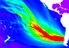
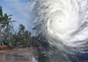
How the world’s largest earthquake made waves in Australia
22 May 2020
Tsunami in Australia are rare, yet when they do occur, they pose a serious risk to our large coastal population. Looking at past events helps us understand how tsunami might impact Australia in the future.
Message from Chief Executive Officer on COVID-19
1 May 2020
As we see on a daily basis, COVID-19 (Coronavirus) is changing the way organisations around the world are carrying out their business.
Geoscience Australia update in response to COVID-19
16 November 2021
The Australian Government is seeking to minimise the impact of COVID-19 (Coronavirus) on the health of Australians, the health system and the economy.
Applying geoscience to disaster risk reduction
19 March 2020
Geoscience Australia is marking the importance of the Sendai Framework for Disaster Risk Reduction 2015-2030 to reducing the impact of natural hazards around our region, five years after it was adopted by Australia at Third UN World Conference in Sendai, Japan on 18 March 2015.

New data shows increase in critical minerals
4 March 2020
Minister for Resources, Water and Northern Australia, Keith Pitt today announced the release of new data that shows Australia’s stock of identified critical mineral resources is increasing.