


News archive (November 2013 to July 2023)

Geoscience Australia recognised for commitment to gender equity and diversity
21 February 2020
Steps taken by Geoscience Australia to eliminate gender bias and build an inclusive workplace culture have been recognised by the Science in Australia Gender Equity (SAGE) initiative at a ceremony held last night at the Adelaide Town Hall.

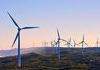
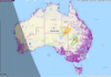
Planting the seeds of Australia’s farming future
18 February 2020
Geoscience Australia is harnessing the power of satellites to deliver benefits to farmers on the ground.
Geoscience Australia’s 10 year priorities
20 December 2019
We have chosen to refresh our organisational design with a new structure and governance. This structure includes two new scientific divisions, a new corporate division, and the ongoing Office of the Chief Scientist
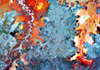
The beauty of Earth observations – art that informs our modern world
20 December 2019
We have been observing the Earth and its processes for centuries to understand the world around us and how it’s changing.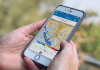
Change in forecast for GPS signal data
11 December 2019
Data on the delay of Global Positioning System (GPS) signals reaching Australia is being used to help improve the accuracy of rainfall predictions.
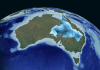
30 years of Australia at its barest
4 December 2019
Geoscience Australia and the Australian National University (ANU) are celebrating a collaborative effort to create a single cloud-free image of Australia’s soil and rock cover – effectively stripping our landscape bare.
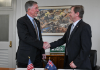
US-Australia partnership on critical minerals
19 November 2019
Collaboration between Australia and the United States on critical minerals is now even stronger through the signing of a project agreement today.
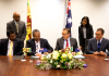
Geoscience Australia secures new international agreements
15 November 2019
Geoscience Australia confirmed its role as a leading global collaborator last week at one of the world’s largest gatherings of Earth observation practitioners and policy makers – GEO Week 2019.

Ever-present risk of tsunami highlighted by near-miss in Broome
5 November 2019
Today (5 November) marks World Tsunami Awareness Day and experts from the Joint Australian Tsunami Warning Centre are reminding those living near coastal areas to recognise the natural warning signs for tsunami and to know how to respond.
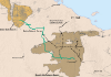
New data to bridge gap in frontier oil and gas regions
4 November 2019
Minister for Resources and Northern Australia, Matt Canavan, and the Northern Territory Minister for Primary Industry and Resources, Paul Kirby, today announced a new seismic survey in the Northern Territory’s Barkly region will wrap up this week.
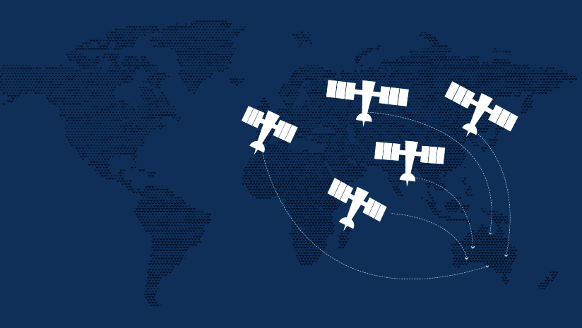
40 years of Landsat in Australia
4 November 2019
Geoscience Australia’s Alice Springs satellite ground station hosts two 9 metre antennas, a 2.4-metre antenna, and associated infrastructure. The satellite ground station is one of three forming a global Landsat satellite ground station network and has been in operation since 1979.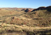
Gravity: More than meets the eye
29 October 2019
Ever opted to take the stairs over the lift for the sake of additional exercise? You’ll be pleased to know that on reaching the top, you’ll appear to weigh an average 100 mg less than what you did at the bottom!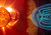
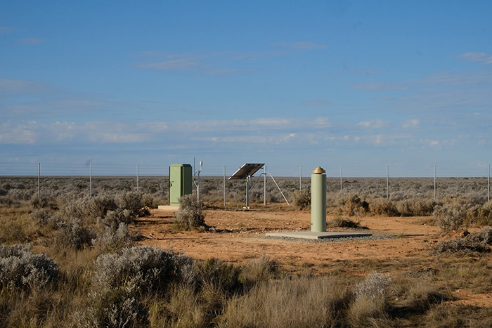
Geoscience Australia’s role in space weather monitoring
22 October 2019
Imagine if all the electrical grids and devices in the world suddenly stopped working; or all the satellites currently in orbit dropped out, resulting in no satellite communications, and no GPS.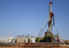
New deep stratigraphic well to unlock resource potential in the Pilbara
14 October 2019
Minister for Resources and Northern Australia, Matt Canavan, and the West Australian Minister for Mines and Petroleum, Bill Johnson, today announced a new deep stratigraphic well in the Canning Basin.
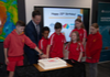
Celebrating 20 years of geoscience education
14 October 2019
Today, Geoscience Australia welcomed the Minister for Resources and Northern Australia Matt Canavan to celebrate the 20-year anniversary of our popular Education Centre.

Geoscience Australia’s maps move to digital
4 October 2019
Geoscience Australia is committed to providing fast and easy access to our mapping services for the community.

Digital Earth Australia recognised for excellence
4 October 2019
Geoscience Australia’s Digital Earth Australia (DEA) program has been recognised for its innovative platform, stakeholder engagement and best practice at the Australian Government Digital Awards.
New report shows Australia highly prospective for hydrogen production
24 September 2019
The Minister for Resources and Northern Australia Matt Canavan today released Geoscience Australia’s report ‘Prospective hydrogen production regions of Australia’.

Reach for the Moon in Canberra this July
To celebrate the 50th Anniversary of the Apollo 11 mission, Canberra locals and visitors can embark on a voyage of discovery on a special Moon Rock Trail from Friday, 5 July 2019.
Digital hazard mapping used during the federal election
7 June 2019
In the lead-up to the recent federal election, Geoscience Australia developed a digital mapping tool for the Australian Electoral Commission (AEC) to monitor their election sites for potential natural hazards.
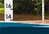
Clear skies for new Australian Rainfall and Runoff update
23 May 2019
Local flood modellers now have access to more reliable and robust data than ever before following the release of the latest update to Australian Rainfall and Runoff.

Library closure for renovations
Users of the N.H. ‘Doc’ Fisher Library at Geoscience Australia are advised that it will be CLOSED for building works from 17 April until a date in August (to be determined).
Lord Howe Island – a window to the depths of Zealandia?
Rare pieces of rock from Lord Howe Island may provide insights into the deep geology of Zealandia, a submerged continental fragment once joined to Australia.

Statement on Budget 2019-20
The Australian Government has handed down the 2019-20 Budget.
Game-changing landscape management workshops held across Australia
NRM Regions Australia and Geoscience Australia have completed five collaborative workshops with natural resource managers from across the nation to make use of geoscience data to help manage our natural resources.
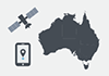
Planting the seeds of Australia’s farming future
19 March 2019
Ground-breaking satellite positioning technology was on show today, when the Minister for Resources and Northern Australia Matt Canavan visited SwarmFarm Robotics in Emerald, Queensland.

New airborne electromagnetic (AEM) survey data released
19 March 2019
The Minister for Resources and Northern Australia Matt Canavan today announced the second data release for the world’s largest airborne electromagnetic survey.
New strategy to help Australian industry use satellite data
18 March 2019
Geoscience Australia and FrontierSI have engaged with more than 500 stakeholders on the development of its industry strategy for the Digital Earth Australia (DEA) program.

Critical Minerals in Australia report released
8 March 2019
The Minister for Resources and Northern Australia, Senator Matt Canavan today announced the release of the Critical Minerals in Australia: A Review of Opportunities and Research Needs report.

Australian minerals shine on global stage
5 March 2019
Geoscience Australia has released the latest report on Australia's Identified Mineral Resources (AIMR) during the Prospectors and Developers Association of Canada Convention in Toronto.
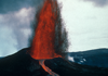
New volcano monitoring tool to be trialled in Papua New Guinea
13 February 2019
Remote locations in Papua New Guinea will be more resilient and informed about volcano hazards than before with the next stage in an Australian study to be trialled in Rabaul.
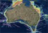
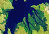
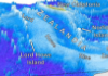
Seeing more of Australia's seafloor
7 February 2019
New high-resolution bathymetry datasets are now publicly available on the AusSeabed Marine Discovery Portal.
Groundwater shines a light on hidden mineralisation
20 December 2018
Geoscience Australia released today new data from remote groundwater bores, which give hints of hidden mineralisation.
Funding for Great Artesian Basin Groundwater Project announced in Mid-Year Economic and Fiscal Outlook 2018-19
21 December 2018
The Australian Government announced yesterday in the Mid-Year Economic and Fiscal Outlook for 2018-19 that it will invest $6.5 million over three years in the Great Artesian Basin Groundwater Project.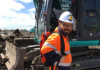
Construction industry latest to trial new global positioning technology
10 December 2018
Construction is the latest of 10 industry sectors to see significant improvements through increased safety and also greater productivity from a trial of advanced satellite-based positioning.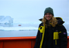
Supporting gender equity in STEM
6 November 2018
Geoscience Australia has proudly contributed to the Australian Government's Women in Science, Technology, Engineering and Mathematics (STEM) Decadal Plan consultation process.
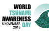
World Tsunami Awareness Day: highlighting the ever-present tsunami threat to Australia
5 November 2018
While tsunami is a real and constant threat, Australia has well-developed systems in place to help protect the community.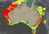
A new wave of tsunami hazard data
5 November 2018
Geoscience Australia today released the 2018 update to the Probabilistic Tsunami Hazard Assessment (PTHA), which outlines the tsunami hazard for all of Australia and its offshore territories.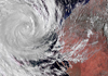
Applying science to build community resilience against tropical cyclones
1 November 2018
Geoscience Australia today released the first update to the Tropical Cyclone Hazard Assessment (TCHA) since 2014.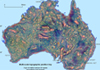
New satellite data peels Australia's landscape bare
Geoscience Australia has stripped Australia's landscape bare through the first continent-scale, cloud-free spatial views of Australia's soil and rock cover.
Using science and collaboration to help Pacific neighbours reduce disaster risk
12 October 2018
In 1989, the United Nations General Assembly called for the International Day for Disaster Reduction to help build a global culture of risk-awareness and disaster reduction.
Thirty years of Canberra history from space
5 October 2018
Geoscience Australia has used satellite imagery to produce a 31 year time lapse of the nation's capital.

Testing Australia's Tsunami Readiness
11 September 2018
Australia's preparedness for a major tsunami is being put to the test today with a full-scale exercise, PacWave18, involving multiple agencies responding to the simulated threat of a tsunami bearing down on Victoria, New South Wales, Queensland and Tasmania.
SHRIMP time machine uncovers mineral potential
On its 10 year anniversary, Geoscience Australia's world-renowned Sensitive High Resolution Ion Micro Probe (SHRIMP) mass spectrometer has uncovered a new age for gold bearing rocks near Tennant Creek.

Geoscience Australia welcomes new Chief Scientist
9 August 2018
Geoscience Australia is pleased to announce Dr Steven Hill as the new Chief Scientist of Geoscience Australia.
Join in and celebrate 80 Days of Earth Discovery
1 August 2018
Geoscience Australia today launched an 80-day-long celebration of the highly diverse and wonderful world of Earth science and how it impacts our daily lives.
New investment helps Digital Earth Australia to take off
18 July 2018
The $36.9 million investment in Digital Earth Australia announced as part of this year's Federal Budget will be used to help local business and industry harness the untapped potential of Earth observation data.