


News archive (November 2013 to July 2023)
Gaining a deeper understanding of the sea floor through unprecedented access
12 July 2018
Geoscience Australia awarded for scientific discoveries made during the search for MH370.
National Earthquake Alerts Centre gets a shake-up
29 June 2018
The upgraded National Earthquake Alerts Centre at Geoscience Australia was officially reopened today by the Minister for Resources and Northern Australia, Matt Canavan.
The data behind the search for MH370: Phase Two data released
28 June 2018
Geoscience Australia today released the underwater search data collected during the second phase of the search for missing Malaysia Airlines flight MH370.
China-Australia Geological Storage project celebrates 10-year milestone
26 June 2018
Australian and Chinese researchers are celebrating a significant 10-year milestone of international collaboration to find a solution to a global problem by lowering carbon dioxide (CO2) emissions and promoting and advancing carbon storage technology.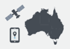
Route to innovation mapped
20 June 2018
In this year's Budget, the Australian Government committed almost $225 million over four years to programs led by Geoscience Australia that will make reliable positioning data accurate to 10 centimetres available across all of Australia.
Pandora spectrometers fill vital gap in global satellite validation network
14 June 2018
Geoscience Australia has successfully installed and deployed two Pandora spectrometers on behalf of the European Space Agency.
Geoscience Australia modernises earthquakes website
23 May 2018
Geoscience Australia has updated and moved its earthquakes website to the "cloud".
2018 Offshore Petroleum Exploration Acreage Release
15 May 2018
The Minister for Resources and Northern Australia, Senator Matt Canavan has formally released the 2018 offshore petroleum exploration areas at the annual APPEA Conference in Adelaide.
Ten years of Australia-Indonesia partnership strengthens disaster management
7 May 2018
Today in Jakarta, Australia and Indonesia are celebrating a 10-year partnership on disaster management.
Latest Australian Energy Resources Assessment released
2 May 2018
Today's release of the 2018 update to the Australian Energy Resources Assessment (AERA) reaffirms Australia as a powerhouse of energy resources.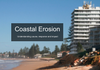
Helping coastal managers plan better for future storms
24 April 2018
Researchers from Geoscience Australia have developed a new tool-kit that is helping coastal managers to better understand how beaches are impacted by storm events.
Exploring for the Future delivering results for Northern Australia
20 March 2018
New data collected between the world-class mineral-endowed regions of Mount Isa and Tennant Creek shows the South Nicholson Basin is three times larger than previously thought.

Australia leading the world in the latest mineral resource statistics
5 March 2018
The Australian Government has released the latest Australia's Identified Mineral Resources (AIMR) report.

Canberra set to become the sand capital of Australia
12 February 2018
Long summer days and memories of the beach: Canberra is set to become the sand capital of Australia, with Geoscience Australia now housing the most comprehensive set of sand samples in Australia.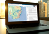
ELVIS's excellence recognised on world stage
22 January 2018
Geoscience Australia's Elevation Information System (ELVIS) has won the Geospatial World Excellence Award for Application of Geospatial Technology in Open Data Platform at the Geospatial World Awards.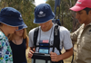
Next generation of geoscientists uncover their potential at Geoscience Australia
18 January 2018
Australia's most talented science students are investigating real-world problems at Geoscience Australia throughout January. During their visits they will find and analyse a potential mineral deposit using the same techniques that our scientists use in the field and laboratories.
More accurate navigation when Santa comes to town
22 December 2017
It will now be easier for Airservices Australia to track Santa and his crew when he enters Australian airspace this Christmas, thanks to two recent developments by Geoscience Australia and partners.
Atmospheric monitoring: When one estimate is not enough
16 March 2018
An atmospheric monitoring experiment has shown that using a combination of techniques provides a more accurate estimate of possible greenhouse gas emissions rather than relying on a single technique.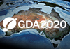
Australia officially moves 1.8 metres northeast
15 December 2017
Australia's coordinates have officially moved 1.8 metres northeast, with Minister for Resources and Northern Australia Matt Canavan today launching Australia's new coordinate reference frame, the Geocentric Datum of Australia 2020 (GDA2020).
Revealing the secrets of Australia's Antarctic history
8 December 2017
Geoscience Australia is taking the history of Australia's Antarctic science online, with the digital publication of field notebooks documenting the work of our pioneering Antarctic geoscientists from as early as the 1960s.
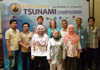
A wave of tsunami modellers descends on Canberra
6 December 2017
Geoscience Australia has welcomed tsunami modelling experts from across Australia for a workshop to develop nationally-consistent guidelines for tsunami hazard modelling in Australia.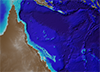
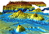
Undersea maps reveal GBR in unparalleled detail
19 January 2018
High-resolution sea floor maps released today show 1.5 million square kilometres of Australia's iconic Great Barrier Reef in unprecedented detail.
Australia and Japan helping to reveal the secrets of the hidden 'continent' of Zealandia
21 November 2017
Earlier this year, a group of international scientists attracted worldwide attention when they published research identifying Zealandia as the Earth's 'lost seventh continent'. Large parts of Zealandia lie within Australian waters just off our east coast, however given it is almost entirely submerged beneath the ocean, little is known of Zealandia's geology. So a research project between Australia and Japan is shedding light on this unique sunken land mass.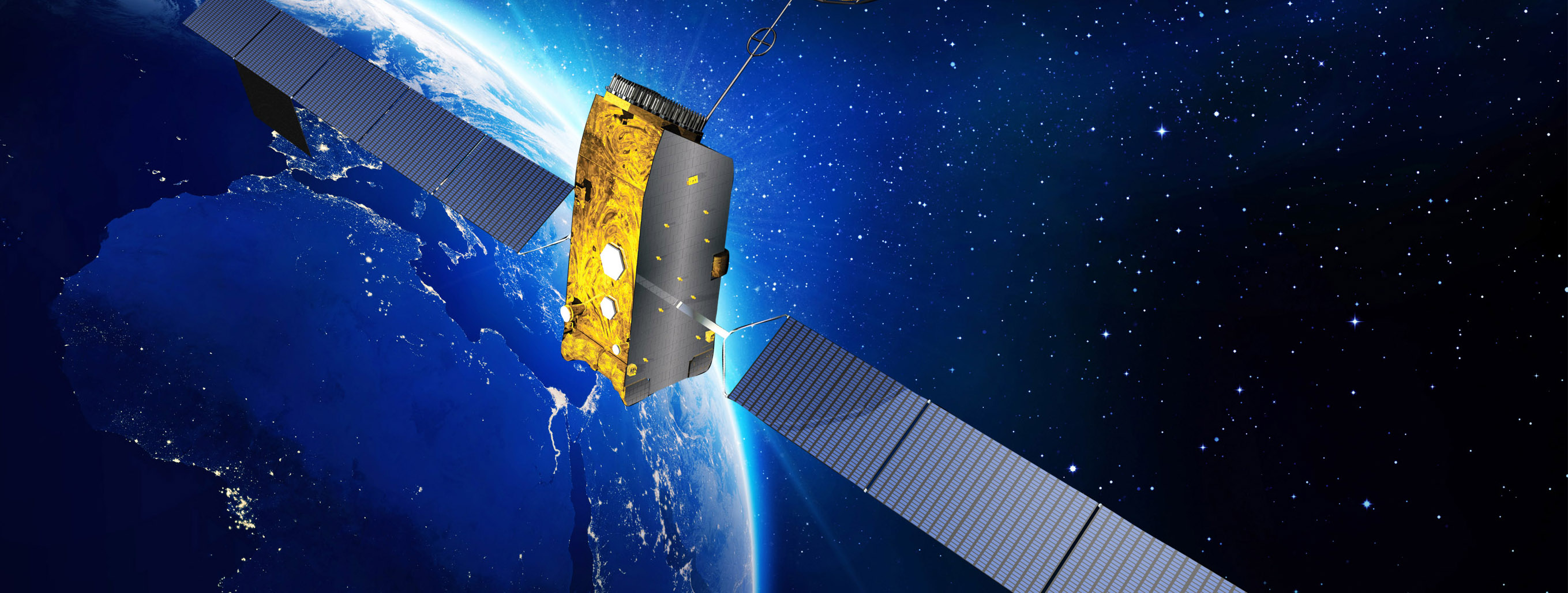
International collaboration strengthens tsunami response
3 November 2017
Preparation is the key to reducing the impact of a tsunami, which is why Australia is focused on maintaining our early warning systems and working with our neighbours to develop better strategies to manage tsunami risk.
GovHack rolls out the red carpet
16 October 2017
Renewable energy and science education entries have won Geoscience Australia-sponsored GovHack awards announced over the weekend at the 2017 GovHack Red Carpet Awards in Brisbane.
South Australia's shaky history revealed
29 September 2017
More than 175 years of historical data about earthquake and seismic monitoring in South Australia has been made publicly available by Geoscience Australia and the Geological Survey of South Australia.
Australia's geospatial expertise on show at IAC 2017
22 September 2017
Almost every sector in the Australian economy benefits from space technologies. The advent of global satellite and positioning technologies has enabled the precise navigation and positioning that Australians rely on in their everyday lives.
EM-LINK helps prepare emergency responders for natural disasters
21 September 2017
Australia's emergency responders and planners now have faster access to reliable spatial information at their fingertips, thanks to the new EM-LINK platform.
Critical commodities: enabling our high-tech lives
8 September 2017
As part of continuing investigations into critical commodities, Geoscience Australia, together with University of Western Australia's Centre for Exploration Targeting, has released new analysis looking at Australia's potential for critical commodities.
Unearthing local talent in Alice Springs
7 September 2017
Ten new laboratory-based roles designed to upskill Alice Springs job seekers have been created by Geoscience Australia in partnership with local Aboriginal not-for-profit company, the Centre for Appropriate Technology. The establishment of the laboratory and training roles are part of the four-year $100.5 million Exploring for the Future programme.
Geoscience Australia's 2017 Open Day is a roaring success!
29 August 2017
The 2017 Geoscience Australia Open Day was once again a huge success, with approximately 5000 visitors coming along to learn about our exciting and valuable work and to experience the wonderful world of geoscience.
Feedback sought on new Data and Publications Search
8 August 2017
Geoscience Australia has heard your feedback that we needed to improve our Data and Publications search via our website.Australia brings geological storage of CO2 expertise to northwest
31 July 2017
Geoscience Australia carbon capture and storage (CCS) researchers have delivered another successful round of capacity-building workshops in Xinjiang, in northwest China via the China Australia Geological Storage of CO2 (CAGS) project.
GovHack is back in 2017!
26 July 2017
Geoscience Australia is proud to again be sponsoring GovHack in 2017, demonstrating an ongoing commitment to providing open access to government data.
2017 Open Day: Exploring our past, shaping our future
24 July 2017
The count-down is on to Geoscience Australia's annual Open Day on Sunday 20 August 2017. Come along and learn how understanding our past helps shape our future!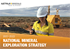
A new strategic direction for the Australian minerals exploration industry
18 July 2017
Geoscience Australia welcomes the COAG Energy Council's endorsement of the new 2017-2022 National Mineral Exploration Strategy.
The data behind the search for MH370: Phase One data released
19 July 2017
Geoscience Australia is today releasing the sea floor mapping data collected during the first phase of the search for missing Malaysia Airlines flight MH370.
Libraries help the community prepare better for natural disasters
4 July 2017
Today is Australasian Libraries in Emergency and Security (ALIES) Day, a day to acknowledge the important role that many people across Australia and New Zealand in technical specialists and support roles play to keep our community safe from natural disasters.
Top honour for Geoscience Australia geophysicist Richard Lane
19 June 2017
The 2017 Australian Society of Exploration Geophysicists (ASEG) Gold Medal has been awarded to Geoscience Australia geophysicist Richard Lane.
Dr Phillip McFadden receives well-deserved Queen's Birthday honour
13 June 2017
Congratulations to Dr Phil McFadden AO, former Geoscience Australia Chief Scientist and newly-inducted Officer of the Order of Australia.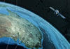
New open-source software enhances satellite geodesy capability
5 June 2017
Scientists from Geoscience Australia have released new software that will improve the ability to process big remotely-sensed satellite datasets.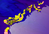
New offshore areas released for petroleum exploration in 2017
15 May 2017
The Minister for Resources and Northern Australia, Senator the Hon Matt Canavan has announced the latest offshore petroleum exploration areas at the 2017 APPEA Conference in Perth.
New CEO for Geoscience Australia
8 May 2017
We are pleased to announce Dr James Johnson as the new Chief Executive Officer (CEO) of Geoscience Australia.
New funding announced for Digital Earth Australia
10 May 2017
Geoscience Australia welcomes the release of Budget 2017-18 by the Treasurer, which includes $15.3 million in new funding to establish the Digital Earth Australia over the next two years.
Coming in from the cold - three successful Antarctic surveys return home
11 April 2017
Geoscience Australia's Antarctic Geoscience program has completed three highly successful Antarctic surveys during the 2016-17 field season. Marine geoscience and geophysical data acquisition surveys help us to learn about these precious environments.
The LINK to spatially located data is here
5 April 2017
The launch of ANZLIC's new Location INformation Knowledge (LINK) Platform delivers an exciting new era of open access to essential spatial datasets across all levels of Australian government.
Key partners meet to progress SBAS test-bed project
22 March 2017
Geoscience Australia and the key partners of the Satellite-Based Augmented System (SBAS) test-bed project have met in Canberra to review the project plan and schedule of the project.
Working together to improve understanding of Australia's earthquake hazard
20 March 2017
Geoscience Australia has welcomed experts from across Australia and New Zealand for a workshop to share their knowledge and perspectives on seismic hazard in Australia.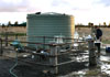
Easier access to groundwater dataset provides a well of information
10 March 2017
Geoscience Australia has collaborated with the Bureau of Meteorology to make its groundwater hydrochemistry data available via the web-based mapping portal Australian Groundwater Explorer.