


News archive (November 2013 to July 2023)

Count-down to Geoscience Australia's 2015 Open Day
24 July 2015
The count-down is on to Geoscience Australia's annual Open Day on Sunday 23 August 2015, when we invite the community along to see, learn and explore the exciting and diverse range of work carried out by Australia's national geoscience agency.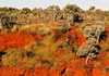
Ministers launch new roadmap for Australian minerals industry
22 July 2015
The Minister for Industry and Science Ian Macfarlane, together with the Western Australian Minister for Mines and Petroleum, Bill Marmion, has launched a new roadmap for the Australian minerals industry.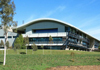
Catch a behind-the-scenes glimpse of Geoscience Australia
20 July 2015
Geoscience Australia will be offering four behind-the-scene tours of our building and collections during National Science Week. Join one of these exclusive tours and wonder no more what's behind our doors.
Australian earthquakes explained
3 July 2015
When it comes to earthquakes, living in Australia is much safer than other parts of the world, as Australia is well away from tectonic plate boundaries where large earthquakes occur more frequently.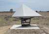
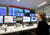
Network measures Earth movements with increased accuracy
30 June 2015
A new state-of-the-art geodetic network installed in the Surat Basin, Queensland can now measure movement of the Earth's surface more accurately, and as a consequence is helping to build understanding of precious resources within the Earth's crust.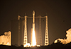
Australia and Europe welcome 'colour vision' as Sentinel Satellite is sent into orbit
24 June 2015
Space collaboration between the European Union and Australia has taken an important step forward today with the launch of the latest of Europe's Sentinel satellites.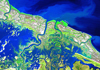
Agreement recognises Australia's expertise in satellite imagery
18 June 2015
Geoscience Australia and the U.S. Geological Survey have signed an agreement to establish a comprehensive new partnership to maximise land remote sensing data that can help to address issues of national and international significance.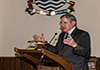
Minister Macfarlane applauds Australian innovation at meeting of world satellite operators
15 June 2015
Science innovation and water security were highlights today as the Minister for Industry and Science Ian Macfarlane officially opened proceedings at the annual international meeting of Landsat Satellite Co-operators.
Petroleum explorers benefit from new Georgina Basin GIS package
12 June 2015
A new collated dataset is now available for the Georgina Basin that will help petroleum explorers in the search for both conventional and unconventional hydrocarbons.
Geoscience Australia's Antarctic heroes
4 June 2015
Geoscience Australia and its predecessor organisations have a long and rich history of contributing to the mapping and exploration of Antarctica.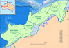
Calibration of Australia's fossil record boosts petroleum exploration
21 May 2015
Recent work by Geoscience Australia to integrate geological interpretations along Australia's margins will provide petroleum explorers in Australia with more comprehensive and reliable stratigraphic data.
New areas released for petroleum exploration in 2015
19 May 2015
The latest offshore petroleum exploration areas have been released by the Minister for Industry and Science, The Hon Ian Macfarlane MP at the 2015 APPEA Conference in Melbourne.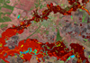
Improving access and quality of Australian flood information
15 May 2015
Geoscience Australia is working with all levels of Australian government to improve the quality, availability and accessibility of flood information.
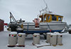
Geoscience voyage puts equipment to the test
13 May 2015
Australia's only blue-water research vessel, the RV Investigator, has returned from her maiden geoscience voyage where researchers took the opportunity to learn more about an ancient reef system off the east coast of Tasmania.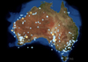
2014 Earthquakes - a quiet year for Australia
7 May 2015
2014 was a relatively quiet year for Australian earthquakes. Most earthquake events measured less than magnitude 4, which is considered small and unlikely to cause damage.
United Nations resolution encourages sharing of geospatial data
20 April 2015
The United Nations General Assembly recently adopted its first ever resolution recognising the importance of a globally-coordinated approach to geodesy - the scientific discipline that measures changes in the size, shape and gravity field of our planet Earth.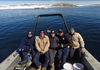
Researchers defrost on return from Casey Station
13 April 2015
Geoscience Australia and Royal Australian Navy researchers have recently returned from a summer mapping the Antarctic waters around Casey Station in unprecedented detail.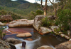
Australian rock star (photos) wanted
9 April 2015
Geoscience Australia is on the look-out for photos with rock-star qualities, with entries now open for the 2015 Top GeoShot photographic competition.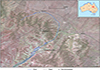
Potential asteroid impact identified in western Queensland
17 March 2015
Researchers have identified a roughly circular structure west of Winton in western Queensland that may have been created by an asteroid impact around 300 million years ago.
Mapping the deep ocean: Geoscience Australia and the search for MH370
23 February 2015
Geoscience Australia has been applying specialist marine geoscience knowledge and capability to assist in the search for missing Malaysia Airlines flight MH370.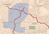
New airborne electromagnetic data reduces mineral exploration risk
20 February 2015
The recent release of the southern Thomson Orogen VTEMplus® airborne electromagnetic (AEM) survey dataset will provide better context for understanding the mineral potential of this relatively data-poor region of central and eastern Australia.
Latest editions of Magnetic Anomaly Grid and Radiometric Map released
17 February 2015
Australia will now be able to lay claim to the best geophysical data coverage of all the continents on Earth following the release of the sixth edition Total Magnetic Intensity (TMI) Anomaly Grid of Australia and the third edition Radiometric Map of Australia datasets.
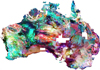
Australian continent uncovered by new 3D model
19 February 2015
Models derived from geophysical properties of rocks are an important source of information about the geological structure hidden below the Earth's surface. Australia is fortunate to be the sole occupant of a single continent and provides the perfect laboratory for continental-scale studies of these geophysical properties.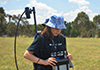
Future scientists take on Australia's water security challenge
20 January 2015
Australia's top Year 12 science students are gathering in Canberra as part of the National Youth Science Forum to learn first-hand about a major challenge for Australia - how to find and secure future water resources for the nation.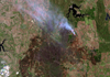
Adelaide Hills fires image captured by Landsat 8 satellite
7 January 2015
Fires continue to burn across parts of South Australia as the heatwave emanating from central Australia raises temperatures in the region.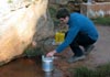
Australia-China science exchange improves CO2 monitoring technique
8 January 2015
A recent science exchange hosted by the Chinese Geological Survey has given Australian and Chinese researchers a chance to share expertise in greenhouse gas monitoring technologies.
Geoscience Australia welcomes RV Investigator
12 December 2014
Australia's marine geoscience capability is today strengthened by the official commissioning of RV Investigator, the nation's newest scientific research vessel.
Exploring the icy waters of Casey station
1 December 2014
This summer, a multidisciplinary team of scientists and engineers are heading to Antarctica to uncover the secrets of the icy waters adjacent to Casey station.
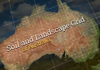
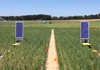
New data builds understanding of Australia's precious soil resources
27 November 2014
Researchers from across Australia have joined together to develop a comprehensive set of digital maps of the country's soil and landscape attributes.
Uncovering the mineral systems potential of the Stavely Region, western Victoria
24 November 2014
A collaborative minerals project being undertaken in the Stavely region of western Victoria is helping to reduce exploration risk for explorers by improving understanding of the subsurface geology and its potential for mineral systems.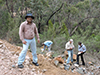
Indian geoscientists share minerals expertise with Australian colleagues
19 November 2014
Geoscience Australia recently hosted three geoscientists from the Geological Survey of India, creating an opportunity for collaboration on several cutting-edge research projects that are helping to unlock the mineral potential of eastern Australia.
Meeting global demand for precious metals in a high-tech world
31 October 2014
The platinum-group elements (PGEs) are a group of six precious metals considered critical commodities for many emerging technologies globally.
2014 Top GeoShot winners announced
15 October 2014
The winners of Geoscience Australia's 2014 Top GeoShot photo competition were announced today, capturing the essence of Earth science and showcasing Australia's unique geological history.
Collated dataset provides clues to Georgina Basin mineral and petroleum potential
9 October 2014
A new mineralogical dataset has been generated for the Georgina Basin in the Northern Territory and Queensland that will aid explorers in their search for petroleum and mineral resources.
New data reduces mineral exploration risk
26 September 2014
The largest Airborne Electromagnetic (AEM) survey by area ever undertaken in Australia will help reduce risk for mineral exploration in the Capricorn Orogen region of Western Australia.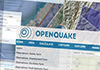
Earthquake modelling to create safer communities in southeast Asia
23 September 2014
Participants from around southeast Asia are meeting in Canberra to be trained in state of the art earthquake modelling techniques to better understand the potential impacts on their communities.
The role of government geoscience in the minerals industry
24 September 2014
Australia's mineral resources are an important component of the nation's wealth, both economically and socially. Governments across Australia recognise the challenges facing the minerals industry in continuing to make the discoveries essential to the success of the industry and health of the economy.
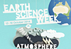
Become connected during Earth Science Week
18 September 2014
The count-down is on to Earth Science Week 2014, with annual celebrations due to kick-off in a few weeks.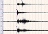
'No earthquake in Charleville' confirms Geoscience Australia
12 September 2014
Geoscience Australia has determined a previously identified earthquake occurring near Charleville, Queensland last Friday, was a shock wave caused by a large truck explosion on the Mitchell Highway near Wyandra.
Developing better techniques for monitoring CO2 storage
4 September 2014
Ensuring the effective and permanent storage of carbon dioxide is essential for any carbon capture and storage project.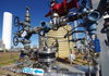
Collaborative project improves CO2 storage understanding
28 August 2014
A new book which provides a detailed account of the CO2CRC's Otway Project, Australia's first demonstration of deep geological storage of carbon dioxide (CO2), was launched at Parliament House by Industry Minister Ian Macfarlane.
Crowds rock in for Open Day
26 August 2014
The 2014 Geoscience Australia Open Day has again proved to be a pinnacle National Science Week event, welcoming the community in to learn more about our work and hopefully inspiring some of our younger visitors to become tomorrow's geoscientists.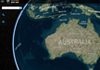
Improving access to Geoscience Australia's spatial data
26 August 2014
Geoscience Australia's ability to provide data in useable formats for stakeholders and the public is key to maximising the uptake and use of our data.
New atlas of Southern Ocean marine life
25 August 2014
A new marine biodiversity atlas that provides the most thorough audit ever of marine life in the Southern Ocean has distinct Australian links.
New apps explore geological time
21 August 2014
Geoscience Australia is entering the world of mobile apps with the release of two new apps that explore geological time.
Canberra's annual exploration into the world of geoscience is upon us
18 August 2014
The opportunity to mingle with the country's top geoscientists, sieve for sapphires, blow up a volcano and even bump into a dinosaur is all on offer this coming weekend at Geoscience Australia's annual Open Day.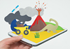
Online visitors to explore the world of geoscience
14 August 2014
The opportunity to experience a virtual meeting with the country's top geoscientists, learn about life working in Antarctica, and get the facts on dinosaurs, is available to all Australians via Geoscience Australia's virtual Open Day.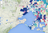
GovHack winners announced
11 August 2014
The GovHack 2014 winners have been announced, with this year's competition receiving almost 40 entries in the Best Science Hack category and 14 entries for the Best Geoscience Hack.
Compendium of airborne survey data released
6 August 2014
The latest index of airborne geophysical surveys from across Australia has been released.
Open access to Geoscience Australia's data
30 July 2014
Geoscience Australia is a leader in the provision of open spatial data, enabling clients to discover and use these data for a broad range of scientific, government, industry and community purposes.