News
Satellite imagery to help aerial firefighters find usable watersources
Published:20 May 2024
Upgraded Digital Earth Australia (DEA) Waterbodies to form part of new decision support tools.
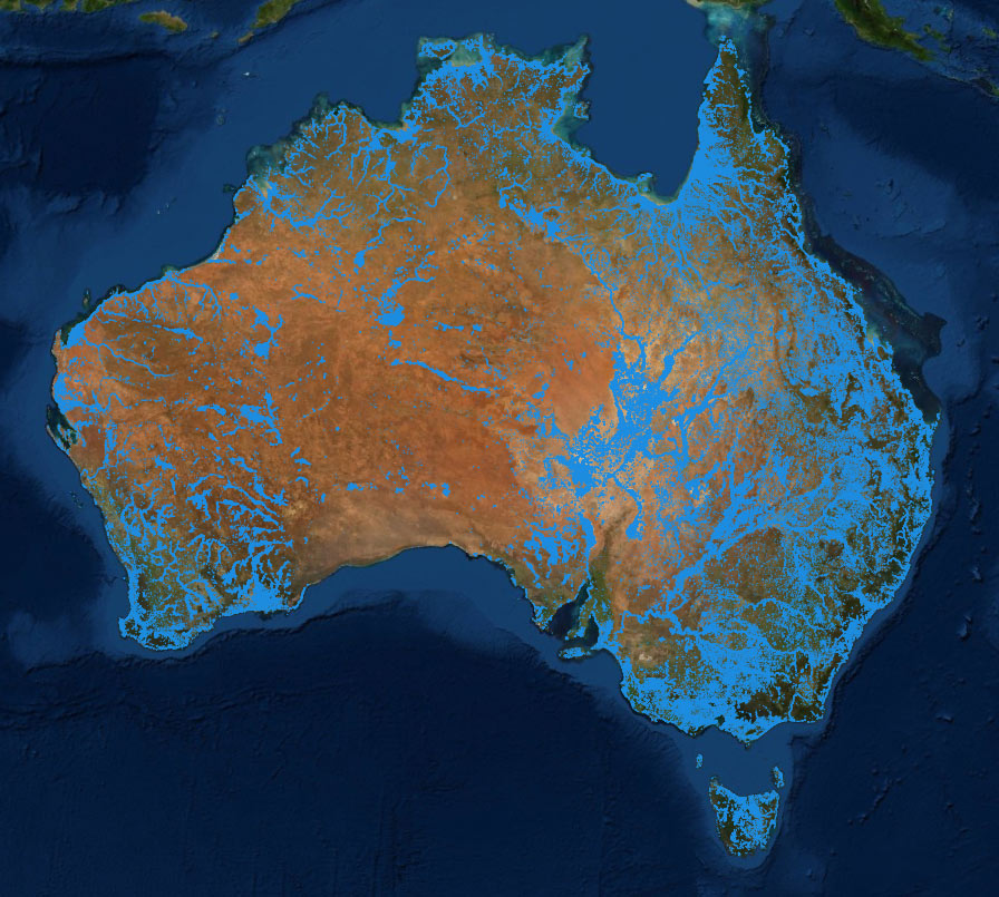
A continent-wide image of Australia overlayed with approximately 300,000 waterbodies of the DEA Waterbodies product. Thick blue outlines indicate areas where water has been observed at least some of the time over the last 30 years (DEA Maps).
Satellite imagery tells us that there are over 300,000 waterbodies across Australia – but was any water in them recently? The Australasian Fire and Emergency Services Authorities Council (AFAC) asked Geoscience Australia this question in 2023 and the answer has arrived in the latest version of DEA Waterbodies, which now includes improvements to help support emergency managers Australia-wide. DEA Waterbodies uses satellite data collected since 1987 to show changes in the estimated wet surface area of Australian lakes and dams. Since its initial release in 2019, it has been used by farmers and environmental managers to understand how waterbodies in their areas have changed in the last three decades.
When AFAC learned about DEA Waterbodies, they were excited to find a tool that could potentially help aerial firefighters understand where water was available on the ground, however, they needed more detail – such as how up to date the information was – before being able to confidently use it in their operations.
Bex Dunn is an Earth Observation scientist and the project lead for DEA Waterbodies.
“As part of a collaborative project between AFAC, Natural Hazards Research Australia (NHRA) and FrontierSI, we learned that emergency managers wanted clearer and more reliable information about our satellite data on water to make it more useful in pre-season and pre-flight planning.
“We improved our data to clarify when the satellites had last seen water, and when the last satellite passed over the waterbody, as well as to provide an estimated wet surface area of each waterbody from the most recent satellite observation. These updates will help support aerial firefighters in understanding the currency and distribution of surface water across Australia when planning emergency responses,” she said.

DEA Waterbodies shows the estimated surface area of Island Lagoon and Lake MacFarlane near Woomera, South Australia. The inset graphs show how the water surface area has varied significantly year on year since 1986 (DEA Maps).

Lake Argyle in the Northern Territory with DEA Waterbodies showing the percentage of surface area (not volume) observed as wet (DEA Maps).
AFAC Executive Director National Capability Sandra Whight says the organisation facilitated engagement with members across the sector, and helped with data formatting to ease integration into decision support tools used by AFAC in aerial firefighting operations.
“The earlier version of DEA Waterbodies did not necessarily contain the information agencies are seeking when trying to understand where water might be in the environment.
“The new product includes information that helps to understand the data currency, as well as the potential extent of the waterbody.
“A resource to risk tool is being developed by AFAC (NAFC) as part of the ARENA platform that supports aerial firefighting operations. The new waterbodies data is one of the data inputs that could be used by this tool to support the planning and options analysis work the tool will inform. The tool is still being developed, however having access to this refined data and information is seen as an important part of the project,” she said.
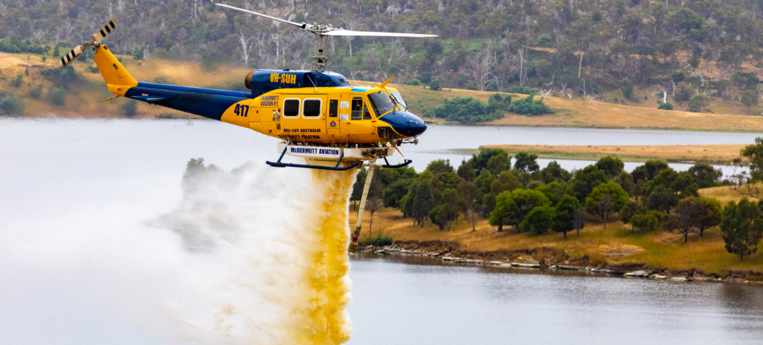
An aerial firefighting helicopter above a lake releasing its water payload (Courtesy NAFC).
Bex notes how working with AFAC has improved DEA Waterbodies for all stakeholders.
“Collaboration has been really vital to hear directly from our stakeholders about what exactly is useful to them and why.
“As part of this process we’ve learned some lessons about the value of incorporating the needs of our stakeholders into our products and how that improves the quality for all our users.
"Ultimately, it has allowed us to get our satellite data all the way through to the people that need it. Supporting them to access it in the best way is pretty valuable,” she said.
DEA Waterbodies 3.0 is now available.