In association with the OB2020 seismic survey, over 8,200 line kilometres of gravity and magnetic data were acquired. These data were subsequently merged with existing satellite data to produce merged grids at 1000m grid cell size. These data are available with the original survey information (ENO0603786) from NOPIMS.
Several enhancement processing techniques were applied to these magnetic and gravity data to better highlight buried features within the Otway Basin. The merged input data from the survey and the enhanced products provide valuable information on the geometry and spatial extent of igneous rocks in the deep-water basin (Figure 1). The distribution of these rocks is critical to the understanding of the petroleum systems and therefore the hydrocarbon prospectivity of the area.
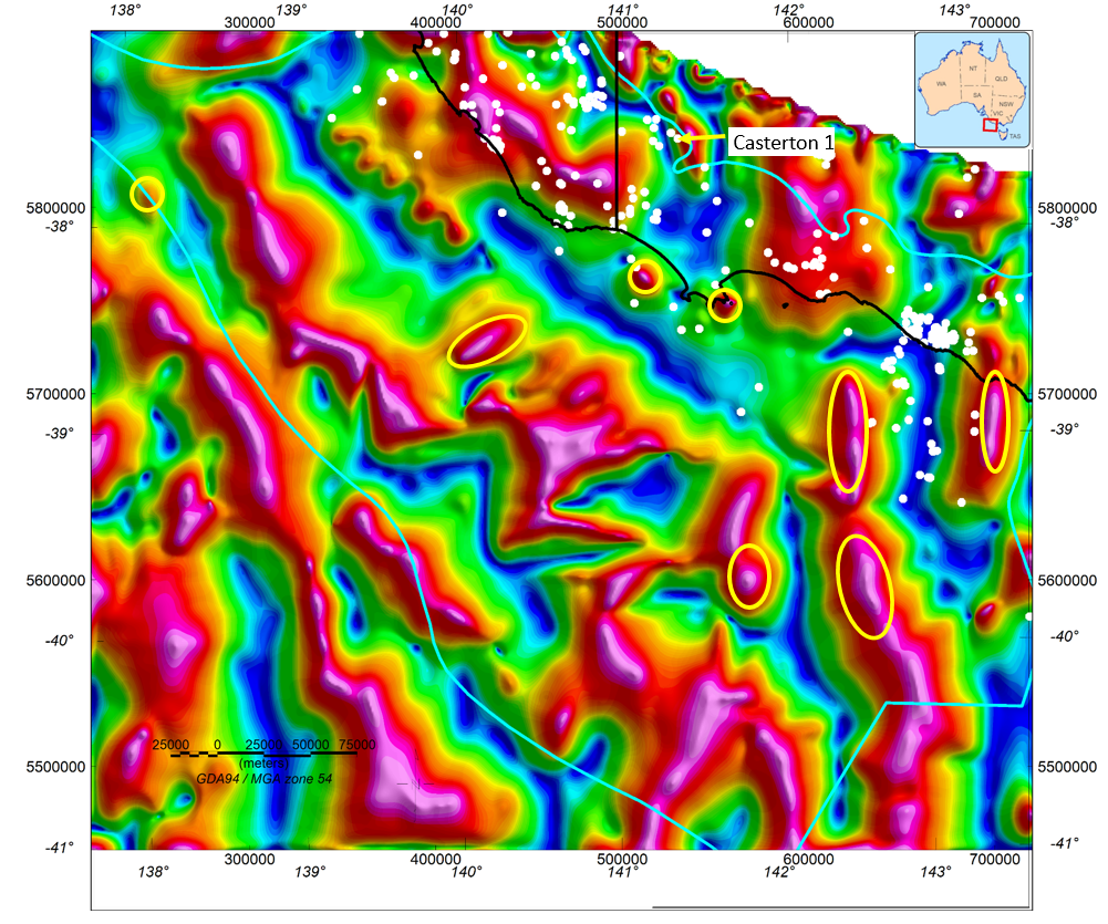
Figure 1: Tilt derivative image of the merged existing and new magnetic data acquired during the Otway Basin Seismic Program 2020. Petroleum wells in white. The onshore Casterton 1 petroleum well correlates with a narrow positive magnetic anomaly and drilling intercepted igneous rocks at 2400m depth.
The enhanced gravity and magnetic grids and images were released on geoscience Australia’s website at http://pid.geoscience.gov.au/dataset/ga/146433