Triassic Horizon Grids, Isochron Grids, and Fault Maps, Central North West Shelf
September 2019 update
New higher resolution versions of J10.0 and TR10.0
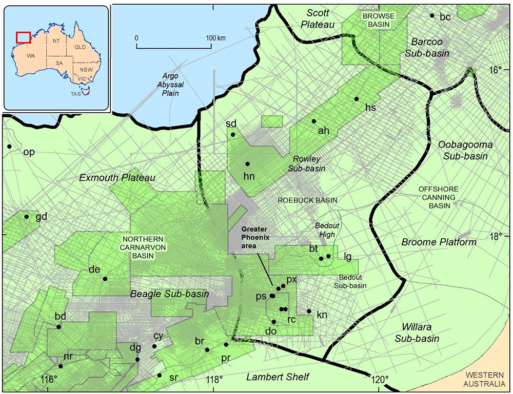
Figure 1. Location map of the central North West Shelf showing basins, sub-basins, 2D seismic surveys (grey lines), 3D surveys (green polygons), and selected wells. ah=Anhalt 1, bc=Barcoo 1, bt=Bedout 1, bd=Brigadier 1, br=Bruce 1, cy=Cossigny 1, dg=De Grey 1, de=Delambre 1, gd=Galahad 1, hs=Hannover South 1, hn=Huntsman 1, kn=Keraudren 1, lg=Lagrange 1, nr=North Rankin 5, op=ODP 760, px=Phoenix 1 &2, ps=Phoenix South 1–3, pr=Poissionner 1, rc=Roc 1 & 2, sr=Skippy Rock 1, sd=Steel Dragon 1. Not all 2D and 3D surveys shown were interpreted.
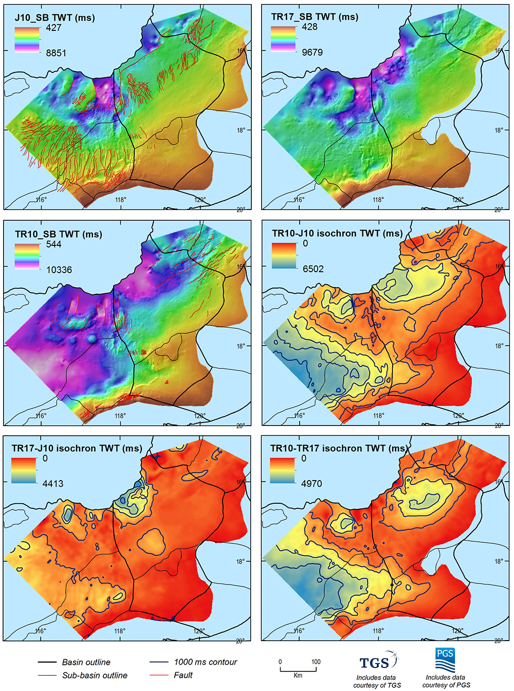
Figure 2. Horizon grids, isochron grids, and faults included in this data package. The display settings (e.g hill shading, colour ramp, isochron contours, legend) were generated in ArcGIS. Sub-basin boundaries, sourced from Geoscience Australia (2018), are shown for geographical context. Basin and sub-basin names are indicated on Figure 1.