Derived data product DEA Land Cover
Page last updated:6 March 2025
Learn about how DEA Land Cover data is produced, and what it is used for
Learn about our ever-changing land
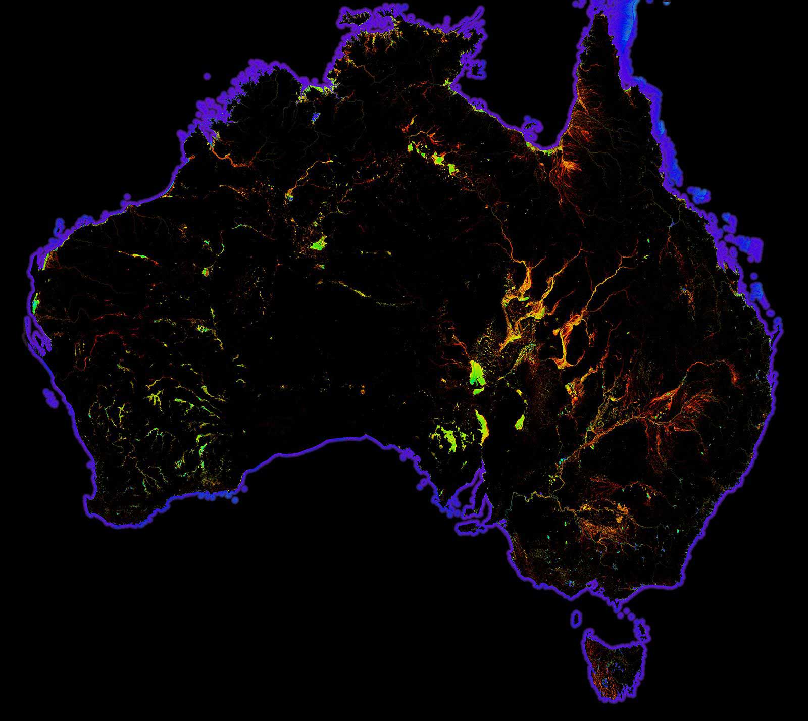
Digital Earth Australia (DEA) Land Cover translates over 35 years of satellite imagery into evidence of how Australia's land, vegetation and waterbodies have changed over time.
DEA Land Cover data can support sustainable farming practices, water resource management, soil erosion prevention, forest management, and more.
With over 80 descriptive classes available, users of DEA Land Cover are able to see Australia's land cover from the past three decades in extraordinary detail.
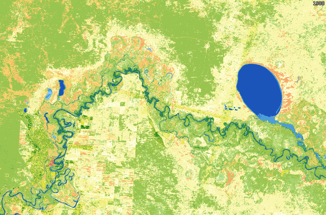
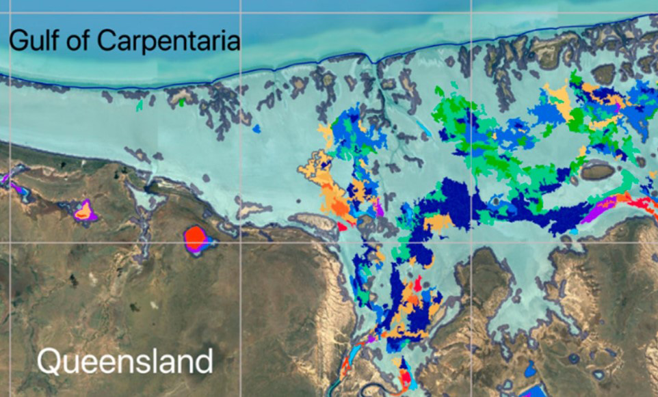
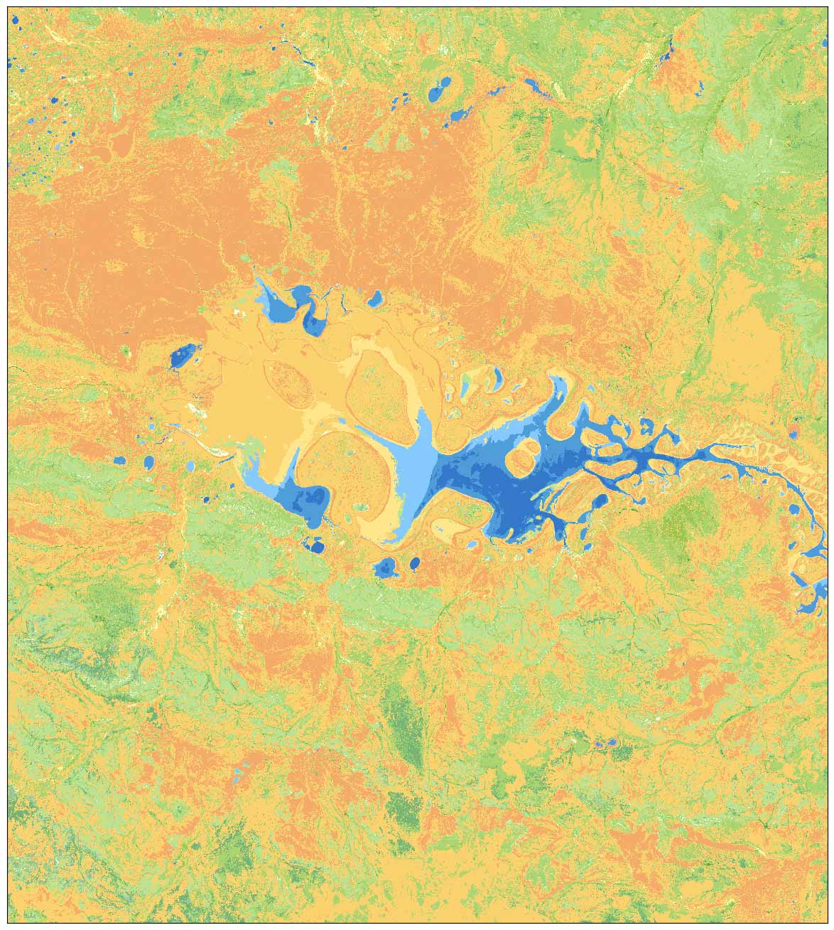
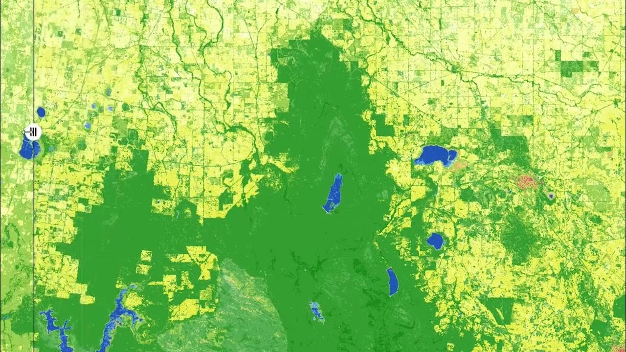
See how the Murray River and its surrounds vary over three decades at the intersection of New South Wales, Victoria and South Australia
Take a walk-through DEA Land Cover
Learn about our ever-changing land and water with DEA Land Cover, which translates over 35 years of satellite imagery into evidence of how Australia's land, vegetation and waterbodies have changed over time.
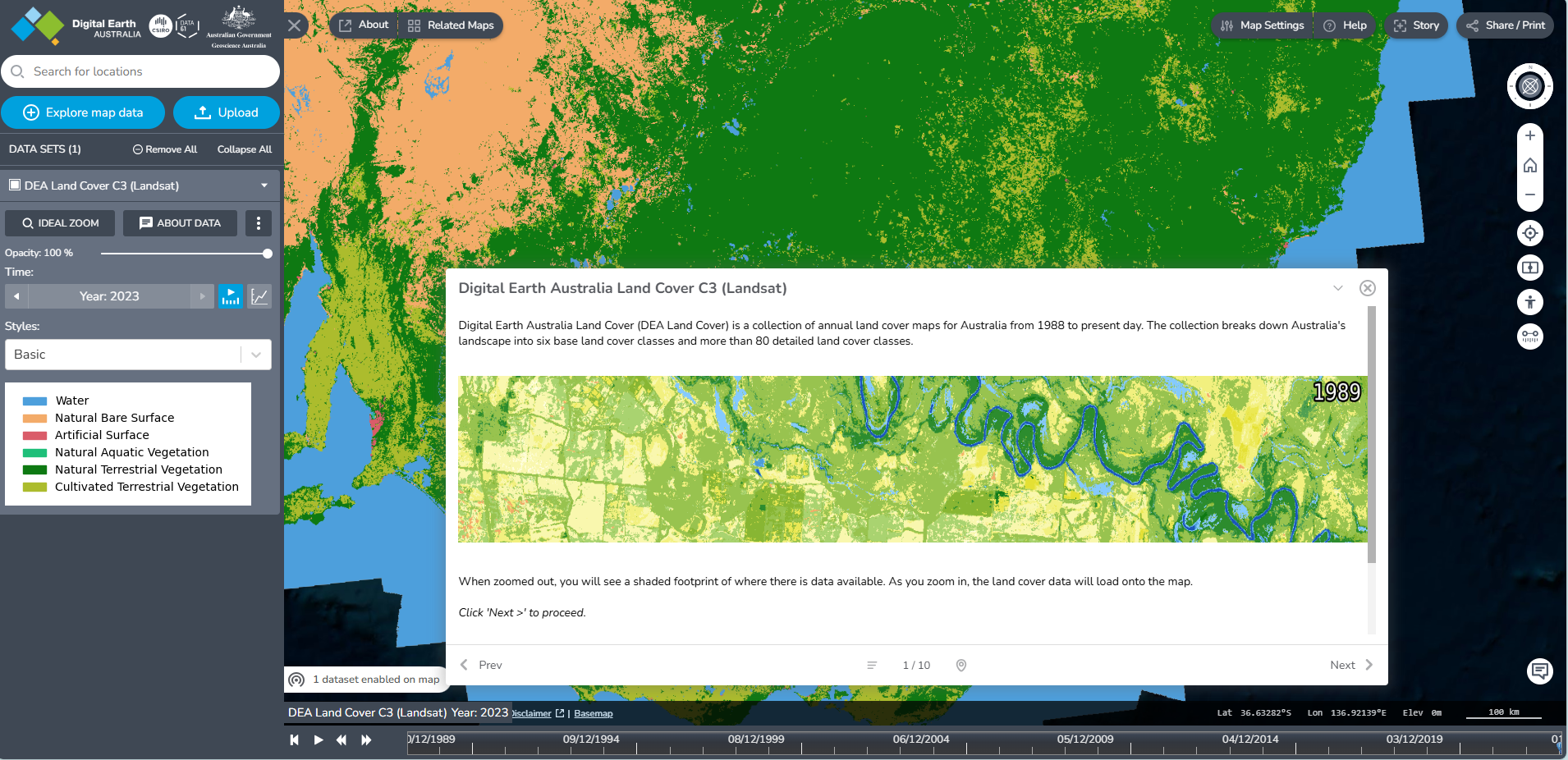
Screenshot of the DEA Land Cover interactive map
- DEA Maps: A user-friendly interactive interface that allows users to view and analyse the DEA Land Cover data and visualise and explore a wide range of other geospatial data. It also provides access to other DEA products.
- Digital Atlas of Australia: An interactive, secure and easy-to-use platform where you can explore, analyse and visualise DEA Land Cover with other trusted national datasets.
- DEA Knowledge Hub: A central repository where users can find comprehensive information on DEA products and services. It brings together user guides, data product information, DEA Notebooks, and more into one easily accessible location. The DEA Knowledge Hub is generally utilised by more technical users.
Why map land cover?
- Provide insights into the relationships between land, vegetation and waterbodies
- Evaluate the impacts of natural phenomena and human development
- Enable resource managers, scientists and policymakers to make more informed decisions
- Assess changes in urban and farmland growth, or bushland regeneration
Related resources
Digital Earth Australia Land Cover enhances Australia’s image from space
Geoscience Australia is excited to announce the release of DEA Land Cover 2.0, incorporating the latest U.S. Geological Survey (USGS) Landsat data, including enhancements from Landsat 9, for improved accuracy and detail.
Digital Earth Australia - DEA Land Cover
Learn about how DEA Land Cover data is produced, and what it is used for.
DEA Water Observations
Continent-scale map of surface water that classifies each pixel from Landsat satellite imagery as wet, dry or invalid.