Data product National Hazard Impact and Risk Service (NHIRS)
Assess the impact of natural hazards on residential buildings.
Page last updated:18 June 2024
Assessing the impact of natural hazards on Australian residential buildings
The NHIRS uses ‘hazard’, ‘exposure’ and ‘vulnerability’ information to forecast the impacts (HEVI) of tropical cyclones, earthquakes and severe winds on residential buildings across Australia.
How much damage a building will suffer depends on the hazard type, the specifics of the area exposed, and the building’s vulnerability to damage.
The NHIRS helps users Australia to understand the vulnerability of the built environment and predict the damage caused by different levels of hazard. Modelling hazard scenarios can help to define both the impact probability and natural hazard risk in your area.
Who is the NHIRS for?
The NHIRS provides essential data to emergency managers, government employees and the insurance industry. It produces automated impact forecasts for earthquakes, tropical cyclones and severe winds, providing vital and timely information to the emergency services and emergency sector decision makers during a natural hazard event.
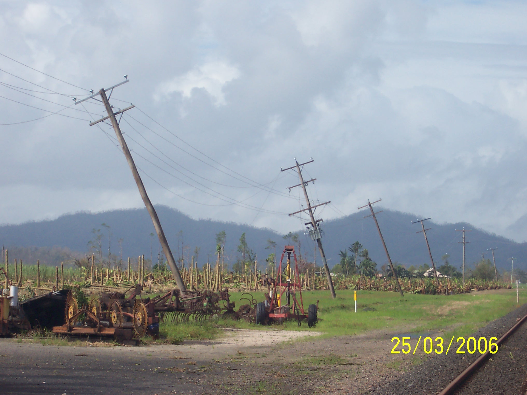
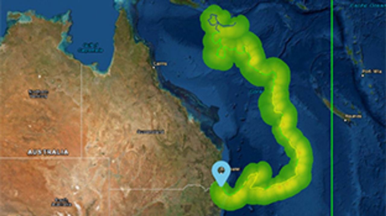
Electricity network and agricultural damage caused by Tropical Cyclone Larry
What is the NHIRS’s capability?
- Geoscience Australia has developed NHIRS in collaboration with the Bushfire and Natural Hazards Cooperative Research Centre (BNHCRC), the Bureau of Meteorology, and emergency services representatives across Australia.
- It can be used as a web map service (WMS) or web feature service (WFS) with GIS software.
- The production of an NHIRS impact forecast is triggered by the release of a tropical cyclone track forecast by the Bureau of Meteorology, or an earthquake ShakeMap by Geoscience Australia.
- NHIRS severe wind impact forecasts are produced every 6 hours.
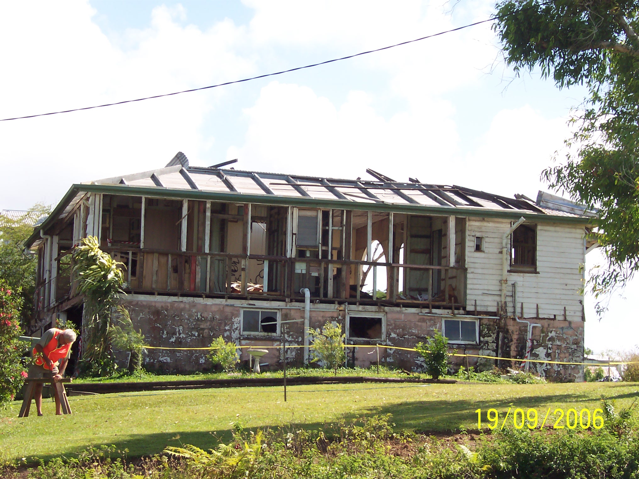
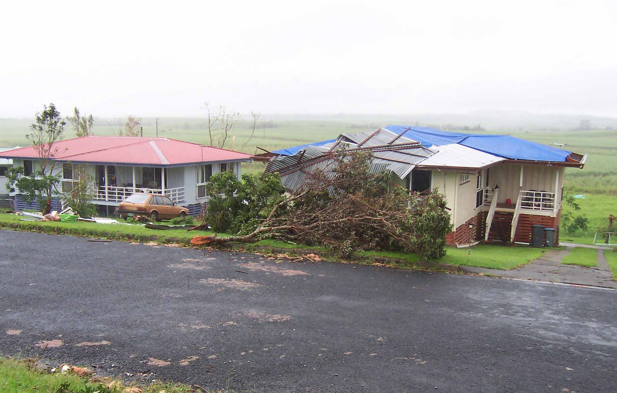
Rebuilding after residential building damage caused by Tropical Cyclone Larry
How the NHIRS works
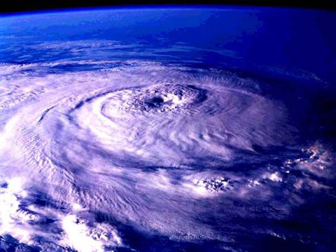
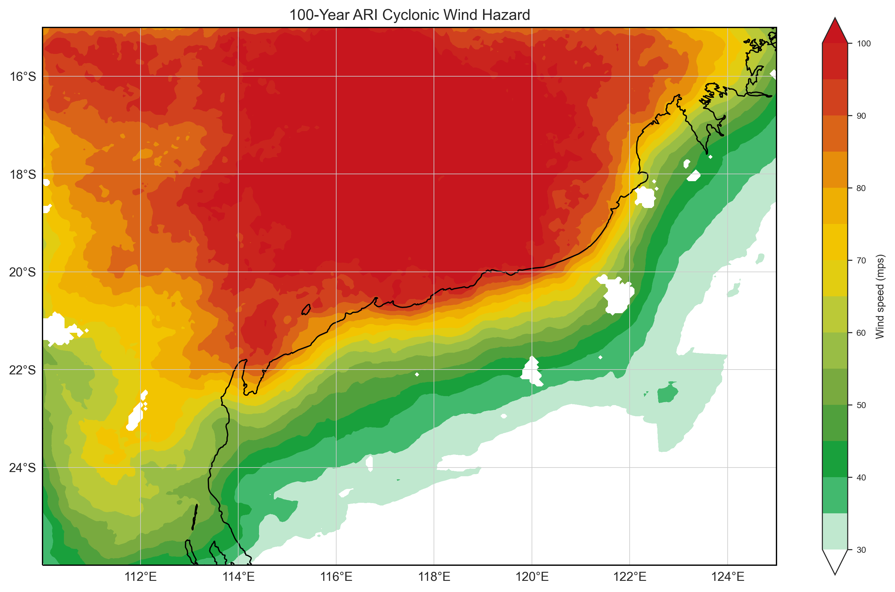
- NHIRS tropical cyclone hazard data comes from cyclone track forecasts issued by the Bureau of Meteorology. This data is passed through Geoscience Australia’s Tropical Cyclone Risk Model (TCRM), which considers local topography and site characteristics to calculate local wind speeds.
- NHIRS severe wind hazard data is supplied by the Bureau of Meteorology’s ACCESS-C3 numerical weather prediction model from information collected at 7 geographic domains across Australia.
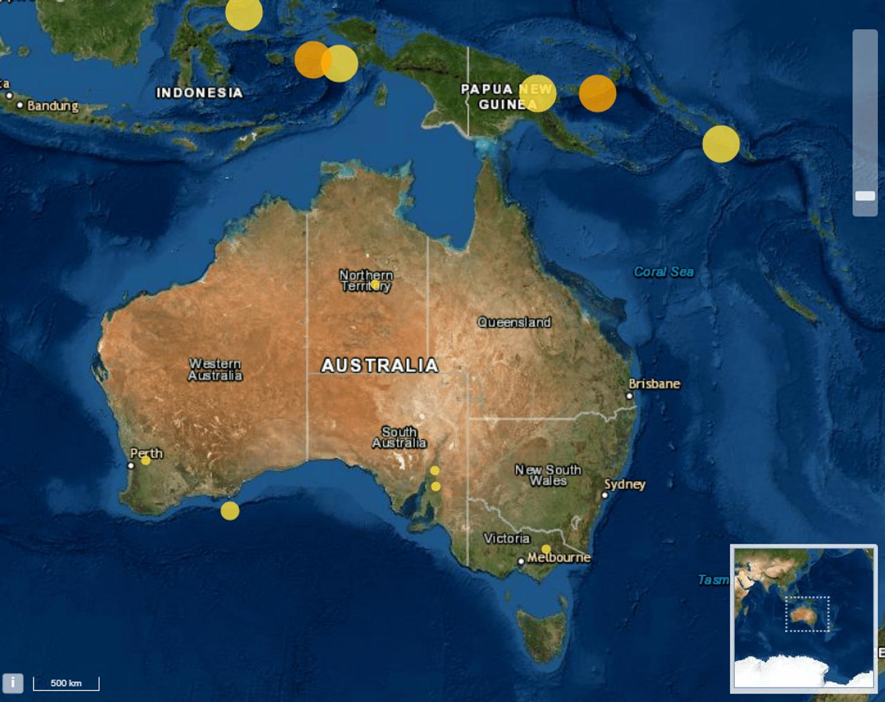
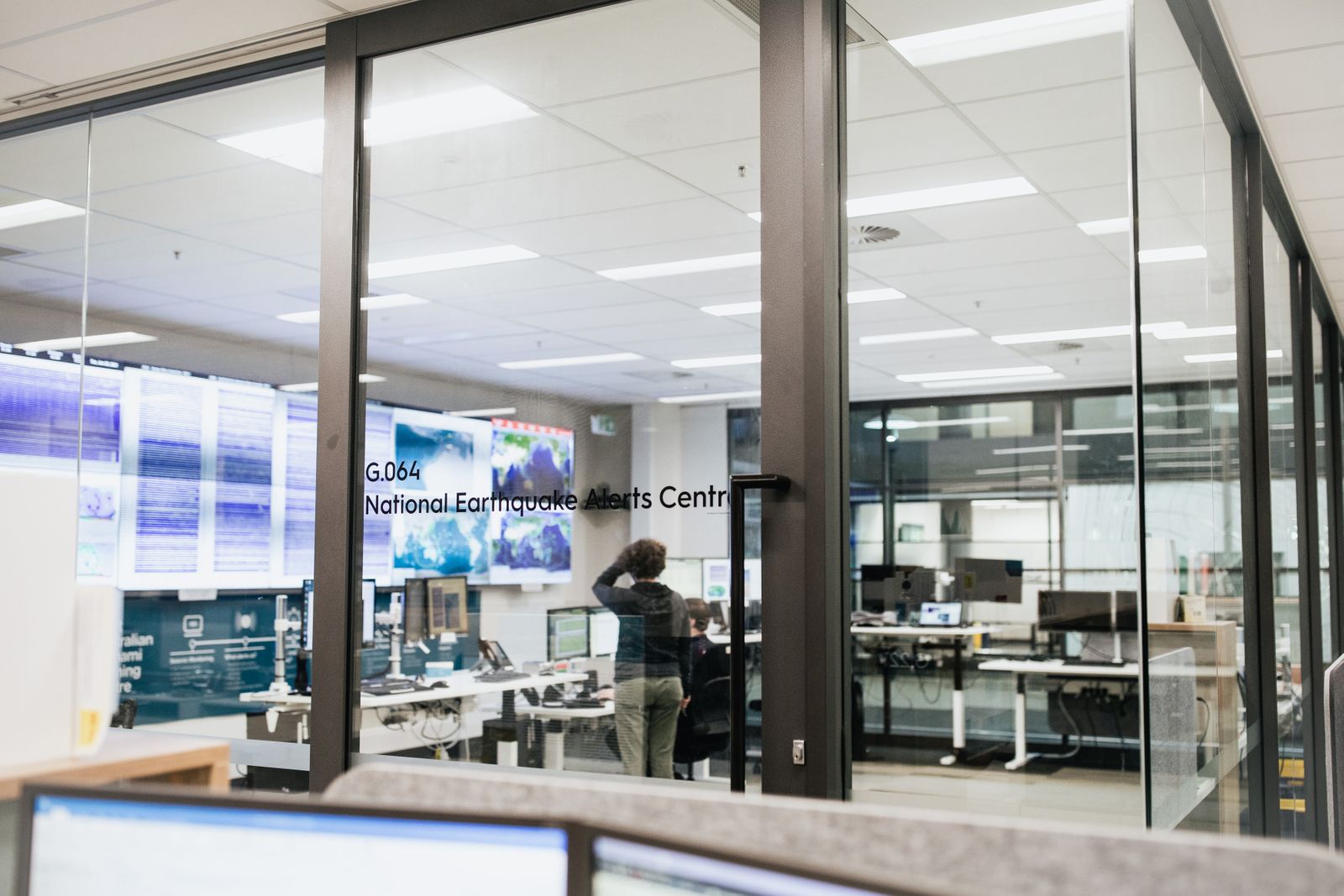
- NHIRS earthquake hazard data is provided by Geoscience Australia’s National Earthquake Alert Centre, ShakeMap, which produces near-real-time maps of shaking intensity following significant earthquakes.
- NHIRS exposure data comes from Geoscience Australia’s National Exposure Information System, which contains data on buildings, infrastructure, social demographics, and agricultural and environmental assets. Data on assets exposed to a hazard can be accessed through Geoscience Australia’s Australian Exposure Information Platform (AEIP)
- NHIRS vulnerability data uses Geoscience Australia’s vulnerability curves to describe the average relationship between hazard intensity and damage. Wind vulnerability is calculated using the Vulnerability and Adaptation to Wind Simulation (VAWS) tool.
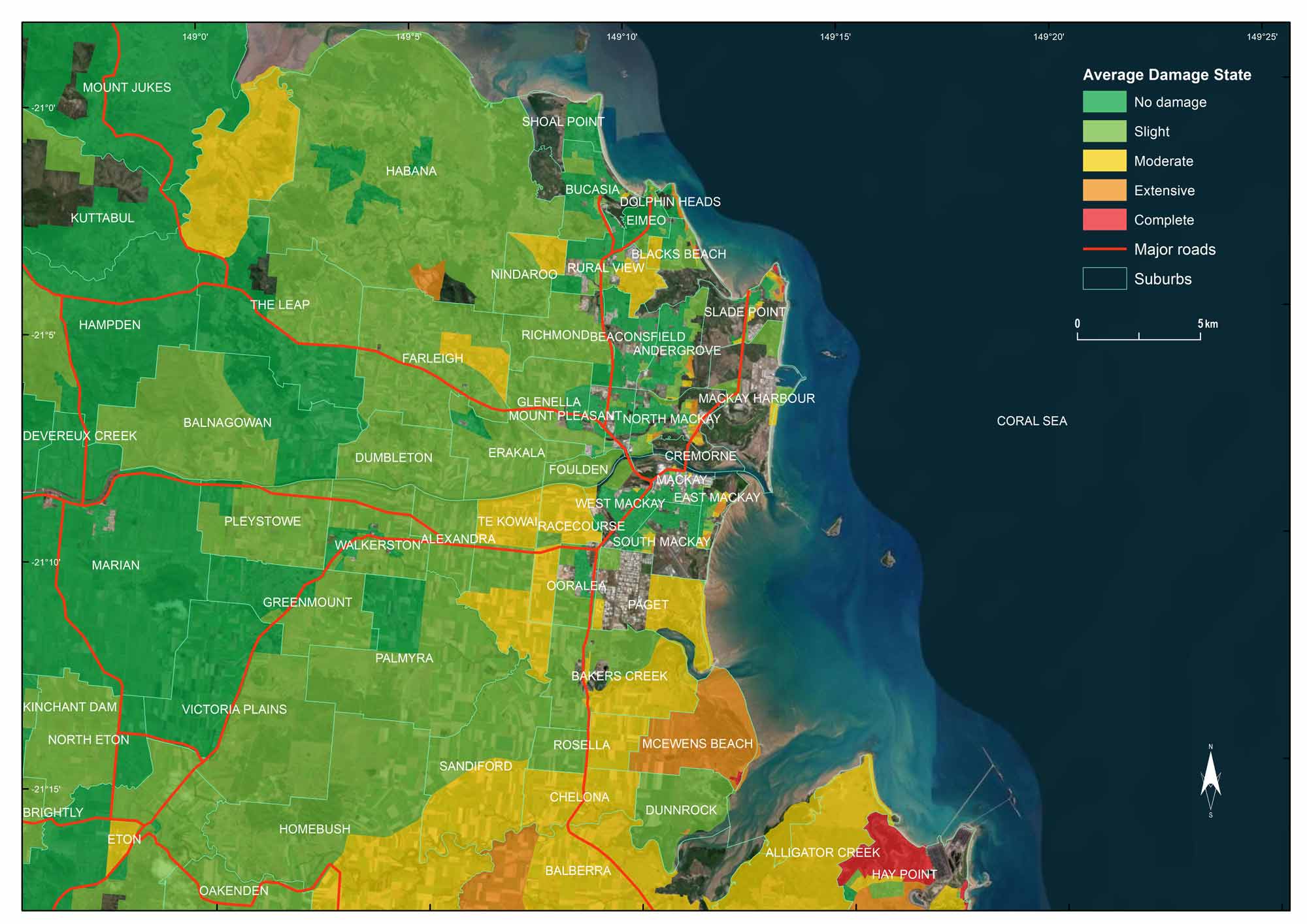
- NHIRS impact data uses vulnerability curves to forecast the potential impact to residential detached and semi-detached buildings, evaluated using Geoscience Australia’s Hazard Impact Assessment software (Hazlmp), Impact is calculated as a damage ratio at the building level, expressed as the cost to repair an exposed asset versus the cost to replace the asset.
- Damage ratios are then aggregated to an appropriate statistical area and an average damage for that area is presented by a damage state, which provides a description of the average forecasted impacts.
Case study Partnering with QFES for tropical cyclone hazard assessment
How science and data were combined to help Queensland’s emergency managers plan for and reduce the impacts of tropical cyclone hazards.
Good to know
The NHIRS considers the impact of earthquakes, tropical cyclones and severe winds on detached and semi-detached residential buildings only. It doesn’t measure hazard impact on multi-dwelling residential buildings, commercial or industrial buildings, or other types of building infrastructure. Rural residential buildings are not included in the data. NHIRS impact forecasts don’t cover wind-related hazards such as storm surge or tree fall. Accurate impact forecasts rely on accurate ‘hazard’, ‘exposure’ and ‘vulnerability’ information, so impact forecasts are continuously evolving and improving as our understanding of these elements develops.
Looking forward
Geoscience Australia continues to develop the NHIRS to include the validation and verification of impact forecasts, which requires collaboration with emergency management agencies.
Future improvements to the NHIRS include developing innovative ways to communicate uncertainty at all stages of the impact assessment process, providing a more holistic forecast of potential hazard impacts. This will enable governments and those in the emergency sector to better incorporate impact forecast information into their decision-making processes.

Forecasted impacts from a severe wind event in Tasmania in Nov 2022
Related products
Tropical Cyclone Risk Model Software (TCRM)
Estimate average recurrence interval wind speeds and potential tropical cyclone wind hazard.
Tropical Cyclone Scenario Selector Tool
Use this interactive tool for querying, visualising and downloading cyclone scenarios plausible future tropical cyclone scenarios used for risk management and planning.

Earthquake Scenario Selector Tool
Query, visualise and download earthquake scenarios using pre-generated scenarios that represent plausible events that can be used for earthquake risk management and planning.
Wind multipliers
Learn more about our significant research on wind speed undertaken due to its importance in predicting, mitigating and managing major risks and hazards caused by wind.