Project Monitoring the Earth’s dynamic magnetic field
How Geoscience Australia is accurately tracking geomagnetic changes in the Australian region.
Page last updated:18 June 2024

The problem
The Earth’s rapidly changing geomagnetic field
The geomagnetic field observed on the surface of the Earth is a combination of several magnetic fields originating from multiple sources, including deep within the planet, through the atmosphere and into space.
Geomagnetic data and field models are used extensively, both globally and regionally, in the scientific, industrial and engineering sectors, as well as in the general community. Uses of geomagnetic data and models include:
- space weather monitoring
- compass navigation for pilots, mariners and bushwalkers
- aligning satellite dishes, telescopes and solar-passive houses
- mineral exploration and drilling
- surveying and mapping
- research into the global magnetic field and its secular change
- studies of the Earth's deep interior, crust, ionosphere and magnetosphere.
As the Earth's magnetic field is constantly changing, geomagnetic models must be updated regularly if they are to be accurate, reliable and useful to scientists, researchers and wider community. Tracking geomagnetic changes requires significant investment – both financially and logistically – as well as considerable scientific expertise and resources.
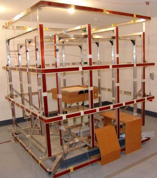
National Magnetic Calibration Facility at the Canberra Observatory, a well calibrated 3-axis set of large coils to determine the relative axis orientations and sensitivity of the modern magnetometers
What we’re doing
Providing up-to-date modelling of the Earth’s geomagnetic field
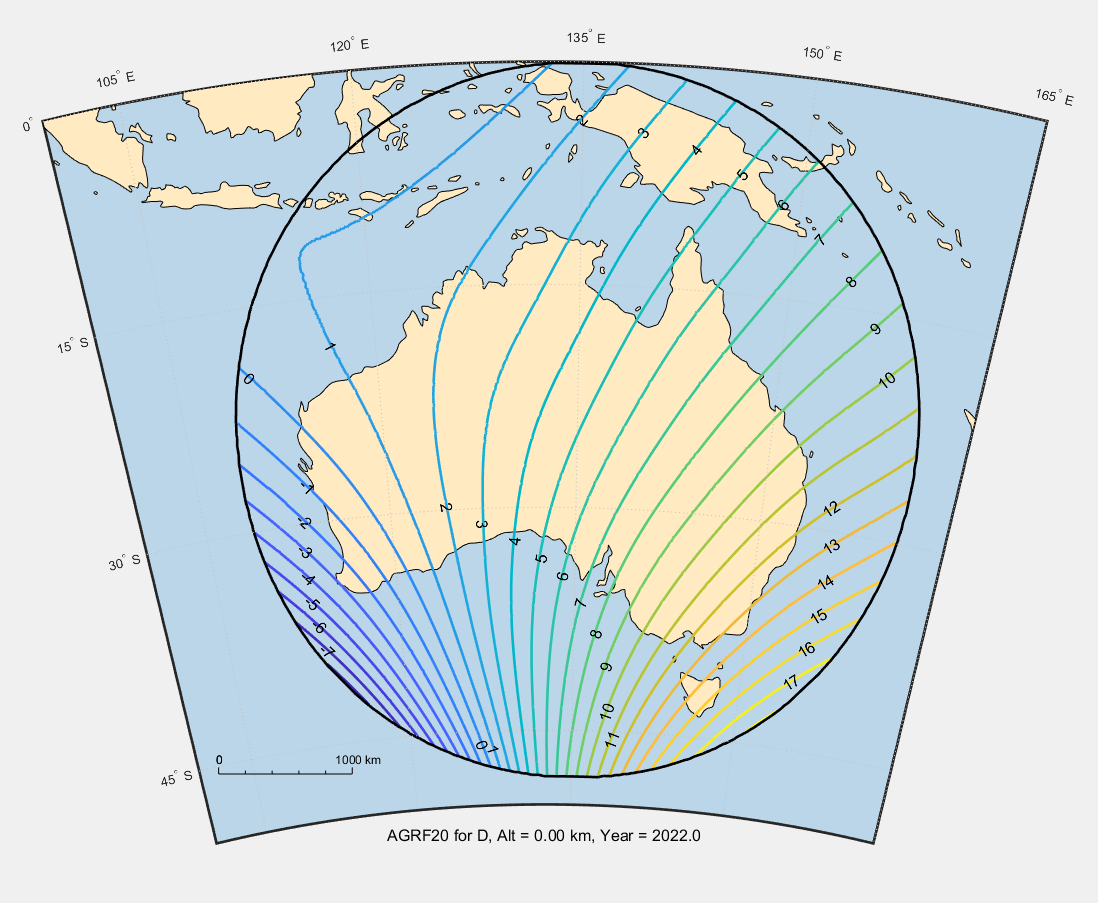
Geoscience Australia’s Australian Geomagnetic Reference Field (AGRF) model represents the Earth's main magnetic field over the Australian region, originating from the planet’s core and long wavelength crustal sources along with its predicted annual changes. The AGRF uses magnetic data from ground level, aircraft and satellite surveys, as well as our network of geomagnetic observatories and repeat stations and those operated by neighbouring countries.
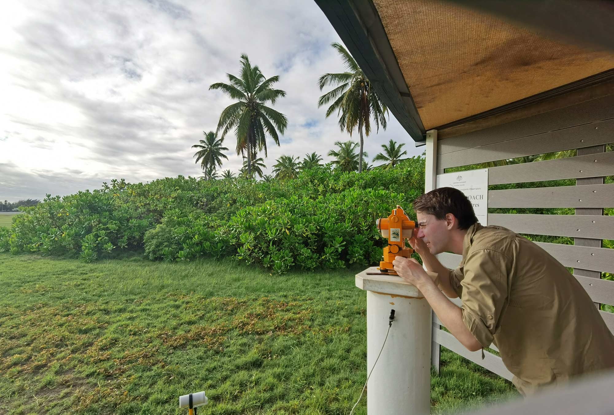
Our Geomagnetic Observatory Network consists of 10 observatories – 6 in Australia, 3 in Antarctica and the sub-Antarctic, and 1 in the Cocos (Keeling) Islands – and 13 repeat stations. The network continually monitors the Earth's changing magnetic field in the Australian region; the repeat stations are re-occupied every few years to monitor the slow change in the field at locations far from the permanent observatories, and its data is used in modelling, mapping and programs aimed at improving the community's understanding of geomagnetic phenomena.
The AGRF model is updated every 5 years. Regularly updating this mathematical model allows our researchers to see how the Earth’s magnetic field has changed over the years, and lets them predict its movement for future years based on its previous rate of change.
View the online calculator.
Geoscience Australia works with state and local governments and the emergency management industry sector across Australia to develop local hazard assessments. For more information, contact hazards@ga.gov.au
Looking forward
Accurate up-to-date geomagnetic monitoring
- Geoscience Australia will continue to update the AGRF model at 5-year intervals, allowing for accurate monitoring of the Earth's changing magnetic field in the Australian region.
- AGRF continues to operate in parallel with the International Geomagnetic Reference Field (IGRF) model, allowing both regional and global researchers to access essential geomagnetic data for navigation, surveying, geophysical exploration and military purposes, as well as investigations into geomagnetic phenomena.
How we can help you
Contact us to gain a better understanding of the geomagnetic hazard risk in your state, region or sector so you can develop targeted and effective risk mitigation and risk reduction strategies.
Our geomagnetic resources can help identify your region’s high-threat areas so you can make better-informed natural hazard decisions.
Email hazards@ga.gov.au

