Project Earthquake monitoring in Muswellbrook NSW
Page last updated:24 February 2025
The situation
On 23 August 2024, the communities of Muswellbrook and Denman in New South Wales experienced a moment magnitude M 4.7 earthquake, with its epicentre near the Mount Arthur Coal Mine in the Upper Hunter region.
The main shock on 23 August was strongly felt by the local community, and was felt as far as Wollongong, Tamworth and Dubbo, with over 3,600 felt reports being submitted through Geoscience Australia’s National Earthquake Alerts Centre.
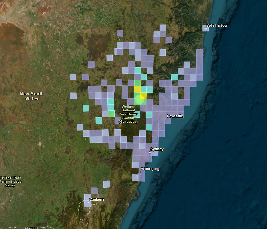
Felt reports show the extent of the 23 August main shock
There were multiple aftershocks in the 24 hours following the initial event, including a M 4.4 event on 24 August. Geoscience Australia recorded over 40 earthquakes in the Muswellbrook region between 23 August 2024 and 31 October 2024, though more events of a lower magnitude may have occurred.
Geoscience Australia into action
Within a few days of the initial earthquake, our team sent temporary Rapid Deployment Kits to the area. These small temporary earthquake monitoring kits, together with the national seismometer network, collected real-time data which was used to determine more accurate information on the frequency, location, depth and magnitude of aftershocks.
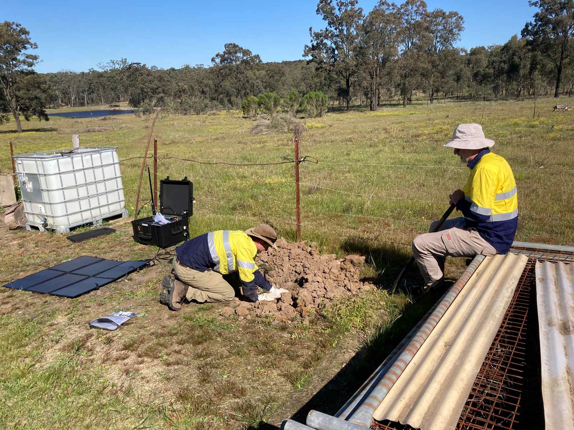
This is a routine response to significant earthquakes as it allows us to develop a deeper and more thorough understanding of seismic activity in our country.
The equipment measured numerous aftershocks, including a M 4.5 event on 7 September and a M 4.1 event on 12 November.
The results
The data collected by the additional monitoring sites is used to improve the location accuracy of earthquakes in the current sequence, provide improved real-time intelligence to emergency services and the public, and to capture rare strong-motion data from moderate-to-large stable continental region earthquakes to help understand the earthquake hazard in these areas.
We have prepared a report detailing the findings from the Rapid Deployment Kits and our analysis of these data. Get the report here.
The data we have gathered gives us greater insight into the potential for earthquake related damage to buildings in the Muswellbrook region.
It is also an invaluable input to our ongoing work to improve our understanding of earthquake activity in Australia and our overall seismic risk profile.
The intensity of earthquake ground shaking can vary greatly over short distances. Shaking intensity is dependent on several factors, including the magnitude of the earthquake, the distance of the observer from the earthquake epicentre and the geology and topography at the observation site.
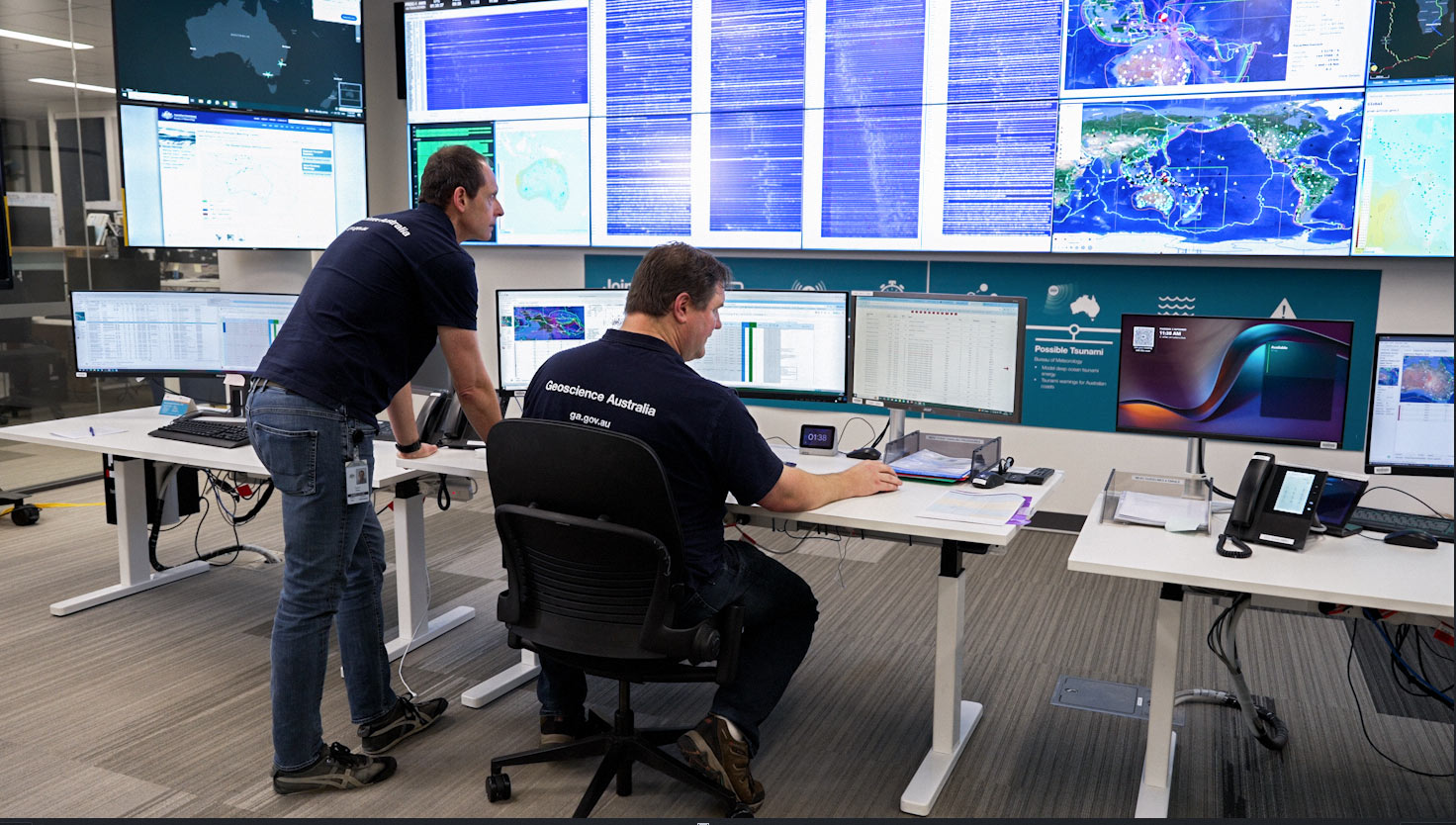
Geoscience Australia monitors, analyses and reports on significant earthquakes to alert the Australian Government, State and Territory Governments and the public about earthquakes in Australia.
We periodically produce the National Seismic Hazard Assessment, which defines variations in the level of earthquake ground shaking hazard across Australia. It provides an improved understanding of the seismic hazard and its uncertainties for Australia, allowing communities to be better prepared for future earthquakes.
How we support your sector
Our natural hazard resources can help your organisation be better prepared

Emergency managers
We offer a range of scientific tools to help emergency services plan and prepare for natural hazards, with the goal of reducing their impact when they do occur.

Government
Our scientific community safety resources can help inform robust government policy making with an evidence-based understanding of natural hazards.
Infrastructure
Our scientific tools and resources can help the infrastructure industry understand the exposure and vulnerability developments may have to natural hazards.

Industry
Our scientific tools and resources can help industry understand the exposure and vulnerability businesses may have to natural hazards.