Project Improving the earthquake hazard resilience of remote Western Australian communities
How Geoscience Australia is building a better understanding of the potential impacts of an earthquake event in the Yilgarn region.
Page last updated:13 June 2025

The problem
Assessing the risk of earthquakes in remote Western Australian communities
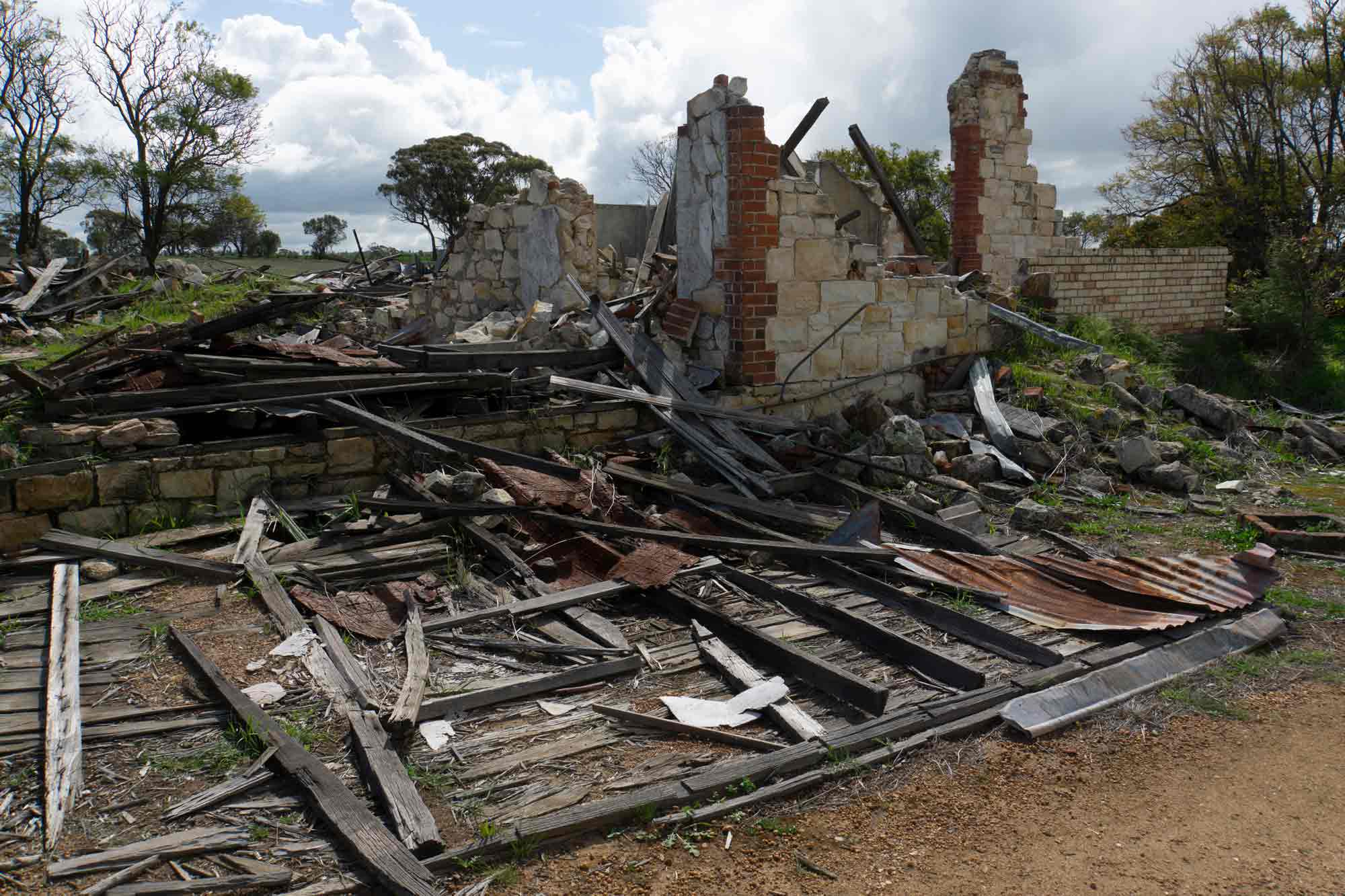
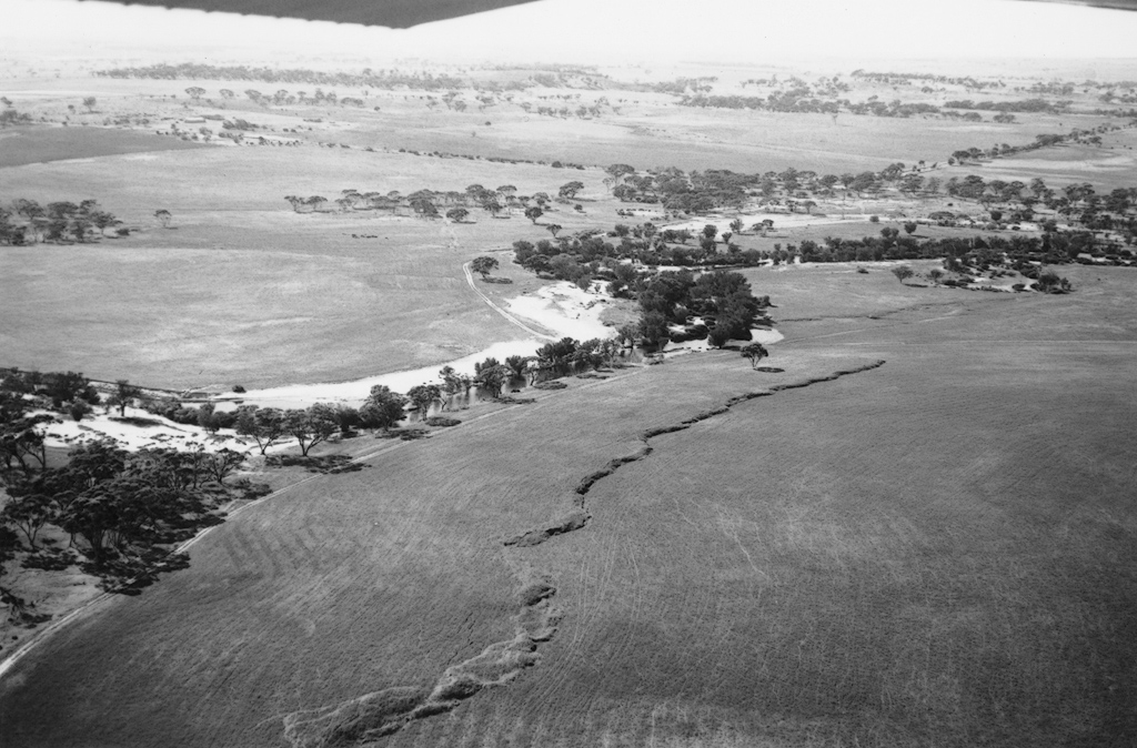
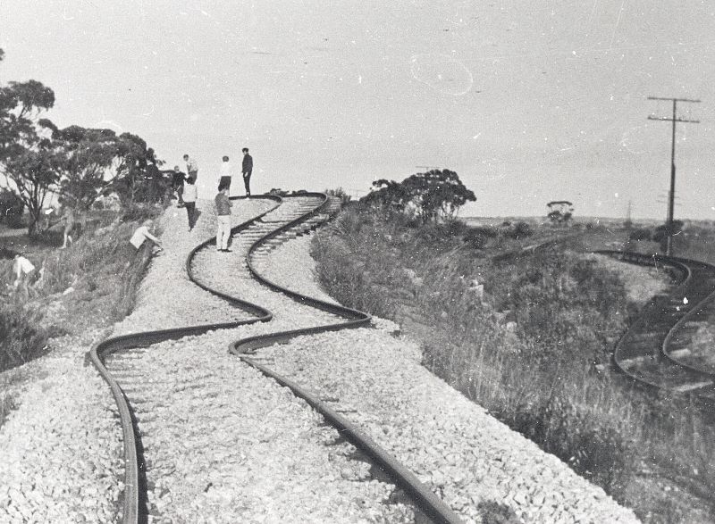
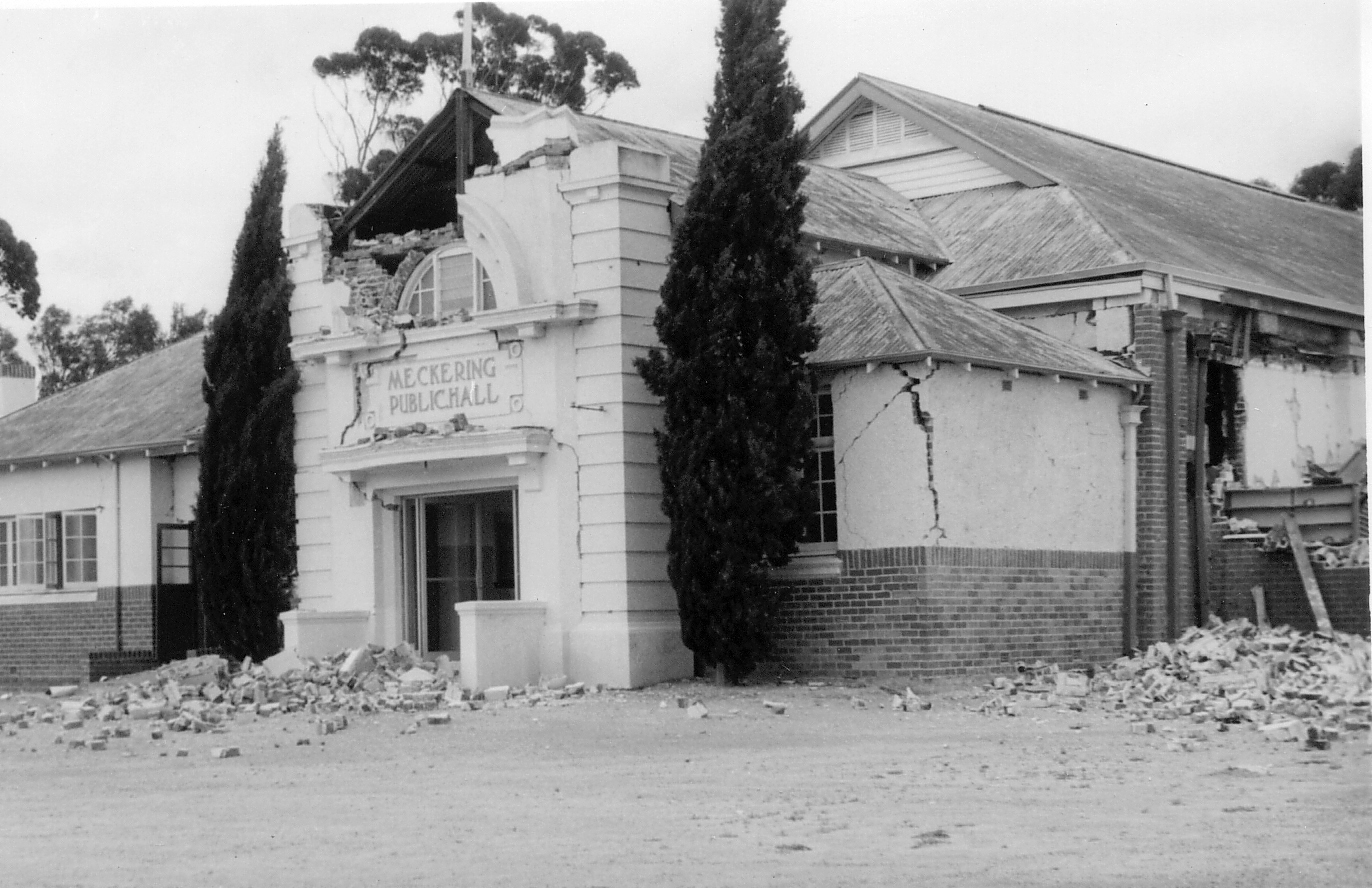
The Yilgarn is a remote area of Western Australia located in the Wheatbelt region, east of Perth. Although some parts of Australia are more likely to experience earthquakes than others, they can occur anywhere, and with little warning. The seismic hazard in the Yilgarn region is relatively high in the national context, but still moderate by world standards. It’s home to several small communities, including Meckering which, in 1968, experienced a magnitude 6.5 earthquake that damaged buildings and roads, and ruptured the surface of the earth.
If another earthquake of similar magnitude occurs in this area, critical infrastructure like water, electricity, transport and health services may be impacted. Older buildings of significant heritage value may also be damaged or destroyed.
To help the Yilgarn communities reduce their vulnerability to future earthquakes, understanding the region’s network of critical infrastructure is vital. This will build knowledge of where the communities are most vulnerable – in relation to not just their dwellings, but also key lifeline dependencies – and help protect against damage.
What we’re doing
Building a knowledge base to support earthquake preparedness and emergency management
Geoscience Australia is running the Risk Assessment and Mitigation Study for Earthquakes in the Yilgarn (RAMSEY) project in partnership with the Western Australian Department of Fire and Emergency Services (DFES). From April 2022 to June 2024, the project will work with seven small Yilgarn communities: Wundowie, Northam, Meckering, Cunderdin, Tammin, Kellerberrin and Merredin.
The information from this study will help the region to be better prepared, plan an effective emergency management response, and develop mitigation strategies to strengthen vital elements of the infrastructure network.
Crucially, this project will include direct collaboration with infrastructure operators responsible for electricity, water, road and rail transport systems in the region.
Through the RAMSEY project, we are:
- building on the relationships and capabilities developed in the context of the preceding project Earthquake Impact and Risk Assessment for Perth and Supporting Infrastructure (EIRAPSI)
- identifying key facilities and networks, modelling their vulnerability and risk to seismic hazards (including their interdependency), and developing and testing the effectiveness of this mitigation advice through detailed modelling
- updating and utilising Geoscience Australia’s National Seismic Hazard Assessment (NSHA) and the Global Earthquake Model (GEM) Foundation’s OpenQuake Platform to assess earthquake risk
- incorporating the results back into Geoscience Australia and GEM Foundation earthquake assessment tools to support further growth of these capabilities
- updating and utilising the Systemic Infrastructure Resilience Analysis (SIRA) tool to simulate the impact of earthquake event sets on critical Yilgarn infrastructure networks, such as electricity, water, land transport and health services, with a focus on impacts that affect multiple network elements
- obtaining real-world data from industry stakeholders to support the study, including vital geotechnical reports and design data
- assessing the impact of potential earthquake events on the region’s local health system (including buildings, staffing and patient loads) and determining how the region would cope with disrupted essential services and increased demand
- creating an exposure database for each of the seven Yilgarn communities containing demographic information, details of heritage buildings, information about their resilience to earthquake damage, and the viability of building retrofit measures to mitigate risk.
The resulting information will inform the emergency management sector on the expected demands on resources and logistics resulting from a large event. This approach supports the development of evidence-based advice that is testable and actionable, with a view to lowering risk to people and infrastructure in the region.
Read the full report.
Geoscience Australia works with state and local governments and the emergency management industry sector across Australia to develop local hazard assessments. For more information, contact hazards@ga.gov.au
Looking forward
Sharing knowledge to mitigate earthquake risks in remote communities
- Geoscience Australia will exchange RAMSEY data and information with the WA Department of Fire and Emergency Services (DFES), the WA Department of Planning, Lands and Heritage (DPHL), the local shire councils of Northam, Cunderdin, Tammin and Merredin, and the WA Country Health Service.
- The RAMSEY project will contribute to the Australian Disaster Resilience Index (ADRI) and help refine seismic modelling techniques and tools developed by Geoscience Australia and the GEM Foundation.
- Geoscience Australia researchers will collaborate with international seismic risk experts from the GEM Foundation, based in Pavia, Italy, expanding and strengthening the relationship between the two partners. respecting
- Respecting our collaborative partnerships, Geoscience Australia strives to enrich public domain knowledge taking care to safeguard the intellectual property and reputation of the stakeholders.
How we can help you
Contact us to gain a better understanding of earthquake hazard risk to infrastructure assets in your state, region or sector, so you can develop targeted and effective risk mitigation and disaster preparedness strategies.
Our earthquake resources can help identify your region’s high-threat areas so you can make better-informed natural hazard decisions.
Related information
Australian Seismic Site Conditions Map (ASSCM)
Determine the potential behaviour of geological materials under the influence of seismic ground shaking at a site of interest.
Earthquake Scenario Selector Tool
Query, visualise and download earthquake scenarios using pre-generated scenarios that represent plausible events that can be used for earthquake risk management and planning.
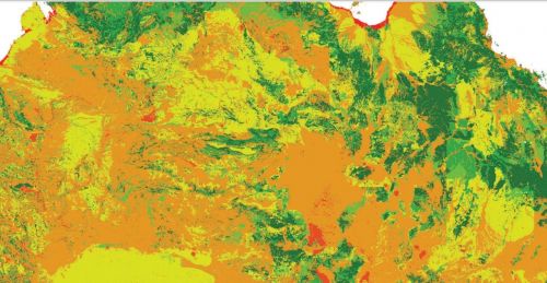
National Seismic Hazard Assessment (NSHA)
The NSHA defines the level of earthquake ground shaking across Australia, allowing higher hazard areas to be identified and mitigation strategies to be developed.