Data product Tropical Cyclone Hazard Assessment (TCHA)
Identify local and regional areas that are at high threat to cyclones and severe wind.
Page last updated:18 June 2024

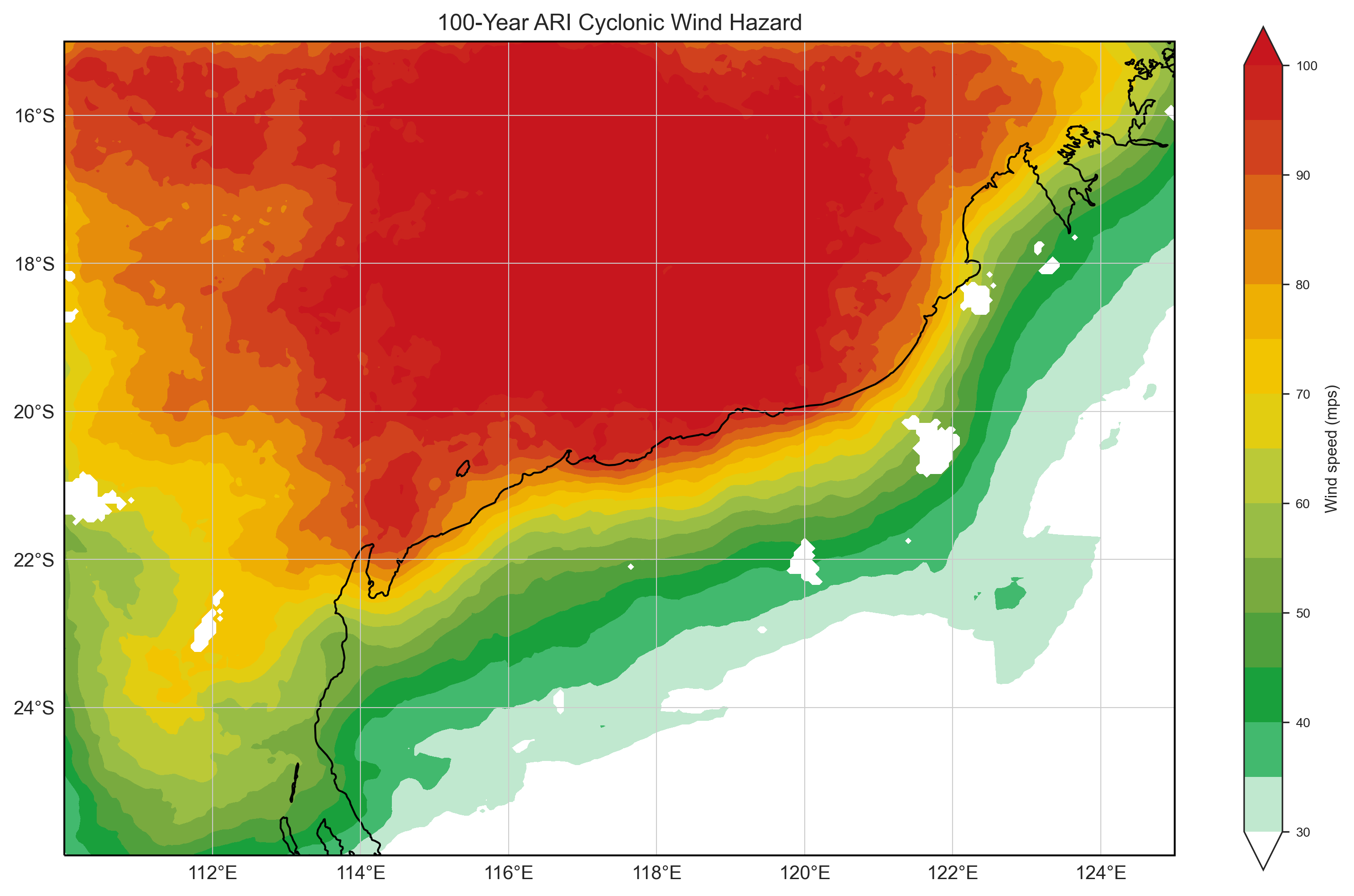
Defining the severe wind hazard threat posed to Australia
The TCHA provides an evaluation of the likelihood and intensity of the occurrence of tropical cyclone winds across the Australian region, covering mainland Australia, islands and adjacent waters.
Use TCHA18
Use our interactive tools for cyclone risk management, and to inform your research of the tropical cyclone threat in your area.
Talk to us about your challenges
We continue to work with different sectors to provide assessments and address new challenges as they emerge.
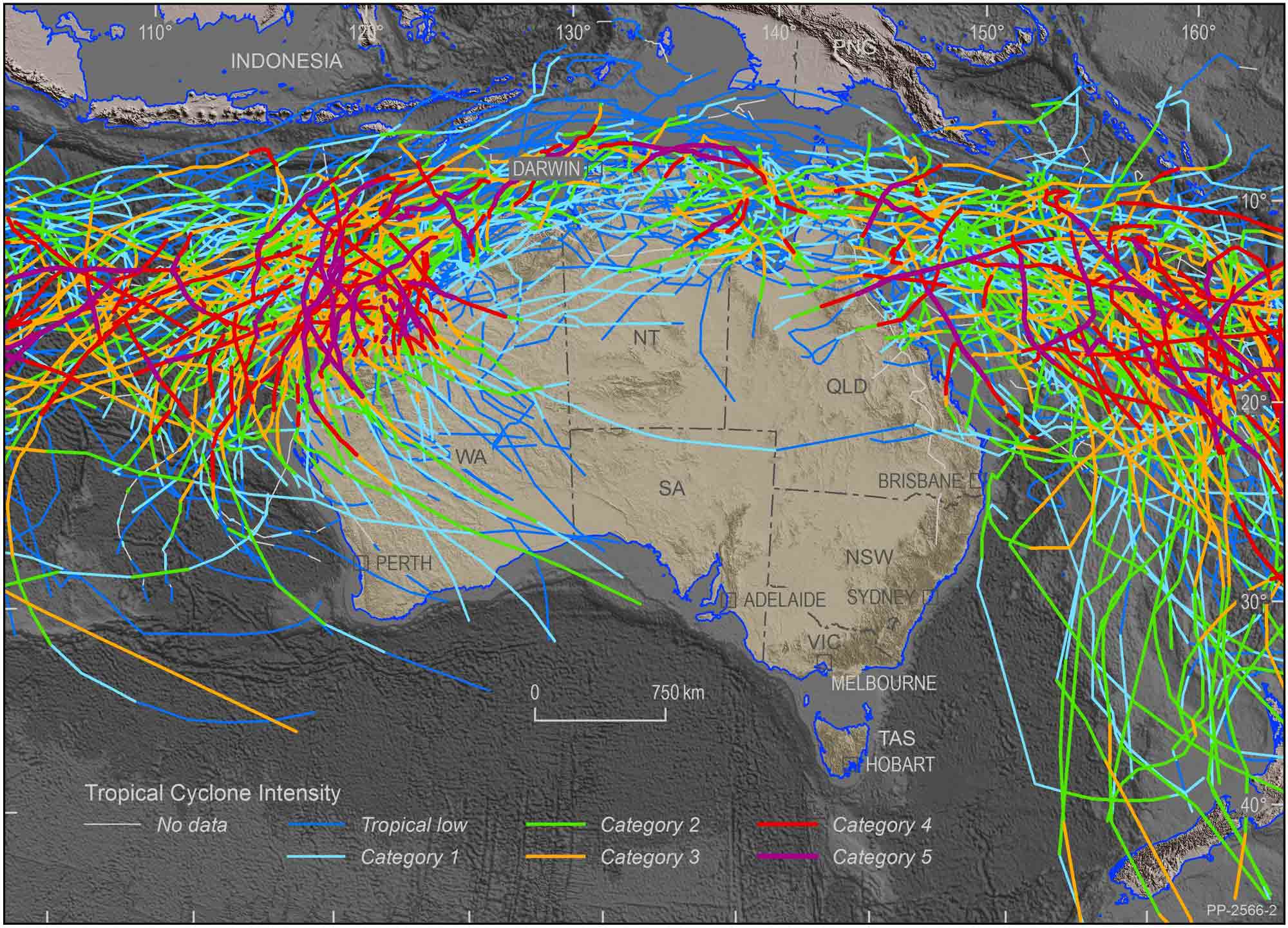
TCHA 2018 that shows trace lines of probable tropical cyclone scenarios
Who is the TCHA for?
The TCHA provides vital information to emergency managers, town planners, infrastructure owners, and the insurance industry. It identifies local and regional areas that are at high threat to cyclones and severe wind.
It is also a key data source used in the development of local cyclone impact models. These are then used to inform disaster management and evacuation plans, infrastructure planning reports and mitigation strategies.
How the TCHA works
- It uses Australian observations and data to determine how quickly tropical cyclones dissipate after landfall.
- It uses the latest scientific methods to create realistically sized simulated tropical cyclones, analysing both intensity and latitude leads to more authentic modelling of a cyclone’s size over its lifetime.
- It records precise details of each simulated tropical cyclone, including wind speeds and their locations around Australia, and the likelihood of extreme wind speeds, and records them in its event database.
- It allows users to extract and examine individual tropical cyclone events, because it stores the wind field from each separate simulated tropical cyclone scenario.
- Its event database allows users to separate hazard information into parts, so they can easily explore scenarios which may be relevant to their own communities.
Good to know
TCHA relates to tropical cyclone winds only. It doesn’t include other severe wind hazards, such as tornadoes, severe storms or cyclones that become storm events. Although this is standard practice for tropical cyclone hazard assessments and recognised internationally as an agreed methodology, it’s a key constraint and one the scientific community is addressing with research.
Looking forward
Geoscience Australia continues to update the TCHA, generally every four years.
The field of science and technology is constantly evolving and improving, and it’s important to incorporate best practice and evidence-based science in our knowledge. TCHA strives to reflect these advancements so Australian communities are as safe as possible from tropical cyclone events.
It’s likely that TCHA will be considered in future revisions to the Australian Standards on wind loading. This will ensure buildings and infrastructure in Australia are built to withstand tropical cyclone events.

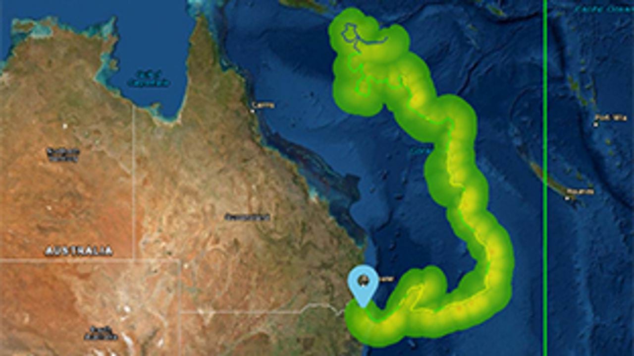
Case study Assessing and improving Western Australia’s vulnerability to tropical cyclones
How scenario modelling helped emergency managers in Western Australia to mitigate the impacts of tropical cyclone hazards.

The selection of credible scenarios enables our sector to improve planning for response and recovery and, most importantly, inform mitigation strategies by having a scale of tangible events to plan against.
Senior Intelligence Analyst, The Western Australian Department of Fire and Emergency Services
Related products
Tropical Cyclone Risk Model Software (TCRM)
Estimate average recurrence interval wind speeds and potential tropical cyclone wind hazard.
Tropical Cyclone Scenario Selector Tool
Use this interactive tool for querying, visualising and downloading cyclone scenarios plausible future tropical cyclone scenarios used for risk management and planning.

National wind multipliers dataset
Evaluate local wind speeds over topography and different land cover types, which can be used for applications like determining the speed of a fire front.

National Exposure Information System
Use our nationally consistent exposure data to help understand what could be at threat from natural hazards.