Data product Wind multipliers
Understand local wind speeds for hazard and risk assessment.
Page last updated:18 June 2024

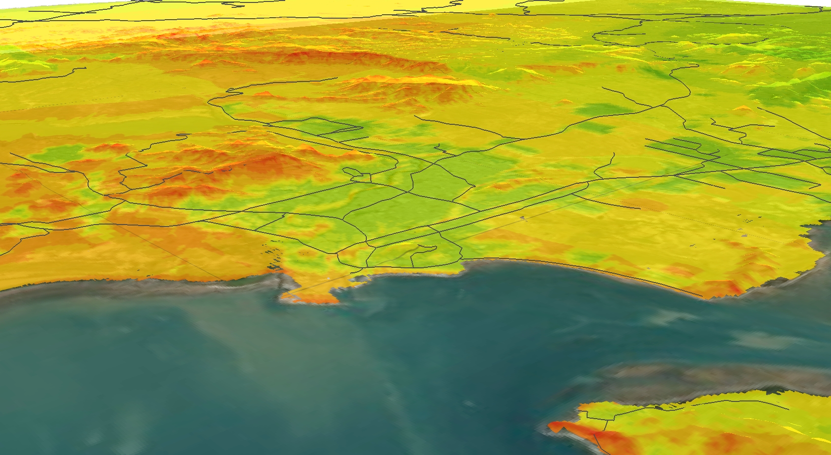
Assessing local wind hazard
Severe wind can have a devastating impact on infrastructure and communities in Australia. Geoscience Australia undertakes significant research on wind speed due to its importance in predicting, mitigating and managing major risks and hazards caused by wind.
Wind multipliers are factors that transform regional wind speeds to local wind speeds based on the local area’s terrain. They are an integral part of the calculation used to assess wind speed accurately at the local level.
Who are wind multipliers for?
Wind multipliers, and concepts such as wind speed and wind loading, are used by construction industry professionals to ensure buildings and other infrastructure remain safe in the event of a severe wind gust. Wind multipliers are regularly used by engineers in building applications to make sure their infrastructure projects meet particular wind loading standards and codes.
Knowledge of wind multipliers and the latest wind-related research is also critical for those working in wind energy generation, wind risk assessment, bushfire spread modelling, waterway management, pollution dispersion analysis and farming.
How wind multipliers work
- To understand wind hazards locally, wind speed is the most important wind behaviour to assess.
- Several factors determine wind speed, including wind intensity, ground surface roughness, topography and height.
- Wind multipliers are applied to regional wind speed data to calculate the local wind speed at a given location.
- Four main wind multipliers help determine wind speed and the degree of wind hazard: wind direction, terrain/height, shielding and topography.
- The impact of terrain (surface roughness) on wind speed can be significant – from the length of the grass, to whether the area is open or has trees, to whether it includes a low or high density of buildings.
- How wind moves over a hill (known as the topographic effect) has a strong impact on wind behaviour and is determined using spatial algorithms.
- Shielding multipliers are based on building height, width and density, providing a ‘shield’ around other buildings.
Good to know
Recent Geoscience Australia software updates and improvements to wind, terrain and topographic multiplier algorithms have improved the accuracy of local wind speed modelling. As a result, communities, engineers and emergency management services now have access to more reliable local wind hazard information.
Looking forward
Geoscience Australia will continue to explore the use of wind multipliers in assessing wind hazard and risk – particularly across new fields such as waterway management, lake flow modelling, and bushfire spread and impact assessment.

Case study Assessing and improving Western Australia’s vulnerability to tropical cyclones
How scenario modelling helped emergency managers in Western Australia to mitigate the impacts of tropical cyclone hazards.

The selection of credible scenarios enables our sector to improve planning for response and recovery and, most importantly, inform mitigation strategies by having a scale of tangible events to plan against.
Senior Intelligence Analyst, The Western Australian Department of Fire and Emergency Services
Related products
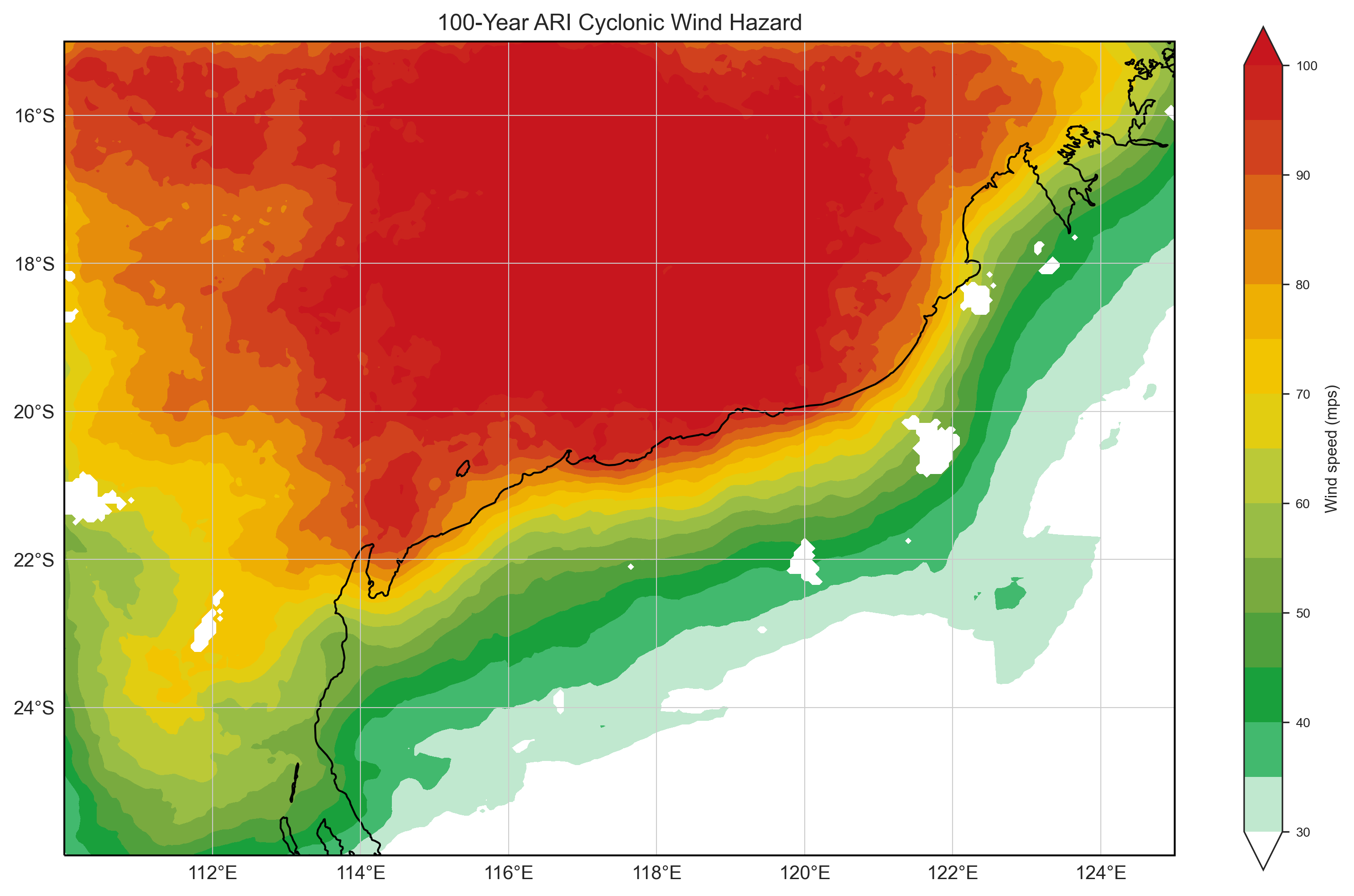
Tropical Cyclone Risk Model Software (TCRM)
Estimate average recurrence interval wind speeds and potential tropical cyclone wind hazard.

Earthquake Scenario Selector Tool
Query, visualise and download earthquake scenarios using pre-generated scenarios that represent plausible events that can be used for earthquake risk management and planning.

Tropical Cyclone Hazard Assessment (TCHA)
Define the severe wind hazard posed by tropical cyclones in Australia. Use it to calculate local cyclone impact models and develop evidence-based evacuation plans and mitigation strategies.

National Exposure Information System
Use our nationally consistent exposure data to help understand what could be at threat from natural hazards.