Derived data product DEA Fractional Cover
Page last updated:29 April 2025
See the colours of our country
Digital Earth Australia (DEA) Fractional Cover splits landscape observation data into three parts — or fractions — enabling measurement of green (leaves, grass, and growing crops), brown (branches, dry grass or hay, and dead leaf litter), and bare ground (soil or rock) in any area of Australia at any time since 1987.
The product can characterise any 30 square metres of Australia, giving insights into not only vegetation, soil and water, but also land, crop and grazing management. Reveal which parts of a property show heavy or under-grazing. Make adjustments and track the success of interventions
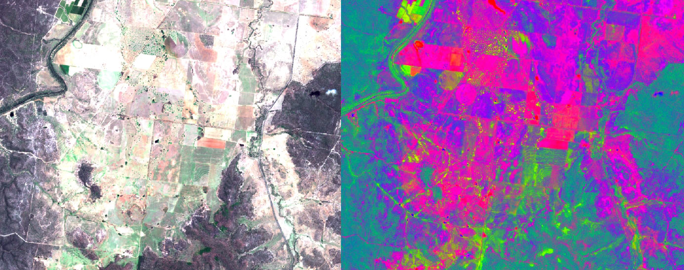
True-colour Sentinel-2 reflectance image of Queensland cropland contrasted with fractional vegetation cover from reflectance values.
Why look at land in cover types?
- Contribute to soil erosion, ecosystem, and vegetation modelling
- Feed data into crop rotation, stubble management, and rangeland management
- Provide insights into the interplay and changes in areas of vegetation and bare soil
- Enable policy agencies, land managers and scientists to monitor land conditions over large areas and long timeframes
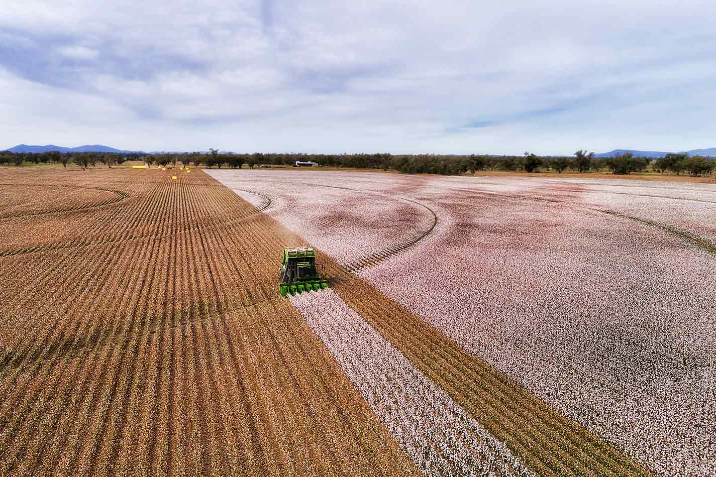
Imagery for impact The colours of Keytah
The vast 65,000 acres of Keytah Station in western NSW gets the fractional cover treatment, revealing just how much change Australia’s agricultural landscapes undergo.
Related resources
DEA Fractional Cover Percentiles
This product calculates the statistical summaries (10th, 50th and 90th percentile) of fractional cover per epoch (whole-of-archive-summary, annual, seasonal).
Journal Article
Continuity of reflectance data between Landsat-7 ETM+ and Landsat-8 OLI, for both top-of-atmosphere and surface reflectance: A study in the Australian landscape.