Derived data product DEA Intertidal
Page last updated:11 April 2024
Dive into the dynamic coastal zone between land and sea
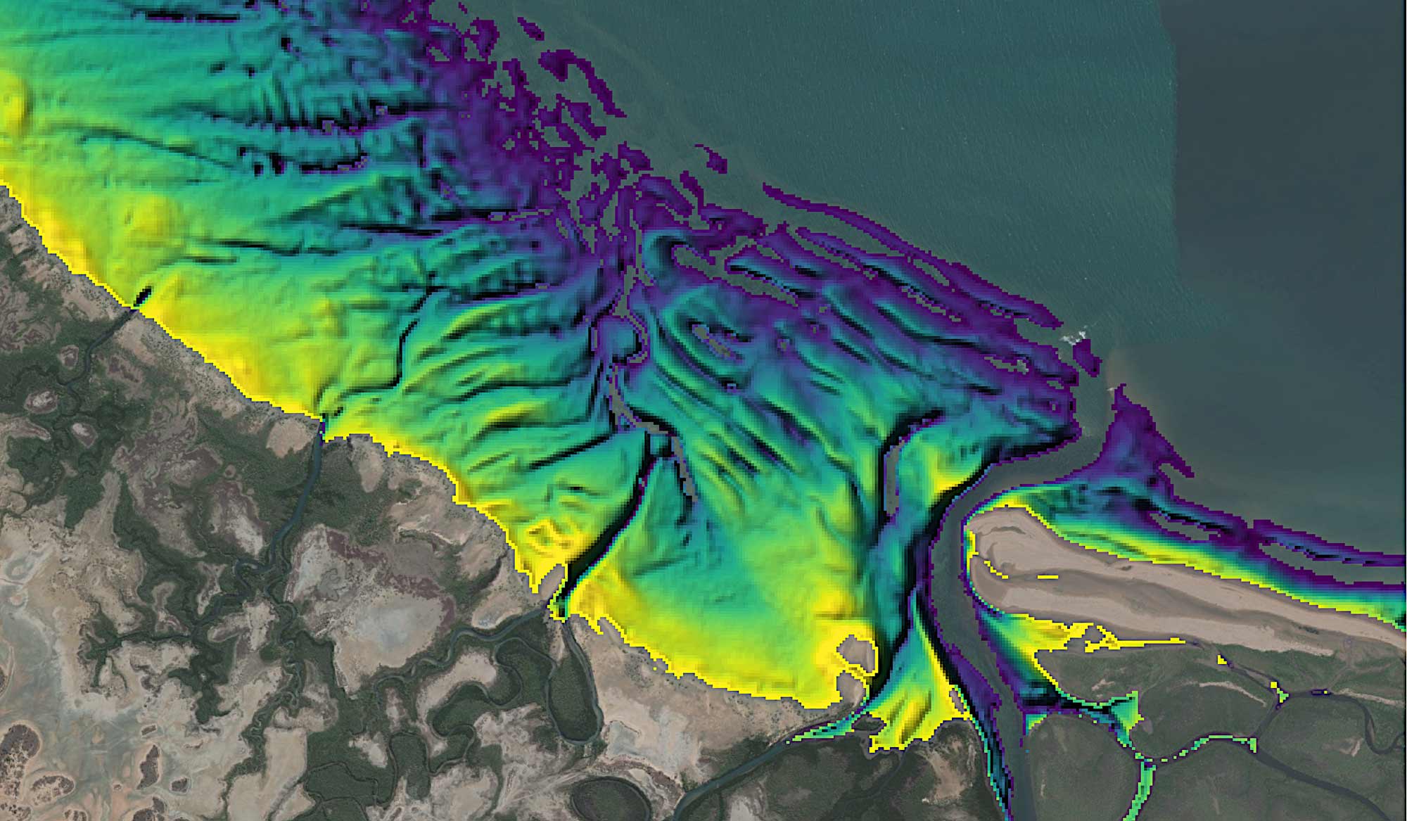
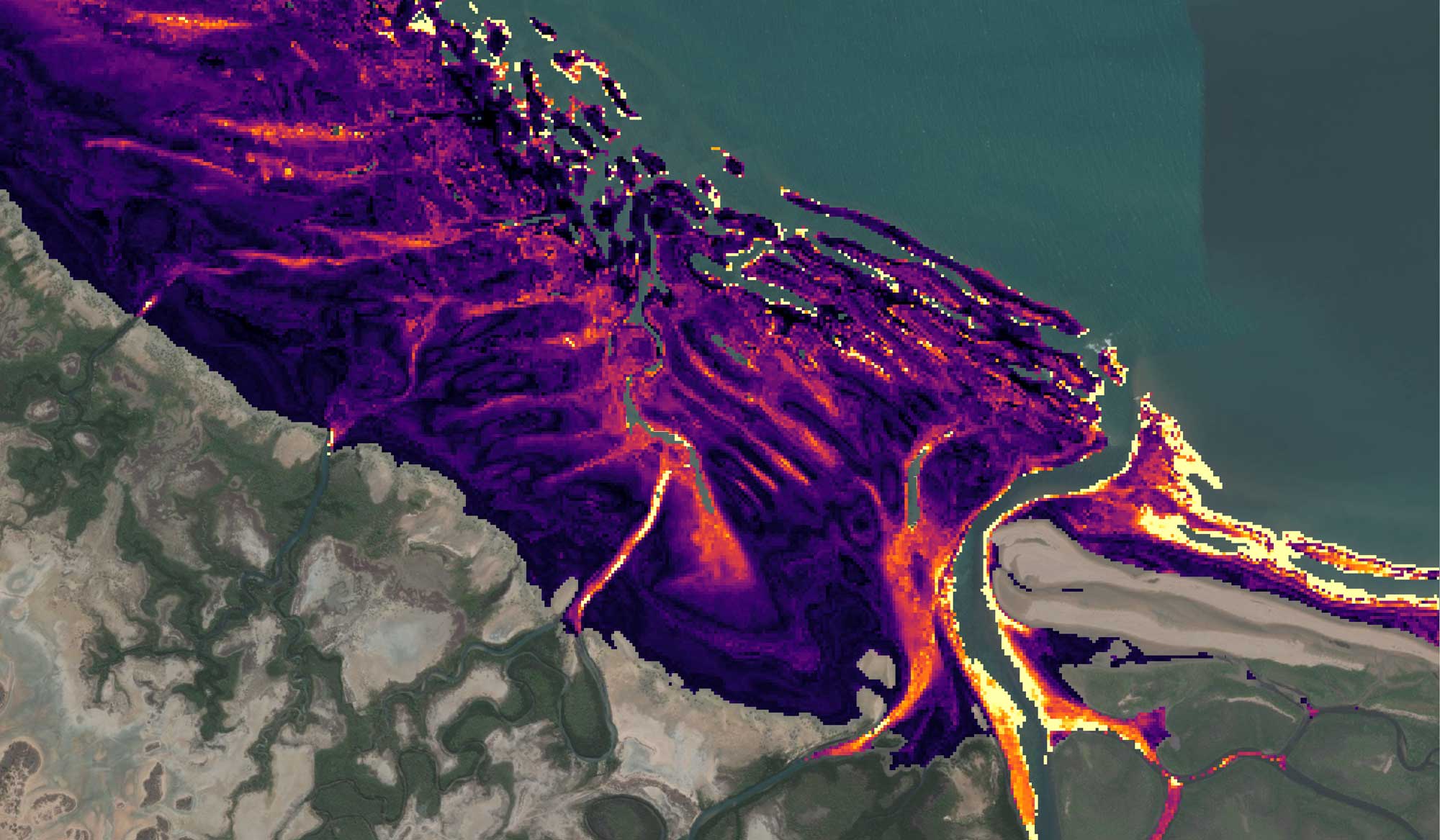
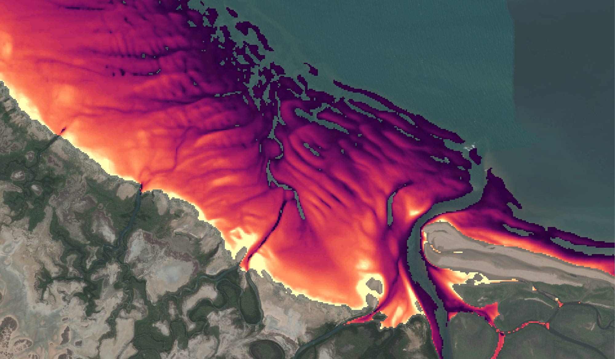
The DEA Intertidal product suite provides annual continental-scale elevation and exposure product layers for Australia’s exposed intertidal zone, mapped at a 10 m resolution from DEA’s archive of open-source Landsat and Sentinel-2 satellite data.
Supports coastal managers assess coastal impacts from extreme weather and inundation events, and shed light on historical erosion and sediment movements
Maps and models the ever-changing habitats of coastal fauna that inhabit the strand between terrestrial and marine environments
DEA Intertidal interactive map
Visit DEA Maps to get the full interactive map with DEA Intertidal and other DEA products.
Why monitor the dynamic intertidal zone?
- Use as baseline elevation data to assist coastal hazard impact assessment from extreme weather and inundation events
- Investigate coastal erosion and sediment transport processes
- Support habitat mapping and migratory species modelling for coastal ecosystems extending across the terrestrial to marine boundary
- Integrate with existing topographic and bathymetric data to seamlessly map the elevation of the coastal zone
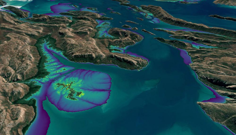
Dynamic data Understanding the coastal zone’s multiple dimensions with DEA Intertidal product suite
The Digital Earth Australia team have built a new intertidal product suite that captures our continent's dynamic coastal regions in unprecedented detail.
Related resources
Using the power of Landsat and Digital Earth tools to understand coastlines in Australia and Africa
How leading-edge Landsat based Earth observation products and tools are helping us to understand Africa’s and Australia’s coastlines.

Welcome to the intertidal zone
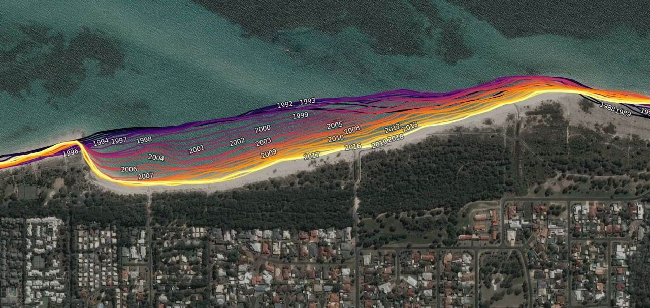
Mapping 50,000 km of Australian coast with three decades of Landsat data.

DEA Coastlines 2.0 now available
Now includes 2021 data, plus new coverage of the Great Barrier Reef, the Torres Strait and northwest WA offshore reefs and islands.

The “Z” of where land meets sea
The Digital Earth Australia team have created the first 3D model of Australia’s entire coastline.