Derived data product DEA Waterbodies
Page last updated:10 April 2025
Find water across the country
Locate over 300,000 waterbodies across Australia and look back at their changes over three decades with Digital Earth Australia (DEA) Waterbodies. Monitor critical lakes and dams, including hard-to-reach waterbodies in remote areas and on large properties.
Explore the online map to find all waterbodies larger than 2,700 sq m (three Landsat satellite image pixels) that are present more than 10% of the time.
Download the data to identify when waterbodies have increased or decreased their wet surface area, informing plans for the future.
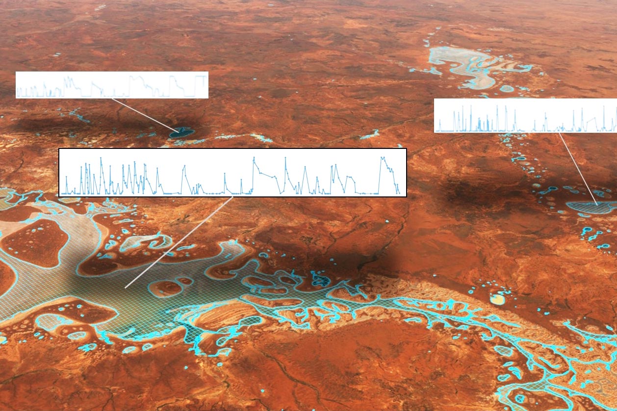
DEA Waterbodies defines polygon boundaries around the significant water areas of Western Australia’s Lake Carnegie, revealing changes in wet area within each polygon over time.
DEA Waterbodies interactive map
Visit DEA Maps to get the full interactive map with DEA Coastlines and other DEA products.
Why detect waterbodies?
- Gain insights into the severity and spatial distribution of drought
- Identify potential water sources for aerial firefighting during bushfires
- Understand local through to national-scale surface water dynamics over time and geography
- Get deeper insight into DEA Water Observations data

Imagery for impact Finding water to fight fire
Satellite data maps of Australian waterbodies are fuelling a more confident flightpath for Victoria’s Country Fire Authority.
Related resources
Journal Article
Mapping and Monitoring the Multi-Decadal Dynamics of Australia’s Open Waterbodies Using Landsat.

Seminar: Australian Water
Hear from Digital Earth Australia’s Dr Claire Krause about using satellite information in decision making.