News The colours of Keytah
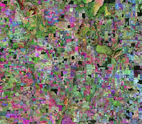
The algorithm behind our DEA Fractional Cover data product turns complex satellite image capture sensitivities into simple colours for easy interpretation.
Page last updated:18 June 2024
Covering approximately 65,000 acres of land in western New South Wales, Keytah Station is a large-scale cropping operation near Moree.
A slice from the vast national Digital Earth Australia (DEA) Fractional Cover dataset shows what Landsat satellites saw over Keytah during the four years from 1988 to 2012.
The animation below shows approximately 'one month per second' of Keytah’s changing land cover types over the four years.
DEA Fractional Cover allocates a colour range to three vegetation types:
- Red colour represents bare soils
- Green colour represents green vegetation
- Blue colour represents ‘non-green’ vegetation. This is vegetation the satellites recognise as being non-photosynthetic, such as leafless trees during autumn and dry grasses
The algorithm behind DEA Fractional Cover was developed by the Joint Remote Sensing Research Program, an Australian collaboration of remote sensing groups supporting the Queensland, New South Wales, and Victorian governments.
A summary of the algorithm is available from the AusCover website.

