News DEA Coastlines 2.0 now available
The latest release of our coastal dataset features annual shorelines for the year 2021, new islands and reefs, new tidal modelling, and improved tools for understanding shoreline data quality.
Page last updated:18 June 2024
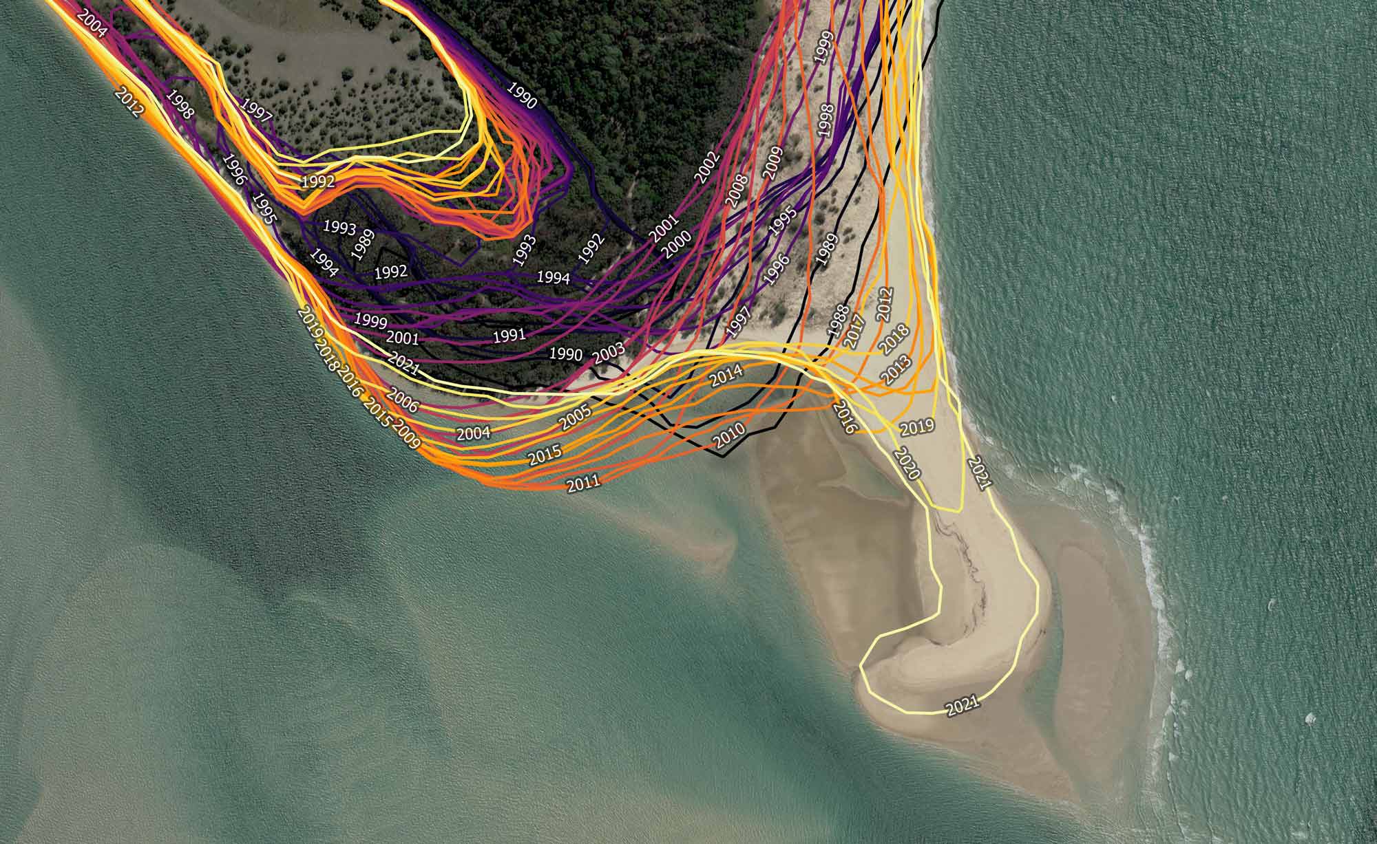
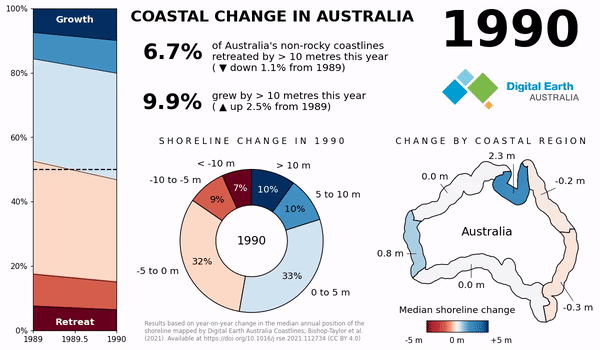
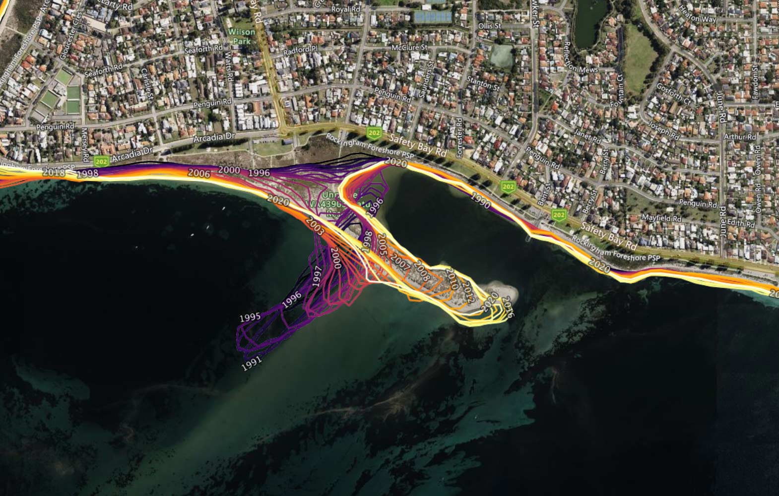
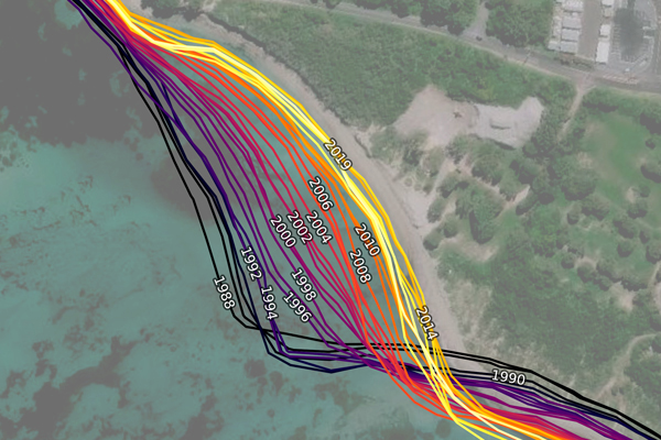
DEA Coastlines combines satellite data with tidal modelling to map the typical location of the Australian coastline at mean sea level for every year since 1988. Resulting shorelines and detailed rates of change show how beaches, sandspits, river mouths, and tidal flats have grown and eroded over time.
DEA Coastlines version 2.0 is available this March, marking a major version update and adding another year of data to the product timeseries.
Updates include:
- Added annual shoreline data for 2021.
- Inclusion of Landsat 9 imagery to provide additional satellite data from late 2021 onwards.
- The use of a new and more flexible global tidal model (FES2014). This model produces accurate tide modelling across Australia and globally.
- Improved tools for understanding and navigating the data quality of each individual annual shoreline and rate of coastal change.
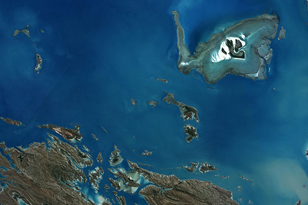
New offshore islands and reefs added
The updated DEA Coastlines also includes data for several offshore islands and exposed reefs not covered by previous versions, most notably, in the Great Barrier Reef, the Torres Strait and northwest Western Australia.
See decades of coastal change
DEA Coastlines combines satellite data with tidal modelling to map the typical location of the Australian coastline at mean sea level for every year since 1988 to 2021.
Note to existing users of DEA Coastlines
The addition of Landsat 9 Collection 3 data to the underlying source data of DEA Coastlines, and the application of a new tidal model, may result in minor changes to the product and historical coastlines.
Where these changes have been identified, they are noted in the Product Documentation.
2022 shoreline data due July 2023
Now that Landsat 9 data has been integrated into DEA Coastlines, annual additions to the dataset can be expected each July. As such, 2022 coastlines data is scheduled for release this July 2023.
How to access
DEA Coastlines version 2.0 is available to download or view online:
Questions and feedback
We welcome your questions and ongoing input into the development of DEA Coastlines.
Please contact us.
Related resources
Mapping Australia’s dynamic coastline at mean sea level using three decades of Landsat imagery
A national overview of trends in coastal change since the late 1980s.
DEA Coastlines
Satellite data combined with tidal modelling to map typical annual locations of mean sea level coastlines since 1988.
DEA High and Low Tide Imagery
Cloud-free mosaics of the Australian coast, calculating geometric medians of highest and lowest 20% of tides.