News Finding water to fight fire
Page last updated:18 June 2024
“We want to get the maximum amount of water onto that fire ground as quick as we can,” says Luke Patterson, Commander Aviation with Victoria’s volunteer firefighting service CFA, of his team’s priority in responding to grass- and bushfire events.
“We want quick turnaround times to water points to collect more water, and we want to be as efficient as we can with time and fuel.
“That’s what makes this product so valuable. It gives us a direction to fly towards where we can be confident there’s a known water source which may be applicable for our use.”
Digital Earth Australia (DEA) Waterbodies is a satellite data product that detects the wet surface area of almost 300,000 waterbodies across Australia. The tool uses data from the NASA/USGS Landsat program to map waterbodies larger than five whole Landsat pixels.
“Showing only waterbodies five pixels or larger means we can minimise noise caused by large numbers of small wet areas in the landscape,” says Assistant Director of Product Development for Digital Earth Australia and DEA Waterbodies project lead, Dr Claire Krause. “The outline of each waterbody shows the historical extent of water observed by the satellites.”
“Five pixels means consistency for us,” says Dr Danielle Wright, a Remote Sensing Analyst in the CFA Research and Development team. “As each pixel is 25 metres across, we know we’re seeing a water point with a bit of size to it, not just a dot of water.”
Water-bombing helicopters are only flying at around 500-1000 feet, Patterson adds. “Pilots can only see to about a five-kilometre radius. One pilot may see a shimmer on the horizon and fly east hoping it’s water, or fly towards a spot on a map that might indicate water, but there may have been a good water source only a few kilometres in the other direction that they didn’t know was there.”
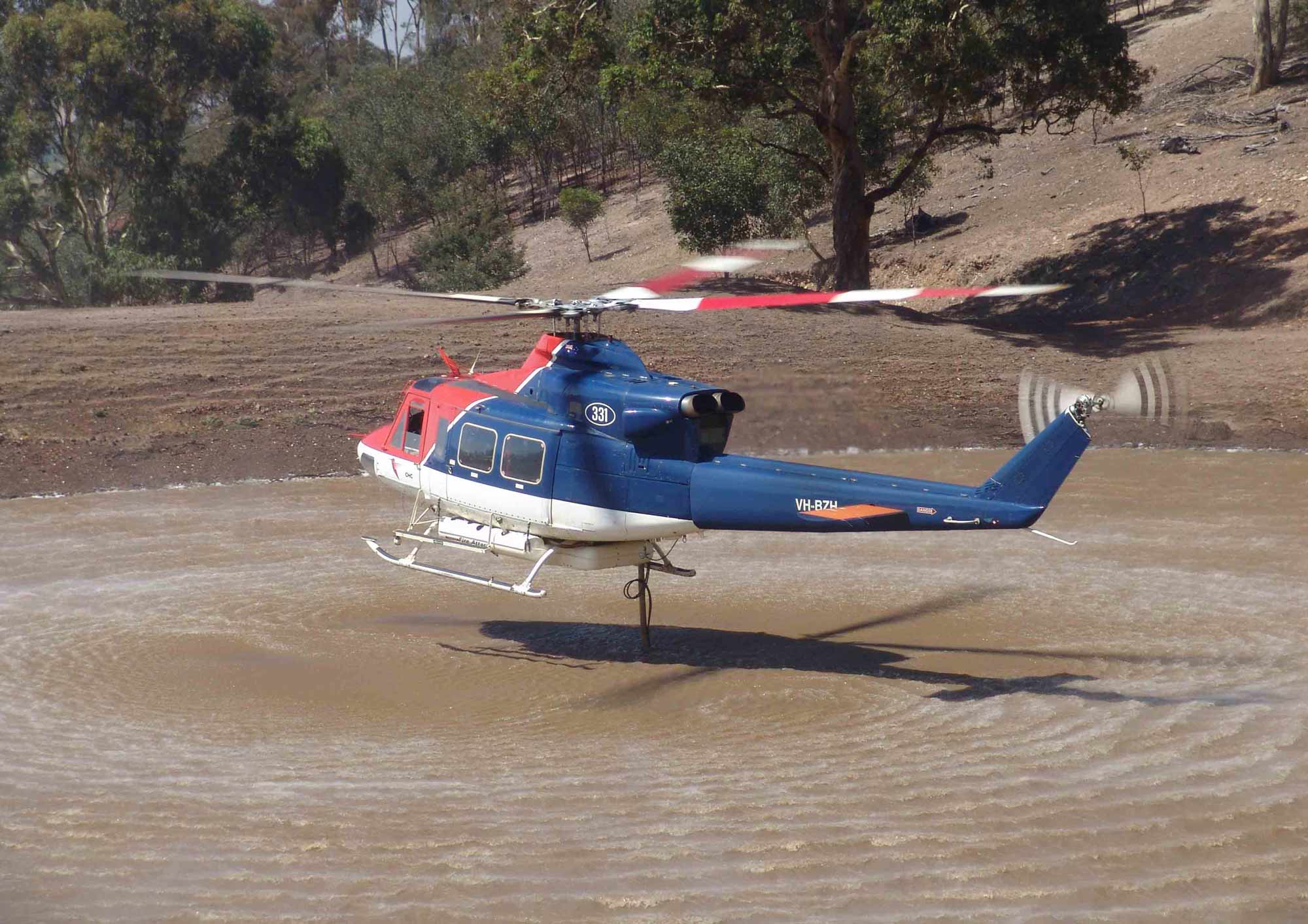
Fresh is best. Salt water, while sometimes readily available for firefighting, is not ideal. “Fresh is best for the fire ground, best for the equipment, and best for the pastures,” Patterson says. Image courtesy of CFA.
Satellite data for efficiency
CFA is Victoria’s volunteer firefighting service, operating to reduce the occurrence and impacts of fire and other emergencies. Across the state, more than 50,000 volunteers give their time to serving the organisation’s emergency and community activities.
“Before we had any satellite data to confirm the presence of water points against our existing maps, we had people across the state trying to do this ‘ground-truthing’ by air or by road,” Patterson says.
“They’d check maps from the roadside as best they could, or ask property owners to report on their dams. Agency air observers would fly over the Mallee and we’d mark GPS points of where water could be confirmed. Ground-truthing can be highly laborious and expensive.”
The CFA Research and Development team, whose mandate is to ensure evidence-based decision making is integrated into CFA operations, first trialled the use of Landsat satellite imagery to assist with water source detection about four years ago, Dr Wright says.
“We accessed the Landsat data from the Amazon Web Services public dataset ourselves and started looking at how we might apply it. Then it was at a remote sensing workshop that I heard a seminar by Dr Claire Krause from Geoscience Australia. She gave a presentation on all of the DEA data products, and I was just amazed.”
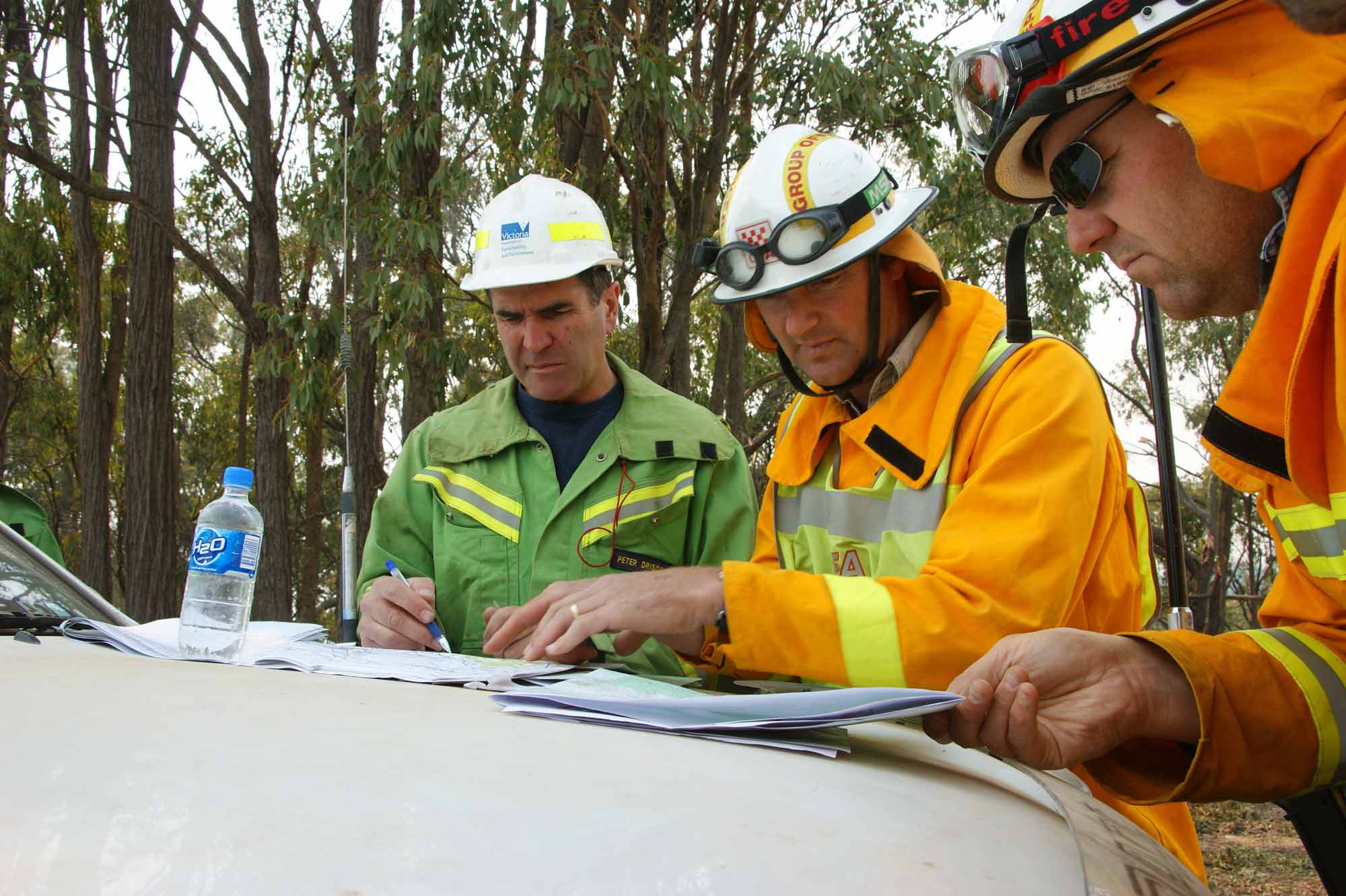
CFA is a dedicated and skilled team, performing roles beyond fire suppression; educating and engaging the community, helping residents develop fire plans, and responding to other emergencies when they happen. Image courtesy of CFA.
Data for decisions
The CFA trial of DEA Waterbodies is already informing the planning and allocation of aircraft and aerial resources, Patterson says. He works with many partner agencies to contract and position up to 50 helicopter and fixed-wing aircraft across the state every summer to ensure fire bombing, observation, and technical surveillance aircraft are available to support ground response activities.
“My question is, ‘Do we have the right aircraft in the right locations?’,” he says. “Helicopters need surface water. If we don’t have surface water close to the fire, our firefight will be inefficient and we are better off with a fleet configuration of fixed-wing aircraft, which get reloaded on the ground. Fixed-wing planes need to pick up water from the nearest capable airport or airbase, so their availability and location is key.”
The availability of surface water is also becoming harder to depend upon. Changes in rainfall patterns, and reduced stream and ground flows are pressures that CFA must be able to respond to. As water management practices improve, Patterson says, significant amounts of water that once filled open-air irrigation channels are being piped underground to avoid evaporation.
“These projects are a win for the water, but not for the aerial firefight,” he says. “Having confidence about the presence of waterbodies matters for our longer-term plans, as much as our response in the moment.”
Layering the knowledge
CFA is accessing and trialling the DEA Waterbodies product in a number of ways; looking at it on the DEA Maps online platform, and downloading the data for use in their own ArcGIS applications.
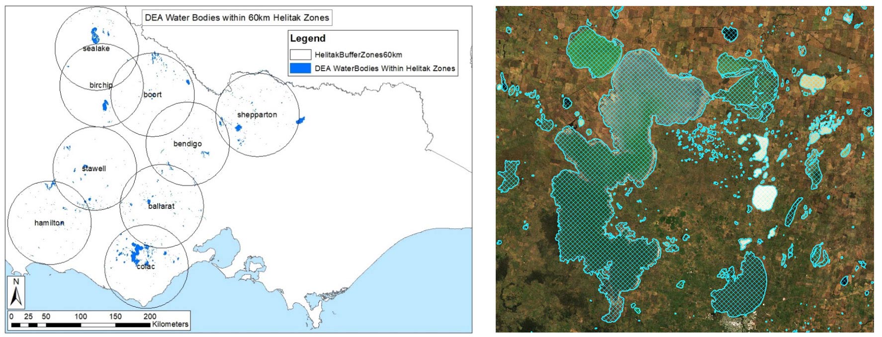
“Bringing the data into our own platforms means we can incorporate data layers of our own,” Dr Wright says. “The main layer we’ve added consists of round ‘Helitak Buffer Zones’. We wanted to see the total area of water available in each of our existing helicopter zones. Bringing the two data layers together means we can easily calculate that area within ArcGIS.”
Left: Map showing DEA Waterbodies that fall within 60 km of CFA Helitak buffer zones. Right: DEA Waterbodies polygon.
From crop boundaries to waterbodies
“We were demonstrating satellite imagery for crop boundary mapping when the spark was lit for DEA Waterbodies,” Dr Krause remembers. “Someone said, ‘This crop mapping is great, but can you do it with water?’ So we went away and mocked up a prototype.”
The DEA Waterbodies tool leveraged an existing Digital Earth Australia data product — DEA Water Observations — for its water classifying data algorithm. Where DEA Water Observations classifies each pixel from its satellite imagery as wet, dry, or invalid, the Waterbodies dataset groups those individual pixels into a waterbody, making the data easier to use and interpret.
“That was the fun thing about this product”, Dr Krause says. “Because we had the data ready to go — it was sitting there in the DEA Open Data Cube — all we had to do was ask the data the right questions and the new dataset was mocked up in a matter of weeks.”
Interest in the new tool has snowballed and the DEA Waterbodies dataset is now being used for drought preparedness projects and in the monthly NSW Seasonal Conditions Outlook, published by the Department of Primary Industries.
“We were thinking about agriculture when we designed this product,” Dr Krause says. “CFA is demonstrating such a terrific use of the tool that we never expected.”
Open source data for water-source decisions
“CFA has trialled various satellite data products over the last 30 years,” says Dr Wright. “For example, we use ground data and satellite data to assess how dry grasslands are across the landscape. This is used for the Fire Danger Ratings, readiness and fire prediction analysis and modelling.”
“It’s access to free satellite data, like through Digital Earth Australia, that gives us the flexibility to conduct these trials in a dynamic working environment. Many of our projects go through multiple iterations before they’re operationalised, and we rely on the data being free and open source.”
The next step for the CFA team is to see the Waterbodies dataset in the hands of their pilots, available on their tablets for quick reference. While at Digital Earth Australia, the product is being upgraded.
“We’re actively working to enhance the Waterbodies Landsat dataset with Sentinel satellite data,” Dr Krause says. “Which means we’ll have data from multiple satellite missions in the product. Currently DEA Waterbodies is updated every two weeks, but with the Sentinel data added in, we’ll have satellites making visits every three-to-five days, and data updated within 24 hours of capture.”
“We know it’s no silver bullet,” Patterson says of the CFA vision for the DEA Waterbodies tool. “A water point may have trees across it or be unusually shallow. But until now we haven’t had any broad-scale waterbodies mapping, and this dataset will give our pilots — and our planning — such a better picture of the landscape.”


