News Mountain, Field, Reef: Mapping the Jaragun Wetlands Project
DEA Cal/Val scientists deploy drones in Far North Queensland to construct an accurate topographical map of an artificial wetlands terrain while exchanging knowledge with the Wanjuri people.
Page last updated:18 June 2024
Stretching below Cairns in Far North Queensland is the Russell River Catchment, a picturesque and fertile landscape blessed with dramatic mountain peaks, surging waterways and floodplains and home to the rich culture of the Wanjuri people from the Yidinji Nation.
In October 2022, Digital Earth Australia's Field Team (Calibration and Validation, “Cal/Val”) travelled to this beautiful part of the world to collaborate with Jaragun EcoServices on an innovative and exciting project. The project combines First Nations knowledge and culture with GA's mapping technologies, intending to transform a retired and marginal sugarcane field into a thriving wetland.
Deploying a drone equipped with a 10-band multispectral sensor and a LiDAR mapping sensor, our Cal/Val Scientists Mark Broomhall and Guy Byrne, along with Earth Observation Data Scientist Margaret Harrison, were able to construct an accurate picture of the terrain while learning from and exchanging knowledge with the Wanjuri people.
This collaboration also allowed our Cal/Val team to use the site as a baseline testing ground for our drones and equipment. Furthermore, the imaging will provide essential validation data for DEA's Wetland's Insight Tool, which gives visibility of changes to the amount of water, green vegetation, dry vegetation, and bare soil that have taken place in key Queensland wetlands since 1987.
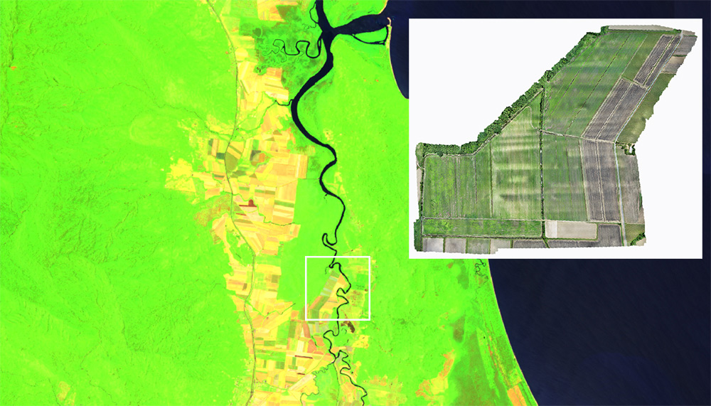
DEA Surface Reflectance (Sentinel-2A MSI) - Styles: False colour - Green, SWIR, NIR. Bright green areas show forested areas, while yellow/orange indicates cultivated land. Inset image showing the Russell River catchment area undergoing wetlands rehabilitation (indicated by white square).
Jaragun: Collaborating with community
Founded by Wanjuru-Yidinji Elder Dennis Ah-Kee and his wife Liz Owen, Jaragun takes a holistic approach to land rehabilitation, working closely with traditional owners, the local farming communities, scientists, the private sector and the Queensland Government.
On her recent visit to Canberra, Liz said that the project is helping to "restore wetland function and improve the quality of water discharged from a catchment area that feeds directly into the GBR [Great Barrier Reef]".
Take a flyover the Jaragun wetland rehabilitation site on the Russell River in Far North Queensland. This mapping animation of the artificial wetlands was created using LiDAR and drones piloted by Digital Earth Australia’s Cal/Val scientists in October 2022, showing the topography and elevation of the land. The flyover shows the area Jaragun EcoServices will transform from a retired and marginal sugarcane field into an artificial wetland that will help filter fertilisers out of water flowing into the catchment area adjacent to the Great Barrier Reef.
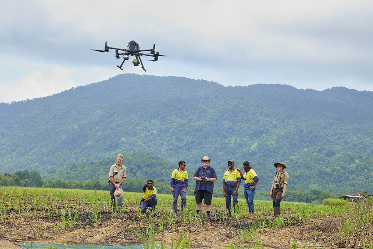
DEA Cal/Val team member and drone pilot Mark Broomhall (centre) sends the drone into the air above the Russell River catchment wetlands rehabilitation area. Source: Romy Photography
The project also plays a "valuable role in bringing First Nations back onto country" - and is "the largest of its kind on the GBR both in terms of land size and investment". Liz also spoke about how the project was made possible through a partnership between Jaragun and GreenCollar, a large environmental markets investor and project developer that funds wetland projects that improve the health of the GBR.
Generously donating his time over the phone, Dennis spoke about the project in terms of “cultural flows” and how traditional owners have a spiritual, social, and environmental obligation to care for wetlands as part of their commitment to caring for the Country.
Mountain, Field, Reef: How the wetlands will work
Strategically chosen for its position, the flat 70-hectare site sits downstream from surrounding sugarcane land. This allows agricultural runoff from the canefields to pass directly through the property. This runoff contains large quantities of dissolved inorganic nitrogen material (also known as DINs or fertilisers), which then feed directly into the Russell River and, by extension, into the Coral Sea, thus affecting the health of the Great Barrier Reef. DIN interception has become a major challenge in protecting the Reef – and the Russell River Catchment is a crucial priority accounting for around 11 per cent of all DINs in the GBR (2015-16).
The Jaragun wetland will effectively function as a natural filtration system, providing a significant annual reduction in the DIN loads. These reductions in DINs will be converted and quantified through "Reef Credits", a tradable market mechanism used to incentivise water quality improvements across catchments of the GBR.
The wetland will also serve to reduce the quantity of fine sediment pollutants into the GBR and help establish a complex ecosystem comprising natural and location-specific flora and fauna.
With earthworks planned in 2023, the aesthetically and ecologically compelling design consists of a series of connecting lagoons, a berm wall around the perimeter to slow and divert runoff and opening points and drainage channels.
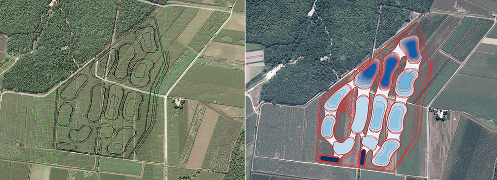
Flight line images showing where wetland will be formed. The image on the right features colour coding with the darkness of the blue corresponding to water depth. The two regular ponds at the southern end are the main inlets designed to catch most of the sediment. The northern end comprises deeper ponds, and the white sections represent the shallow areas between the ponds.
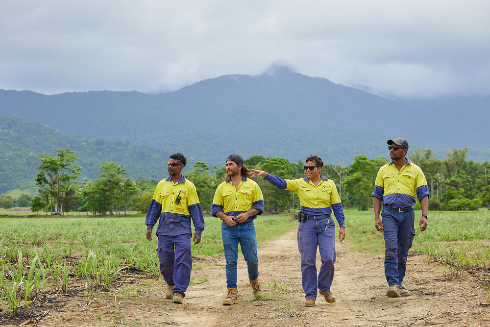
DEA Earth Observation data scientist Margaret Harrison (right) with the Jaragun Ecoservices team. Source: Romy Photography
How does Geoscience Australia and DEA fit into all of this?
DEA’s spectral mapping will help monitor the progression of this wetland over time. By undertaking laser-based LiDAR mapping and hyperspectral imaging via drone aircraft, our field team are helping to create a more thorough picture of the site's current state.
As seen in the animation above, the LiDAR mapping details the site's elevation, profile and topography.
Further LiDAR mapping down the track, however, will show the transformations in the landscape, the depth of the excavations and abnormalities such as surface degradation, slope changes and vegetation growth. Used in this context, "the mapping is a powerful tool in our understanding of the hydrology of the land, the volume capacity, the way water flows, accumulates and its general quality," Liz said.
By contrast, multispectral imaging captures the electromagnetic spectrum of light and colour (including infrared) and will help determine the growth, health and nutritional status of the plants.
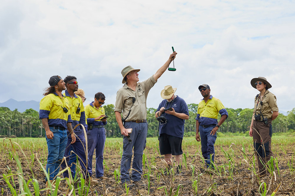
DEA Cal/Val team member Guy Byrne (centre) holds an anemometer to the sky. The tool measures wind speed and is an important component in drone flying. Source: Romy Photography
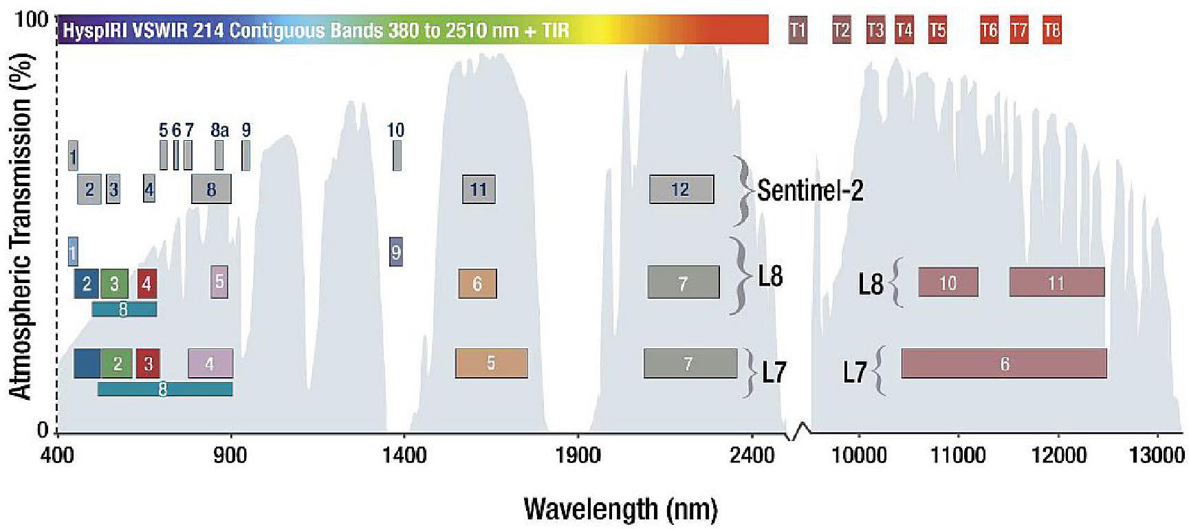
Multispectral EO satellite data: The bands detecting Landsat and Sentinel satellites appear in numbered boxes, and the width of each box represents the spectral range that the band detects. The bands are overlaid on the percentage transmission of each wavelength returned to the atmosphere from the Earth relative to the amount of incoming solar radiation. The y-axis has no bearing on the comparison of the satellite sensors.
GA will also survey the site using the more advanced Hyperspectral imaging. “We are expecting delivery of our hyperspectral instrument in December and would deploy this instrument over the wetland site once it has been revegetated by Jaragun,”Mark said.
Providing an even greater level of detail, Hyperspectral imaging utilises hundreds of bands rather than the ten bands used in our multispectral camera. It is also one of the most advanced and information-rich technologies for detecting weeds, pests, and nutrient and water efficiency.
With increasing developments in drone technology, LiDAR and spectral imaging have become more usable and powerful. It took our GA team three hours to map about 68 hectares of the intended wetland area. The recent drone mapping contrasted with more expensive and labour-intensive fixed-plane mapping funded by the QLD Government back in 2009 and used subsequently by Jaragun for a geomorphic assessment of the Russell River Catchment and Babinda Creek.
DEA’s Mark Broomhall said, “aerial mapping is becoming far more accessible and affordable, and this is empowering small groups like Jaragun to manage their own mapping.”
"Ultimately, Jaragun and other eco organisations will be able to operate these drones and mapping instruments and then render the data themselves."
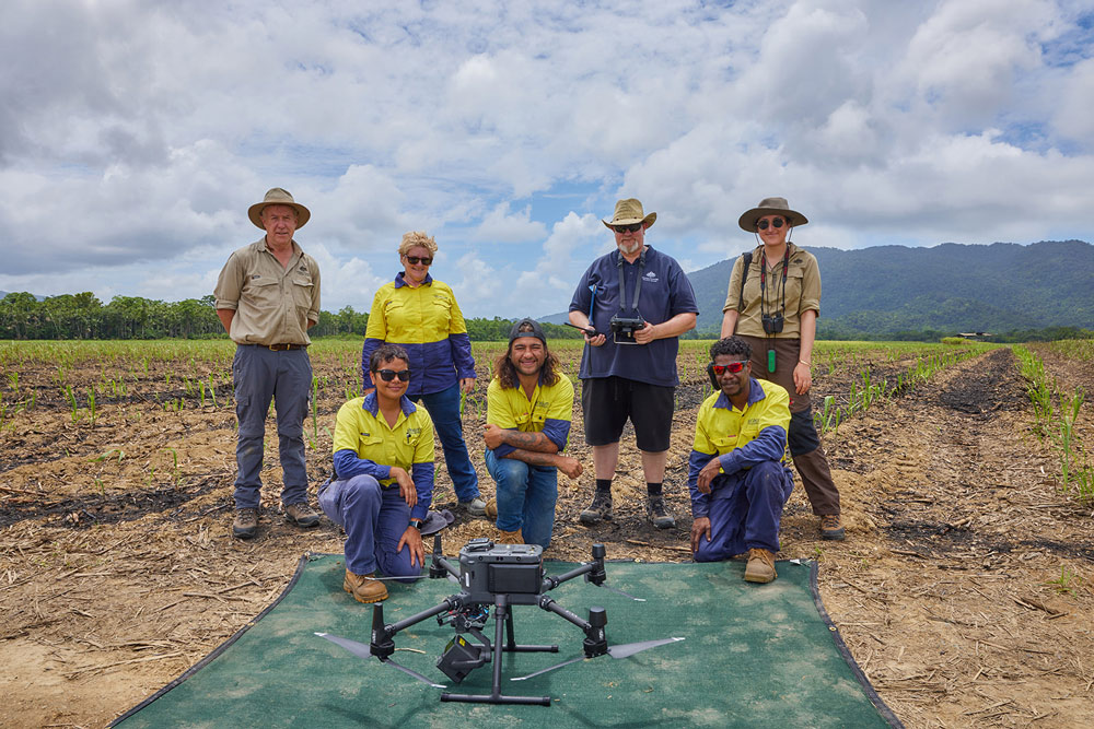
The DEA and Jaragun teams. Back row: Guy Byrne, Liz Owens, Mark Broomhall, Margaret Harrison. Front Row: Kylie, Tobias (Toby) and Johnno. Source: Romy Photography
First Nations Project
The Wanjuru people from the Yidinji nation are at the centre of the wetland project. Jaragun employs several Wanjuru workers at any given time and links many facets of the ecological rehabilitation process to Wanjuru cultural knowledge and traditions. For instance, hibiscus, a flowering plant traditionally used as a kind of twine or string in spear making, will help stabilize stream banks, prevent erosion and sediment build-up and provide shade and habitat for aquatic life.
Dennis stated that “another fascinating element of the restoration process will be to bring back bird life, as the wetlands were valuable hunting grounds for traditional owners.”
“This was especially the case after the wet season when the water dropped and the wetlands were more accessible, and the birds were still present,” he said.
“Another dimension to the project is that it will allow a proper and in-depth cultural heritage study that takes the old people back onto the land to identify the plants, grasses and animals that were used in traditional culture.”
“And it will also provide the opportunity for the younger Wanjuru to reconnect with country and develop the capacity and skill sets to restore ecosystem function."
It is also important to note the historical backdrop to this project and Jaragun's work, where many Wanjuru families had been removed and relocated from the South Russell River catchment area. Jaragun's work thus helps the traditional custodians to return and reconnect with country and record, map and document their cultural heritage.
A Unique Collaboration
The Jaragun wetlands project sits uniquely at the intersection of traditional ecological knowledge and science, with a common goal of restoring a vital catchment area that feeds directly into the Great Barrier Reef.
The project will also pave the way for future collaborations incorporating First Nation approaches to sustainability and geo-mapping data collection. Geoscience Australia is thrilled to participate in this innovative and vital project.
Other jobs up north
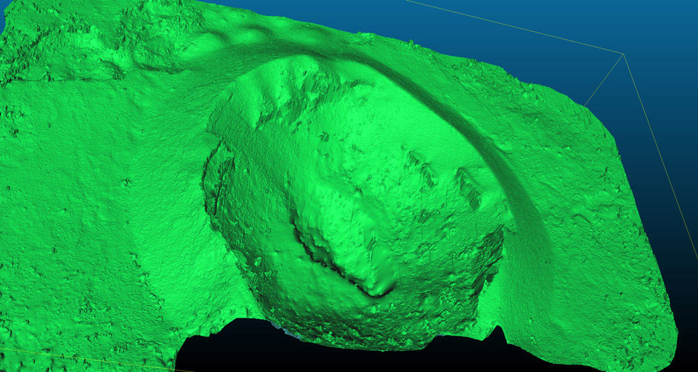
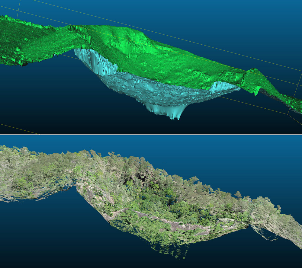
While up in Queensland, our remote sensing team also completed striking LIDAR and multispectral mapping of the Kinrara crater, the site of one of the last volcanic eruptions in Australia roughly 7000 years ago. As noted by Mark, this work was undertaken for GA's Exploring for the Future Program, working in close consultation with the Gugu-Badhun people, the traditional custodians of that area.
The Kinara volcano in LiDAR mapping rendered in 3D. Towards the bottom of these images we also can see a collapse through the Volcano's caldera.
Furthermore, the team also flew at Robson Creek, at what is known as a Terrestrial Ecosystems Research Network (TERN) supersite, Australia's first large-scale rainforest research plot. The mapping aims to create one of DEA's analysis-ready validation data sites. That is to say, remote sensing and surveying data that will help validate and even provide a more detailed account of earth observation occurring from space – from critical satellites such as NASA’s Landsat 8 and 9 and the European Space Agency’s Sentinel 2 satellite from the Copernicus Program.
