News Uncovering habitat change in Australia’s north
Digital Earth Australia data is supporting studies into threatened and migratory species.
Page last updated:18 June 2024
A Marine Biodiversity Hub study led by Geoscience Australia has used satellite remote sensing imagery from Digital Earth Australia (DEA) to map coastal habitats critical to threatened and migratory species in northern Australia.
The study team tapped into more than 30-years of Landsat imagery archived on DEA’s Open Data Cube to explore habitat change for the Keep, Daly, Roper, Macarthur, Flinders and Gilbert River estuaries across northern Australia, as well as Darwin Harbour. The estuaries were selected because of their importance as habitat for species of interest, including threatened sawfish and shorebirds.
The DEA High and Low Tide Imagery and DEA Intertidal Extents data products were used in the project to distinguish between tidal-induced and long-term change.
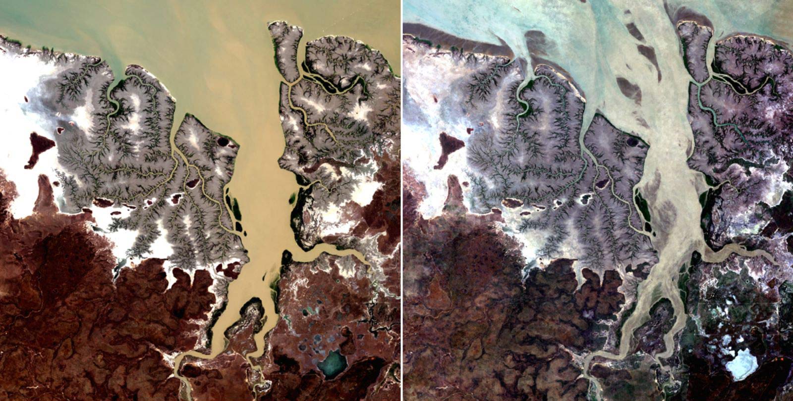
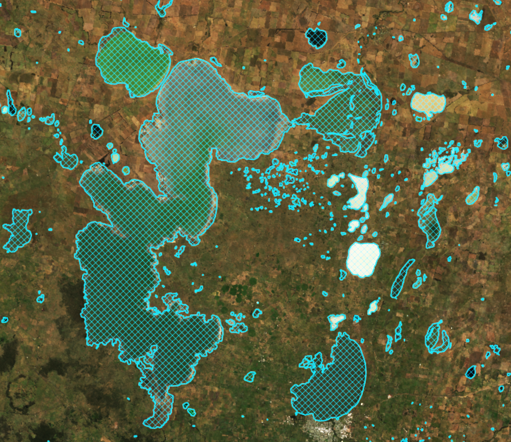
Composite Landsat satellite images for the Keep River estuary at high (left) and low tide (right). At low tide, large areas of sand/mud bank are exposed inside the channel.
“Across Australia, cloud interference can make it difficult to obtain clear satellite imagery,” says DEA Marine and Coastal Sensing Scientist, Dr Claire Phillips.
“Additionally, satellites image the coastal zone at varying stages of the tide. To navigate these issues in this project, every image for each location was attributed with its associated tide-height from regional tidal models, then a geometric median was applied to the stacks of imagery associated with the highest and lowest tide-heights. This meant we could produce crisp, cloud-free composite images that depict the maximum and minimum observed tidal extent for each of the seven estuaries.”
The study found that analysing the long and detailed archive of Landsat imagery provided unique insights into the form, timing, and rate of change in estuarine landforms and habitats. While some areas experienced gradual changes, others were associated with specific events.
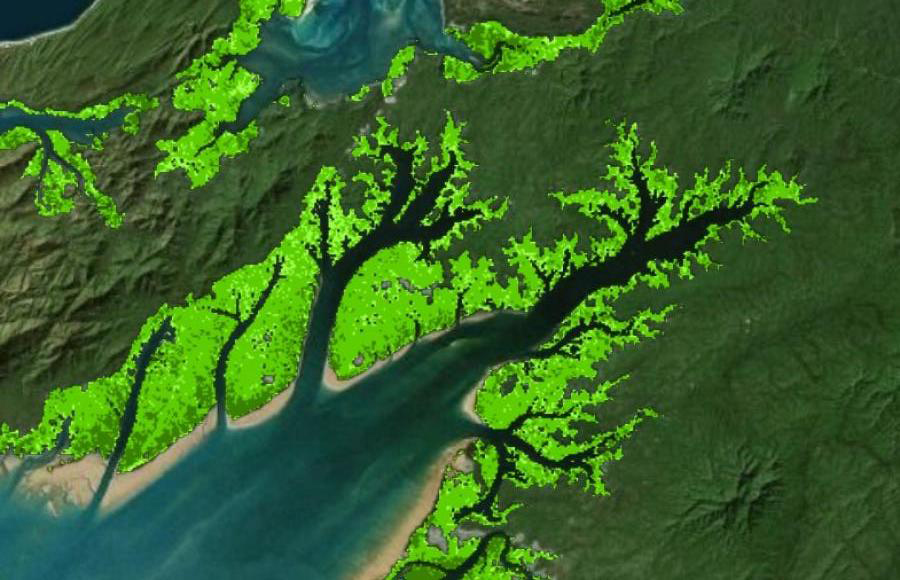
In the Keep River and Gilbert River estuaries for example, large-scale rapid island growth and mangrove expansion was clearly reflected by the imagery. In the Flinders River and McArthur River estuaries on the other hand, expansion of mangroves appeared gradually, over the longer term.
“This information is important for the management of key species, as well as for decisions around coastal developments,” Dr. Phillips says. “With Landsat and new satellite data streams such as Sentinel-2 continually being added to Digital Earth Australia’s available datasets, this time-series analysis approach could certainly be developed into an effective habitat extent and condition monitoring tool for northern Australia.”
Results of the study can be found in this paper, Characterising northern estuaries using Digital Earth Australia, by Claire Phillips, Leo Lymburner, and Brendan Brooke.
The cost-effective application of satellite imagery in the Marine Biodiversity Hub project could also be used to monitor vast remote areas, assist field work prioritisation, and support decision-making related to coastal development, says the Marine Biodiversity Hub.
About Australia’s Marine Biodiversity Hub
The Marine Biodiversity Hub is one of six hubs funded by the National Environmental Science Program, a long-term commitment by the Australian Government to environment and climate research. The Hub’s research provides nationally consistent scientific information to support evidence-based decision making about marine species, marine protected areas, and pressures on the marine environment. The Hub has 10 research partners and is hosted by the University of Tasmania.
Related resources
DEA Wetlands Insight Tool (Qld)
Tracking of changes in 270,000 lacustrine and palustrine (lake and swamp) wetlands in Queensland since 1987.
DEA Mangrove Canopy Cover
Annual maps breaking canopy into three classes according to greenness of satellite image pixels at 25 m resolution.
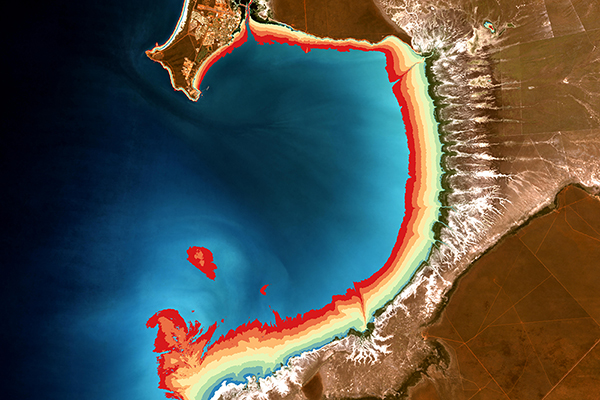
DEA High and Low Tide Imagery
Cloud-free mosaics of the Australian coast, calculating geometric medians of highest and lowest 20% of tides.
DEA Intertidal Extents
Lowest and highest observed tides for a chosen geographic cell, revealing the satellite-observed tidal range.