Seabed mapping
Page last updated:16 November 2023
Seabed mapping
As an island continent, Australia is surrounded by oceans. We also have one of the largest marine jurisdictions in the world. In fact, it is approximately double the size of our land mass and 4 per cent of the world’s oceans. Understanding our ocean is essential to realising the economic, environmental, social and cultural benefits of this valuable natural resource. Accurate and reliable seabed maps are a vital input to any planning or decision-making in our marine region.
Geoscience Australia has a central coordinating function to bring seabed data together from many sources under the AusSeabed initiative.
Our AusSeabed Marine Data Portal features data collected from across private, academic, and government sectors and exclusively publishes the Australian Hydrographic Office Hydroscheme Industry Partnership Program surveys. By delivering open seabed data from across the nation through a single portal, Geoscience Australia allows researchers, policy makers and data users to spend less time searching for data and more time applying it to their work. The seabed data supports a wide range of marine interests including offshore renewable energy development, marine park management, blue-carbon initiatives and improved inundation, storm surge and erosion modelling. All data delivered through the AusSeabed portal are publicly available under the Creative Commons licence.
250 metre resolution national seabed map
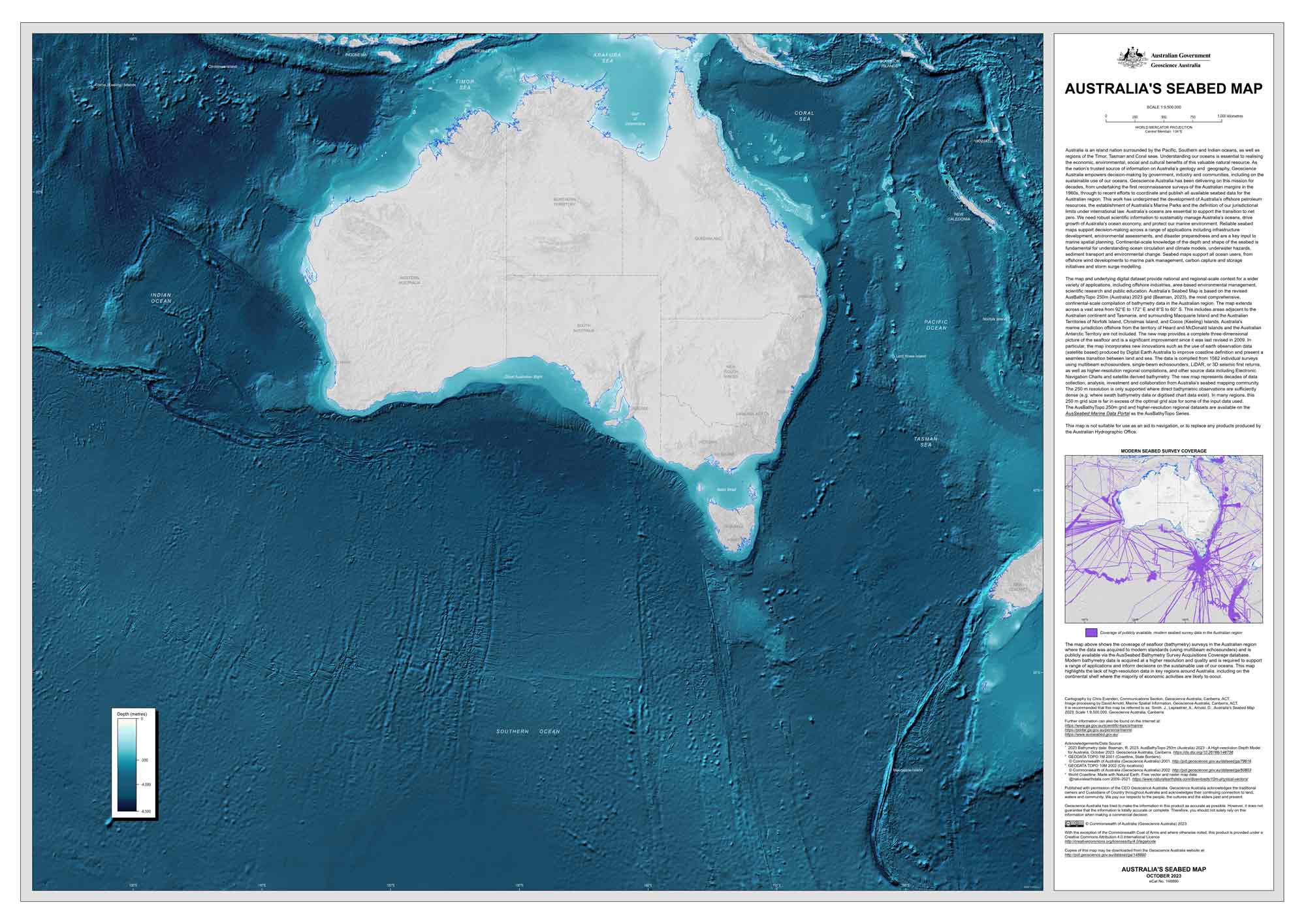
In 2023 Geoscience Australia released the AusBathyTopo 250m (Australia) 2023 Grid - A High-resolution Depth Model for Australia, replacing the previous version of the 250 metre resolution national seabed dataset, sometimes called the national grid. This is the first update of the national grid since 2009 and incorporates data from 1582 individual marine surveys, representing decades of bathymetry data acquisition. The new grid provides a seamless 3D surface with improved coastline definition and greater clarity of the transition between land and sea and can be used to inform planning and management decisions at regional and national scales. The grid has also been used to create Australia’s seabed map.
Geoscience Australia, through the AusSeabed initiative, works to empower the seabed mapping community by facilitating survey coordination through online voyage planning tools, improving data through the development of quality assurance and acquisition software and working to understand and communicate national priorities for data collection. To learn more about these activities visit the AusSeabed website.
Geoscience Australia also hosts the Australian Marine Spatial Information System, a web based interactive mapping and decision support system that improves access to authoritative and curated information on the rights, uses and restrictions in the Australian Marine Jurisdiction. AMSIS provides a mechanism to visualise competing interests in the marine space and enable discussion amongst multi-sectoral users to better plan and manage the Jurisdiction.
