Adding accuracy to marine observations: Ginan on the Great Barrier Reef
Page last updated:14 March 2025
The Challenge
Precise positioning is integral to daily life, enabling us to navigate and locate ourselves no matter where we are in the world. Despite this, the potential of precise positioning capabilities is yet to be optimised in Australian businesses as efficient testing and evaluations for these next-generation technologies can be challenging.
The adoption of uncrewed platforms for regular marine field observations at sea requires multi-parameter sensing, accurate geo-positioning, remote real-time communication, and machine-assisted data analysis technologies to be sufficiently reliable. Emerging capabilities mean platforms such as the M600 drone and Surfbee Queen offer efficient solutions to protect and conserve oceanic environments within the Australian Exclusive Economic Zone, including marine parks like the Great Barrier Reef.
Open-source toolkits, such as Ginan, and enabled services are an efficient way of testing and evaluating next-generation technologies and fully realising the capabilities of precise positioning.
The Solution
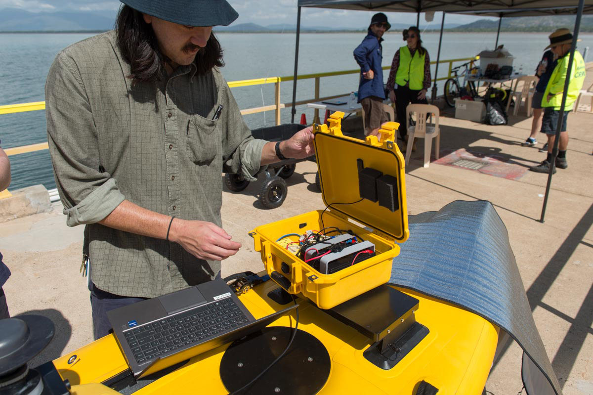
SV the Surfbee Queen.
FrontierSI, in partnership with Geoscience Australia, conducted case studies to show the benefits of Positioning Australia products. The Australian Institute of Marine Science (AIMS) joined as a demonstration partner, examining GNSS positioning solutions and evaluating the suitability, benefits, and challenges of Positioning Australia products, including Ginan.
Ginan, an open-source GNSS correction system and analysis software toolkit, was developed to enhance positioning across Australia by providing real-time correction services with additional software to enable centimetre-level positioning. This includes precision point accuracies of 5 cm with mobile phone coverage. This set of correction software was utilised across a variety of GNSS hardware platforms, integrated as 'Ginan-in-a-box' within the Autonomous Surface Vessel (ASV), the Surfbee Queen (Surfbee) and the Uncrewed Aerial Vehicle (UAV), the DJI Matrice 600 (M600).
An assessment of performance metrics, convergence times, and positioning accuracies produced insights into deploying Real-Time Kinematic (RTK) solutions and harnessing Ginan Precise Point Positioning (PPP).
- FrontierSI, Geoscience Australia, and AIMS tested GNSS positioning solutions, including Ginan, for marine field observations.
- Ginan, an open-source GNSS correction system, provides real-time centimetre-level positioning accuracy, suitable for uncrewed platforms like the Surfbee Queen and the DJI Matrice 600.
- The study highlighted the importance of accurate geo-positioning and machine-assisted data analysis in marine environments using evolving technologies.
The Impact
Ginan, an open-source alternative, showcased its notable capabilities in achieving centimetre-level accuracy through PPP. The study highlighted the reliability and consistency of PPP compared to RTK, with operational insights leading to enhanced system efficiencies. Ginan test sessions consistently achieved convergence, with the fastest and most accurate horizontal and vertical conversion times being 7 minutes and 5-6 cm aboard the Surfbee and M600.
This places Ginan as a noteworthy solution for efficient and reliable positioning in uncrewed marine field observations, particularly valuable for safeguarding Australia's diverse and iconic oceanic environments in the Australian Exclusive Economic Zone. The study emphasises Ginan's precision and reliability, and the progressive potential of advanced GNSS solutions in marine research and geospatial technologies.
The full case study technical report is available.
We’ve worked incredibly hard to get the code base developed to make sure we can benchmark and standardise Ginan against the international offering.
Dr. Anna Riddell Director, GNSS Analysis at Geoscience Australia