Space Our mission
Page last updated:4 December 2024
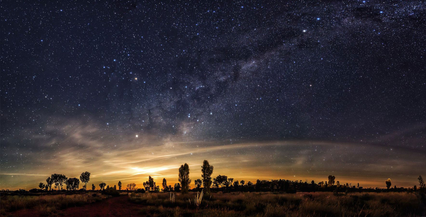
Our mission
By creating a richer and clearer picture of our world and its temporal changes, and by enabling precise positioning, our work in space helps Australian communities, governments, researchers and industry to better understand our ever-changing environment and our location in it.
Understanding where we are helps us know where we are going. Positioning enables us to pinpoint our location and that of our equipment, ensuring we can navigate to where we want to go.
Our better understanding will help:
- Prepare for and respond to more frequent and intense climate change induced disasters, and support recovery
- Drive sustainable economic growth that benefits the Australian people and our communities
- Create jobs that will underpin sustainable practices across industry sectors, including agriculture, utilities, transportation, resources and others.
We’re doing this by:
- Combining our scientific expertise across various disciplines to deliver more comprehensive and connected Earth observation data and precise positioning capabilities
- Building open access Earth observation platforms such as Digital Earth Australia
- Developing world-class positioning infrastructure for Australia through the Positioning Australia program
- Partnering with local, national and international organisations to share expertise and data, and to foster a global network of collaboration and innovation
- Sustaining ground station facilities such as Geoscience Australia’s Alice Springs satellite ground station facility, geodetic observatories and Global Navigation Satellite System (GNSS) reference stations.
We support informed decision making by providing free, open and integrated access to:
- Decadal time-series data and analytic products that depict changes in the Australian landscape
- Analysis-ready satellite land imaging data that has been scientifically corrected and curated covering Australia, Africa, Southeast Asia and the Indian Ocean
- Reliable real-time positioning information that will improve the accuracy of satellite positioning across Australia and New Zealand from the current 5 to 10 metres down to as little as 10 centimetres, and 3-5 centimetres where there is mobile coverage
- An Australia Geospatial Reference System and accompanying infrastructure that accounts for the movement of Australia 7cm north-east per year, enabling centimetre-accurate positioning across our continent.
This information is used by governments, industry and the communities to make decisions in areas such as:
- Agriculture
- Infrastructure and transport
- Climate and environment
- Sustainability
- Water utilities
- Emergency services
- Resources
- Consumer
- Spatial

As a trusted global partner in the space sector, Geoscience Australia utilises global satellite constellations to provide open access to precise positioning and satellite land imaging. © Commonwealth of Australia (Geoscience Australia) 2024.
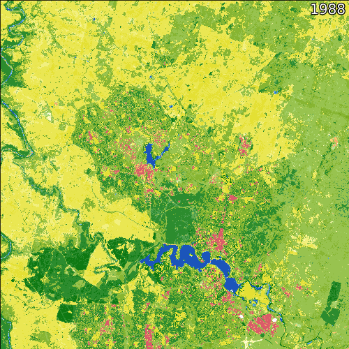
DEA Land Cover - USGS Landsat - 1988-2020 - Canberra, ACT DEA Land Cover shows how Canberra has grown over more than three decades where each pixel represents a 25x25-metre square. See how the suburbs in the north in what is now Gungahlin seem to appear out of nowhere in the 1990s. © Commonwealth of Australia (Geoscience Australia) 2021. Input data from Landsat 5, 7, 8 and 9, courtesy of the US Geological Survey. doi: https://doi.org/10.3390/data4040143
Space and our impact on Earth
Humanity first reached outer space in the 1950s by getting a simple radio satellite in orbit.
In the decades since, our objectives and capabilities in space have grown enormously.
Today we use space technologies to achieve four primary objectives:
- Looking out: Telescopes allow us to explore our solar system and beyond. Techniques such as Very Long Baseline Interferometry (VLBI) are used to develop the Celestial Reference Frame, supporting space exploration and geodesy and positioning on Earth.
- Looking in: Satellites enable Earth observation, remote sensing and weather forecasting, like USGS Landsat and the European Commission’s Copernicus program.
- Positioning and timing: Global Navigation Satellite Systems, such as the GPS program, enable us to know our position on Earth, convey time, and support our knowledge of the shape of our dynamic Earth.
- Communications: Satellite relay communication signals across vast areas, delivering television, phone and internet connectivity.
Geoscience Australia is the custodian of Australia’s operational Earth observation and mapping databases, providing up-to-date and accurate information that is free and openly available to all.
We are responsible for Australia’s national positioning infrastructure, providing the fundamental capabilities and data that Australia’s precise positioning technologies are built upon.
Our work in space is advancing Australia’s science and technology, developing our understanding of the world to enable capabilities and breakthroughs in:
- Climate change and our environment
- Delivering productivity, efficiency, safety and innovation across all industry sectors
- Advanced manufacturing and high-tech trades
- AI and machine learning
- Stronger ties to our international partners around the world.
Space and the United Nations Sustainable Development Goals
Geoscience Australia is a global leader in Earth observation and scientific research, contributing to a more sustainable future. Our high-quality data and analysis are essential for understanding and addressing global challenges.
Earth observation data can be used to support several Sustainable Development Goals (SDGs) providing valuable information for monitoring, reporting, and planning actions.
Through The Digital Earth Australia and Positioning Australia programs, we support Australia's progress towards the SDGs by providing critical data to relevant government agencies with specific reporting responsibilities. Key contributions include:
- SDG 2: Zero Hunger: Supporting sustainable agriculture with precise Earth observation data.
- SDG 6: Clean Water and Sanitation: Monitoring water resources to ensure access to clean water.
- SDG 9: Industry, Innovation, and Infrastructure: Fostering innovation through advanced geospatial data.
- SDG 11: Sustainable Cities and Communities: Providing data for urban planning and sustainable development.
- SDG 15: Life on Land: Managing forests and biodiversity through detailed environmental monitoring.