
| the Christmas Island GIS online
|
|
|
|
| Dataset | |
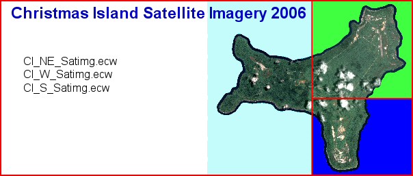
| Title | 2006 Christmas Island Satellite Imagery |
| Custodian | Department of the Environment and Heritage, ERIN |
| Jurisdiction | Australia |
| Description | |
| Abstract | Pan-sharpened satellite imagery of Christmas Island recorded using the QuickBird Digital Globe satellite, taken over the island on Jan 27 2006. Each pixel represents 0.6m. |
| Search Word(s) |
PHOTOGRAPHY AND IMAGERY Satellite PHOTOGRAPHY AND IMAGERY Imagery |
| Geographic Extent Name(s) | Christmas Island Edition 1 2010 1:30000 - Geoscience Australia GEOCAT 70145 |
| Data Currency | |
| Beginning Date | 27 JAN 2006 |
| Ending Date | 27 JAN 2006 |
| Dataset Status | |
| Progress | Complete |
| Maintenance and Update Frequency | as required |
| Access | |
| Stored Data Format | DIGITAL - ERMapper ECW & TIFF/TFW |
| Available Format Type | DIGITAL - ERMapper ECW & TIFF/TFW |
| Access Constraint | Restricted, see contact details below. |
| Data Quality | |
| Lineage |
Quickbird satellite imagery of Christmas Island was commissioned by the Department of Environment and Heritage in mid 2003 and supplied to the Australian Government by DigitalGlobe in March 2006. It took this long (over 2 years) due to persistent scattered cloud over Christmas Island and many sensed scenes, not being up to 'cloud free' specifications. The Quickbird satellite recorded reflectance data of the islands in the red, green, blue, near infra-red and panchromatic bands, in 16 bit format. All sharpened imagery has a resolution of 0.6m/pixel. Three 8-bit pan-sharpened TIFFs, one for each of the three sections, containing the red, green and blue bands was supplied to GA. Each pixel on the pan sharpened imagery represents 0.6m. Due to disk space limitations these images are stored in ECW (Enhanced Compressed Wavelet) format. The files are stored in the 'CIGIS\data\sat_imagery\ecw' directory. |
| Positional Accuracy | The satellite imagery did not need to be shifted to match the 2006 cadastre. |
| Attribute Accuracy | Not Relevant. |
| Logical Consistency | Not Relevant. |
| Completeness | Complete |
| Contact Information | |
| Contact Organisation | Geoscience Australia |
| Contact Position | - |
| Mail Address | Cnr Jerrabomberra Ave and Hindmarsh Drive |
| Locality | SYMONSTON |
| State | ACT |
| Country | Australia |
| Postcode | 2609 |
| Telephone | (02) 6249 9479 |
| Facsimile | (02) 6249 9983 |
| Electronic Mail Address | Keith.Porritt@ga.gov.au |
| Metadata Date | 27-01-2006 |
| Additional Metadata | |
| Projection | MGA(UTM Zone 48) |